
Top waterfall destinations and famous falls
Top waterfall destinations and famous falls
Most impressive waterfalls to see on your travels
Waterfall destinations range from the towering single-drop falls of high plateau edges to the vast multi-channel cascade systems where rivers break across wide fronts before dropping into gorges of considerable depth. The most impressive examples tend to combine scale with accessibility and the best-known sites have developed substantial visitor infrastructure around them. Lesser-known falls in remote jungle and mountain zones often rival the headline destinations in spectacle while offering a significantly more solitary experience.
Water volume varies dramatically by season and timing a visit correctly makes a substantial difference to what is seen. Peak flow after the rainy season delivers the most dramatic conditions but can also obscure viewpoints with spray and make access paths slippery and difficult. Dry season visits trade volume for clearer views and easier access and at some sites reveal rock formations and swimming areas that high water conceals entirely.
Many of the world's most significant waterfalls sit within national parks or protected areas with entry fees and managed access. Boat trips and walkways that approach the base or edge of major falls are often the most memorable part of a visit but require advance booking during peak season. Heat and humidity at lowland tropical sites are considerable and lightweight waterproof gear is worth carrying even when rain is not forecast.
Lists by region
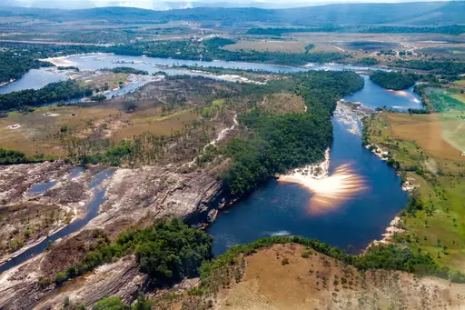
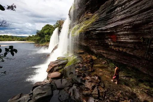
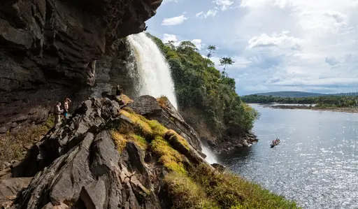
National Park in Venezuela
Canaima National Park
Tepui Peaks and Angel Falls Wonder
This park holds Angel Falls, the world's tallest waterfall, dropping unbroken from a flat-topped mountain called a tepui. Water falls so far that much of it turns to mist before reaching the ground. Boat trips up the Carrao River offer one of the main ways to reach a viewpoint.
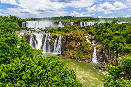
National Park in Argentina
Iguazú National Park and Reserve
Epic Waterfalls and Wild Rainforest
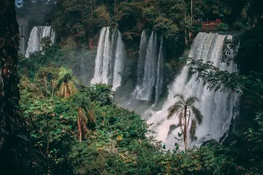
This Argentine park protects the larger share of the Iguazu Falls system within dense subtropical rainforest. Elevated walkways lead visitors across the river directly to the edge of the Devil's Throat. Coatis, a raccoon relative, wander freely near the park's trails and picnic areas. UNESCO recognised the park as a World Heritage Site in 1984.
Village in Norway
Geiranger
Majestic Fjords and Dramatic Waterfalls
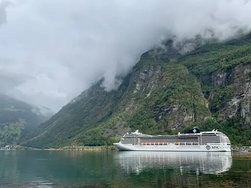
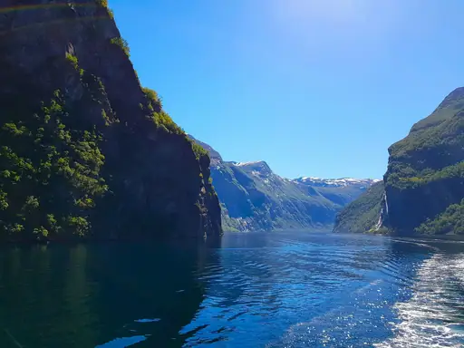
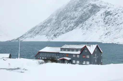
The Seven Sisters waterfall drops in seven separate streams down a cliff above this fjord village. Ferries and cruise ships pass close enough for passengers to feel the spray on calm days. A second waterfall called the Suitor sits across the fjord, facing the Sisters directly.
Island in United States
Kauai
Lush Landscapes and Secluded Beaches
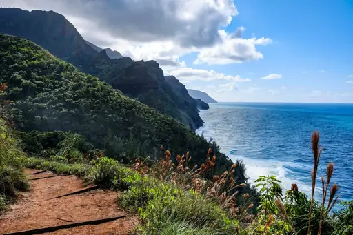
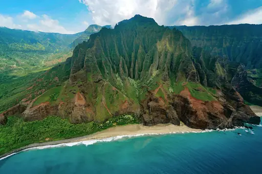
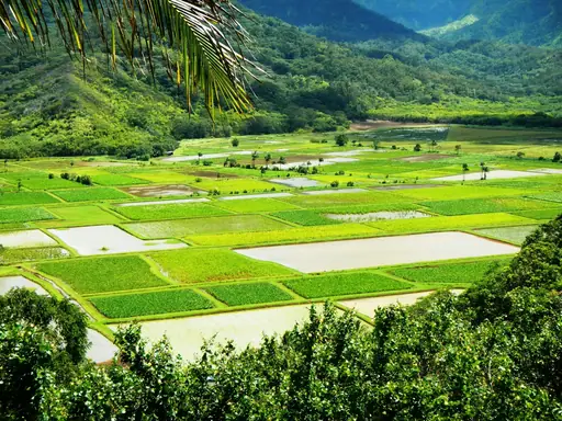
Wailua Falls drops about 80 feet in twin side-by-side streams near this island's eastern coast. The falls appeared in the opening credits of a well-known 1970s television show. A roadside lookout offers a full view without any hiking required. A steep, unofficial trail leads down to the pool for those willing to scramble.
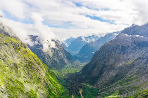
National Park in New Zealand
Fiordland National Park
New Zealand’s Wildest Water World
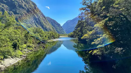
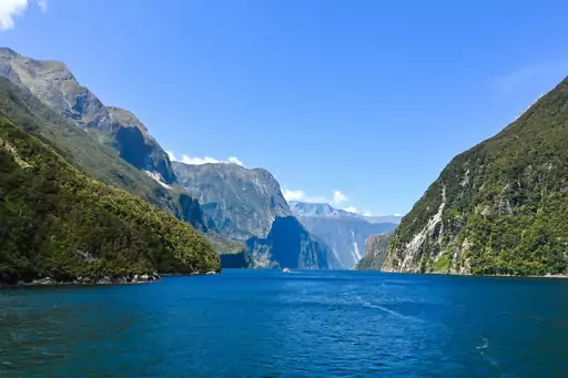
Bowen Falls drops directly into Milford Sound here, visible from cruise boats touring the fjord. Rainfall across the park can exceed 250 inches a year, keeping the falls running strong most seasons. Wind sometimes blows the falling water sideways during storms, scattering spray across nearby boats.
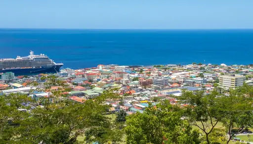
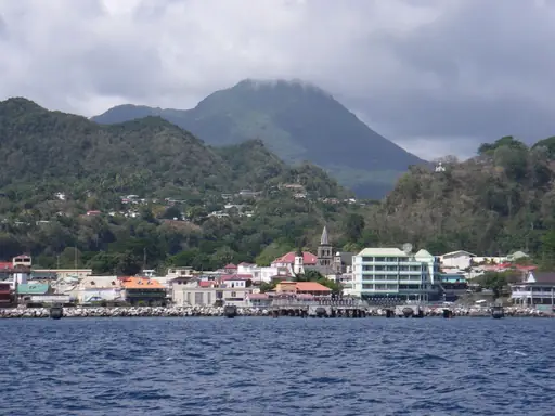
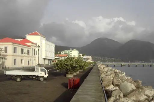
Country
Dominica
Nature island with pristine rainforests
Trafalgar Falls drops in twin streams here, side by side down a cliff surrounded by rainforest. One stream runs warm, fed partly by volcanic springs, while the other stays cold year round. A short trail leads to a viewing platform, with a rougher path continuing to the pools.
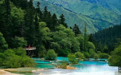
Nature Reserve in China
Jiuzhaigou Nature Reserve
Colorful lakes in Tibetan mountains
Nuorilang Falls spreads nearly 320 metres wide here, among the broadest waterfalls in China. Turquoise lakes throughout the reserve get their colour from mineral deposits carried in the water. Travertine terraces step the water down in layers across parts of the park. Snow-capped peaks frame the reserve for much of the year.
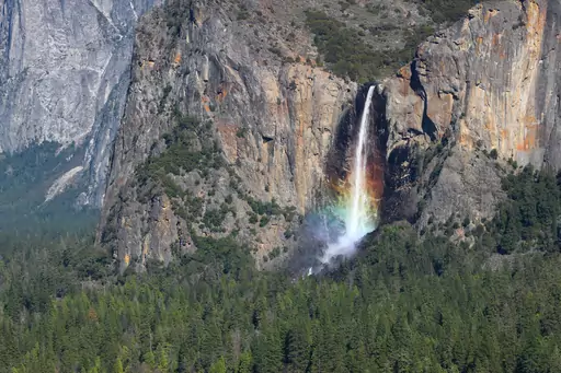
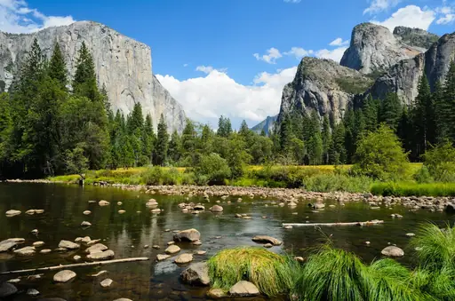
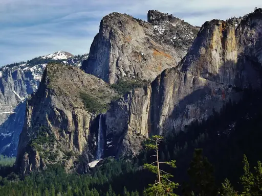
National Park in United States
Yosemite National Park
Nature's Grand Cathedral
Bridalveil Fall drops 620 feet near the park's entrance, often swaying sideways in the wind before reaching the ground. This park holds several of North America's tallest waterfalls, most fed entirely by snowmelt each spring. Flow peaks in May and June, then fades to a trickle by late summer.
Town in Costa Rica
La Fortuna
Volcano Views, Hot Springs, Adventure
This waterfall drops about 230 feet into a pool at the base of a steep jungle canyon. Arenal Volcano rises in the distance, visible from parts of the surrounding trail. A long staircase leads down to the water. Swimming is allowed in one section of the pool.
City in Zambia
Livingstone
Gateway to Victoria Falls Adventure
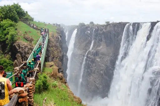
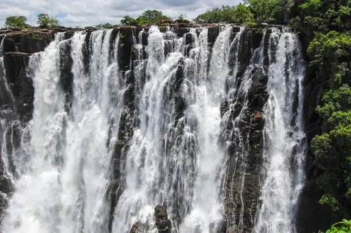
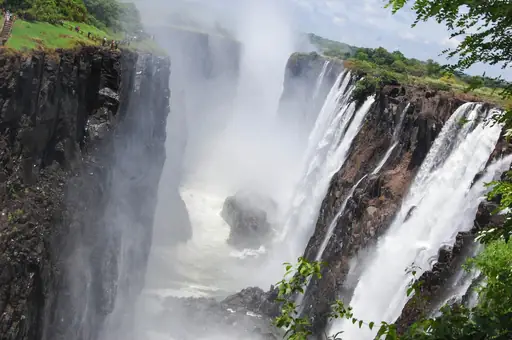
This Zambian town sits directly across from Victoria Falls, named after the explorer who first documented it for Europeans. A bridge nearby spans the gorge just below the falls, connecting Zambia to Zimbabwe. Bungee jumping and other activities draw thrill seekers to the same crossing point.
Town in Zimbabwe
Victoria Falls
The Smoke That Thunders
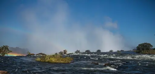
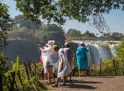
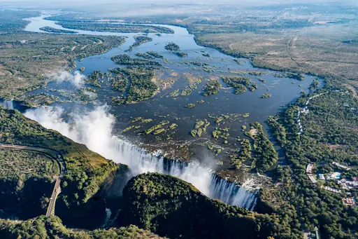
Local name Mosi-oa-Tunya translates to the smoke that thunders, describing the mist and roar produced by this waterfall. Water drops in a nearly continuous sheet over a mile wide, among the largest curtains of falling water anywhere. A section called Devil's Pool lets swimmers approach the edge during low water season.
Island in United States
Maui
Island of Sun, Surf and Serenity
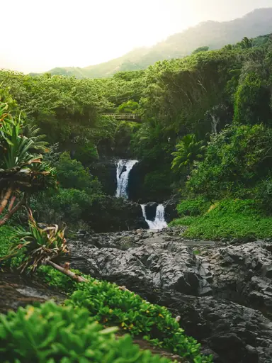
Waimoku Falls drops 400 feet at the end of the Pipiwai Trail, reached through a forest of towering bamboo. Hikers cross a boardwalk where the bamboo grows thick enough to block out the sun. Two smaller waterfalls, Makahiku Falls among them, sit along the same trail closer to the start.
National Park in Croatia
Plitvice Lakes National Park
Cascading Waterfalls and Turquoise Lakes
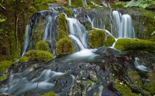
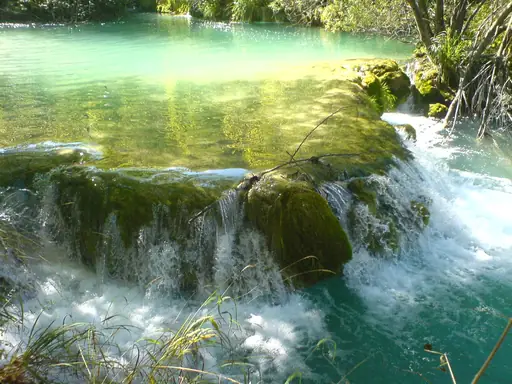
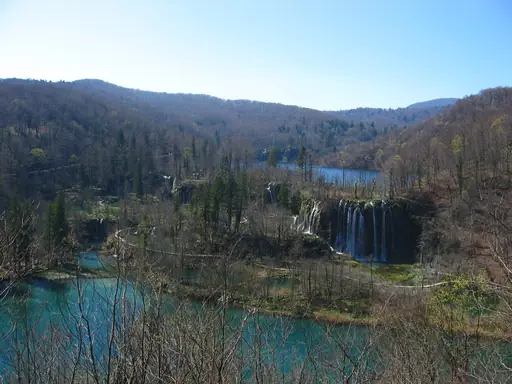
Sixteen terraced lakes connect here through a series of waterfalls, separated by natural dams made of travertine rock. Wooden boardwalks wind across and around the water, letting visitors walk close to several falls. That travertine keeps forming today, slowly reshaping the barriers between one lake and the next.
Region
Patagonia
Untamed Beauty at the End of the World
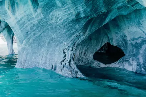
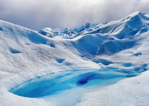
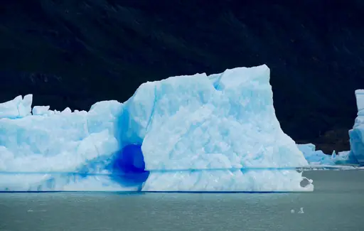
A hanging glacier feeds Ventisquero Colgante here, sending meltwater cascading down a cliff into a lake below. Ice occasionally breaks free from the glacier above, adding to the waterfall's flow in sudden bursts. A suspension bridge and trail system lead visitors to viewpoints across the reserve.
City in United States
Niagara Falls (New York)
Thundering Wonder on the US Side
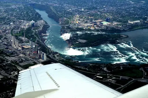
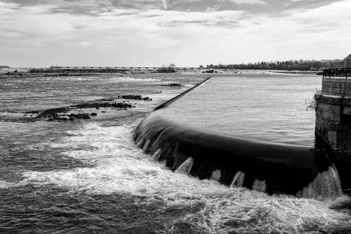
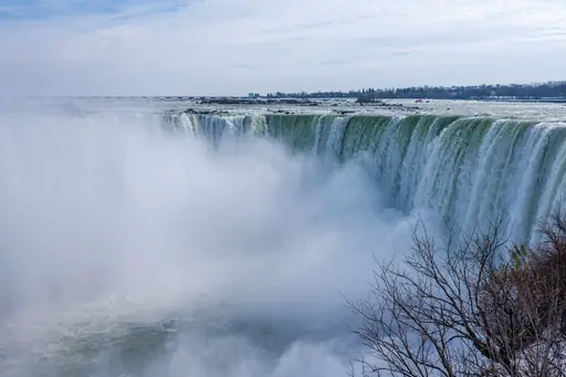
American Falls sits on the US side of this border crossing, smaller than its Canadian counterpart but still dramatic. A boat tour called Maid of the Mist has carried visitors close to the base since the 1840s. Cave of the Winds lets visitors walk on a platform beside the falling water.
City in Argentina
Puerto Iguazú
Gateway to Iguazú’s Thundering Falls
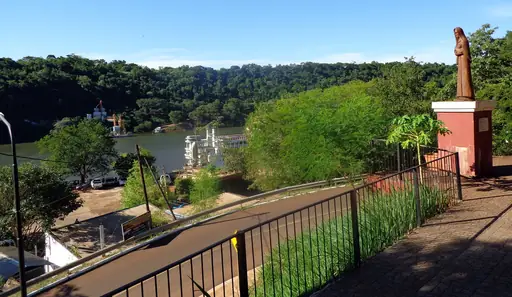
This Argentine town serves as the gateway to walkways that lead directly over the edge of the Devil's Throat. Metal platforms extend out above the churning water, putting visitors closer to the falls than views from Brazil. A small train carries visitors partway to the walkway entrance.
National Park in Dominica
Morne Trois Pitons National Park
Volcanic wonders in pristine rainforest
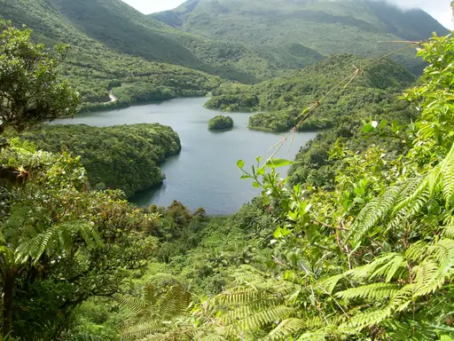
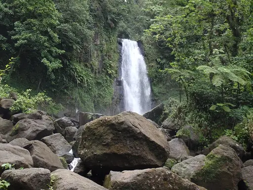
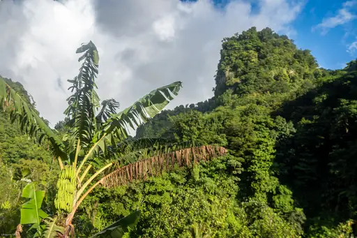
Middleham Falls drops roughly 200 feet here, ranking among the tallest waterfalls anywhere in Dominica. A forest trail leads to the base, crossing streams and passing beneath a dense rainforest canopy. Swimming is possible in the cool pool that collects beneath the falls. UNESCO recognised the surrounding park as a World Heritage Site in 1997.
Island in Japan
Yakushima
Ancient cedars, mossy forest and waterfalls
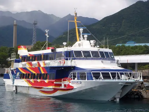
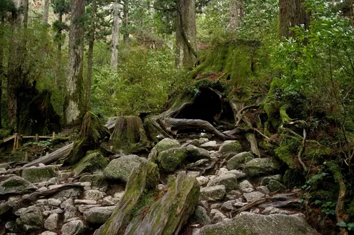
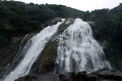
Ohko-no-taki ranks among Japan's top 100 waterfalls, dropping through dense forest on this remote southern island. Ancient cedar trees, some estimated at over a thousand years old, grow throughout the surrounding forest reserve. Moss covers much of the ground beneath the canopy, kept damp by frequent rain.
Nature Reserve in South Africa
Ukhahlamba Drakensberg Park
Barrier of spears touching sky
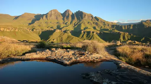
Numerous waterfalls spill from this park's basalt escarpment after rain, cascading down cliffs that rise over a thousand metres. San rock art sites sit scattered across caves throughout the mountain range. Hiking trails connect several of the falls, though weather can change quickly at this elevation.
Village in Switzerland
Lauterbrunnen
Valley of 72 waterfalls
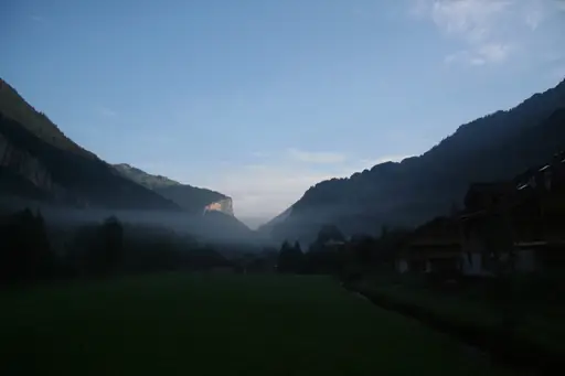
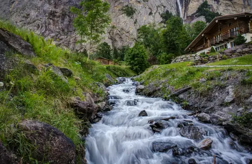
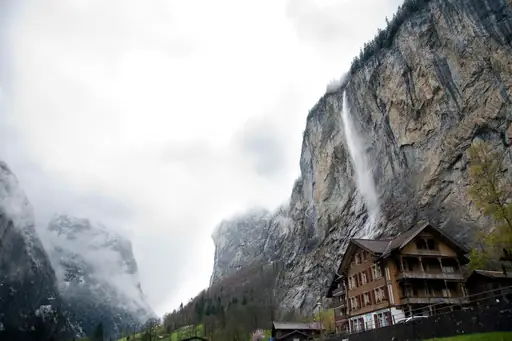
Roughly 72 waterfalls drop from hanging valleys around this Swiss village, carved by glaciers thousands of years ago. Staubbach Falls, the tallest, plunges nearly 300 metres directly above the village centre. Steep cliffs on both sides of the valley funnel meltwater down in cascades through the warmer months.
National Park in United States
Yellowstone National Park
Geysers, wildlife and untamed wilderness
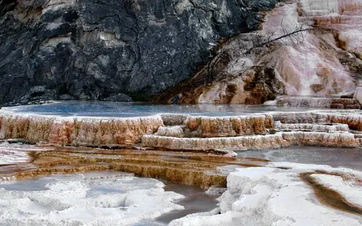
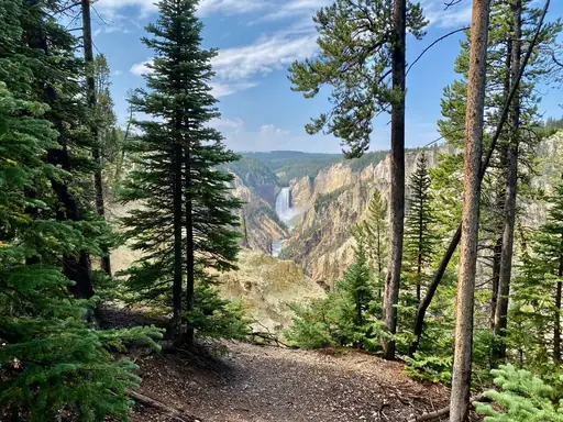
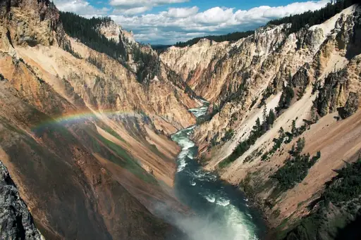
The Lower Falls here drops roughly twice the height of Niagara Falls into a canyon carved from yellow rhyolite rock. That colourful canyon gave the park its name, visible from several overlooks along the rim. A steep trail called Uncle Tom's Trail descends close to the base of the falls.
National Park in Guyana
Kaieteur National Park
World's Most Powerful Single-Drop Waterfall
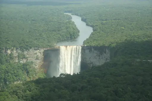
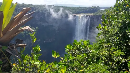
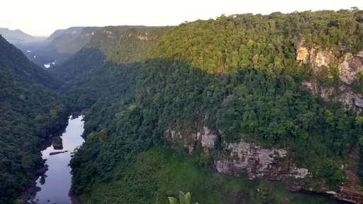
Kaieteur Falls drops in a single sheer plunge nearly five times the height of Niagara Falls. This ranks among the most powerful waterfalls anywhere by height and water volume combined. The falls sit deep in rainforest, reachable mainly by small plane from Georgetown. Few roads lead anywhere near the site.
City in Brazil
Foz do Iguaçu
Where three nations meet waterfalls
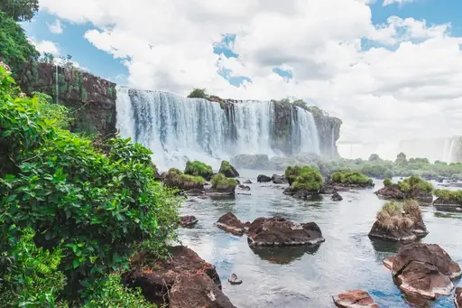
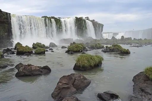
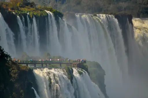
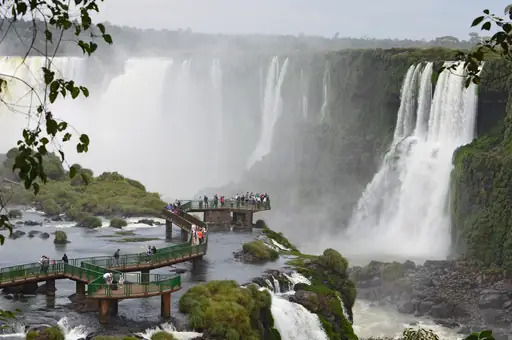
This Brazilian city sits across from the wider, more dramatic side of the Iguazu Falls system. A walkway here leads close to the Devil's Throat, where water from dozens of falls converges into one roaring drop. Boat tours take visitors directly beneath some of the smaller cascades nearby.
City in Canada
Niagara Falls (Ontario)
Nature’s Power, Lights and Mist
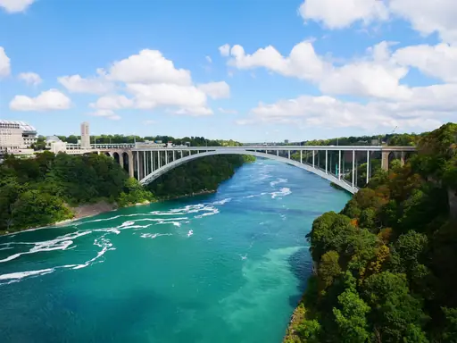
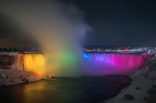
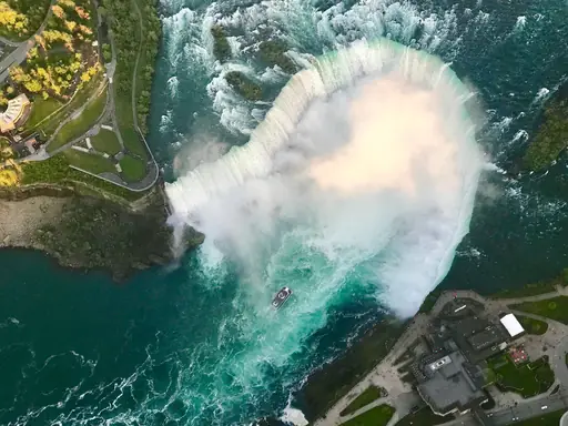
Horseshoe Falls curves along the Canadian side of this border crossing, offering the widest view of the falls. Lights illuminate the water in changing colours each night, visible from viewpoints along the riverfront. A casino and observation tower sit within walking distance of the falls.
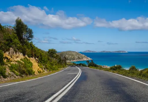
Region in Australia
Victoria
Diverse Landscapes and Cultural Richness
Erskine Falls drops roughly 30 metres through the Great Otway National Park's dense fern-covered forest. A steep staircase leads down to a viewing platform near the base of the falls. Nearby Hopetoun Falls offers a similar setting, framed by moss-covered rocks and tall eucalyptus trees.
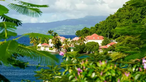
Outer Territory in France
Guadeloupe
Caribbean Gem with French Flair
Carbet Falls drops in three separate tiers down the slopes of an active volcano called La Soufriere. The tallest tier reaches over 100 metres, though access has occasionally closed due to volcanic activity. Trails of varying difficulty lead to each of the three falls. Guides in the area lead tours through the surrounding rainforest.
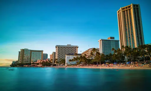
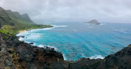
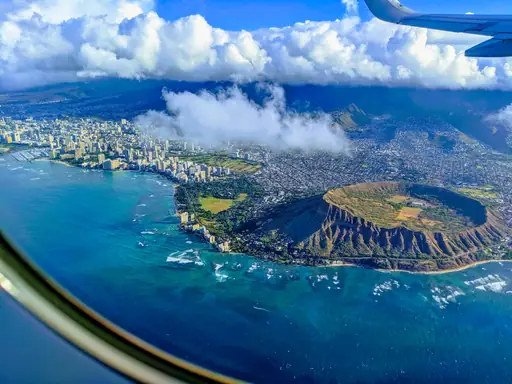
State/Prefecture in United States
Hawaii
Tropical Vibes and Volcanic Wonders
Akaka Falls drops 442 feet in a single sheer plunge on the Big Island's eastern coast. A short loop trail through rainforest leads visitors past the falls and a smaller cascade nearby. Bamboo groves and wild orchids line much of the paved path. The falls run strong year round thanks to the island's steady rainfall.
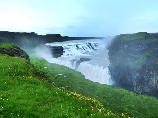
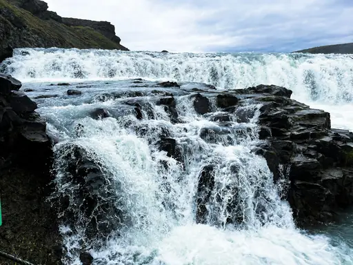
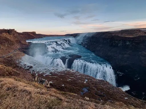
Waterfall in Iceland
Gullfoss Falls
Majestic golden cascade in Iceland
Water drops in two stages here, plunging into a canyon carved by the Hvita River over thousands of years. This ranks among Iceland's most visited waterfalls, part of a driving route called the Golden Circle. Plans to dam the falls for hydroelectric power were blocked in the early 1900s after local opposition.
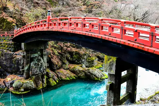

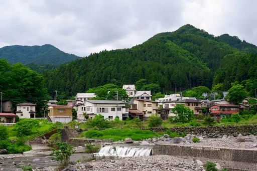
Town in Japan
Nikko
Tokugawa shrines, waterfalls and hot springs
Kegon Falls drops 97 metres from Lake Chuzenji here, one of Japan's most famous waterfalls. An lift carries visitors down through rock to a platform near the base of the falls. Autumn foliage around the falls draws especially large crowds each November, when maples turn deep red across the surrounding hills.
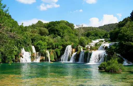
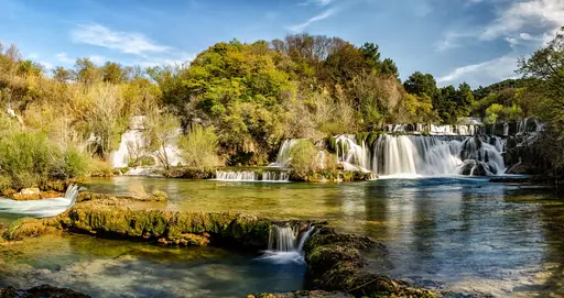
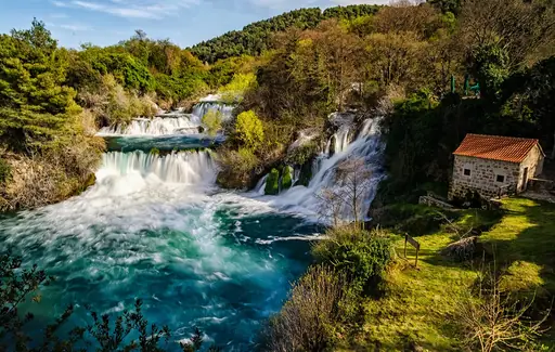
National Park in Croatia
Krka National Park
Waterfalls and Pristine Nature
Skradinski buk spreads across a series of travertine barriers here, forming one of Croatia's most photographed waterfalls. Wooden walkways let visitors walk directly above and beside the cascading water. Old watermills once powered by the current still stand along the riverbank. They once ground grain for nearby villages.
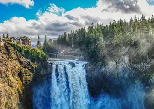
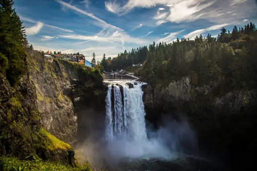
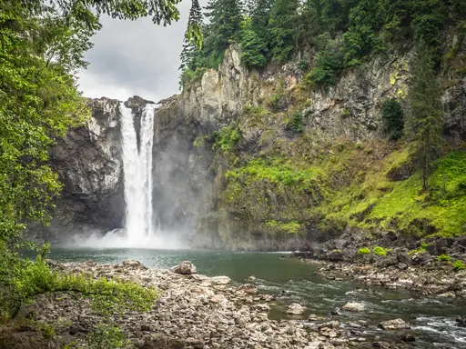
Waterfall in United States
Snoqualmie Falls
Majestic cascade plunges into lush forest
Water drops 268 feet here, taller than Niagara Falls despite carrying far less volume. A historic lodge sits at the top of the falls, offering rooms with direct views over the plunging water. This location appeared as a recurring backdrop in a well-known television series from the early 1990s.
Waterfall in Switzerland
Rhine Falls
Majestic cascades echo through alpine valleys
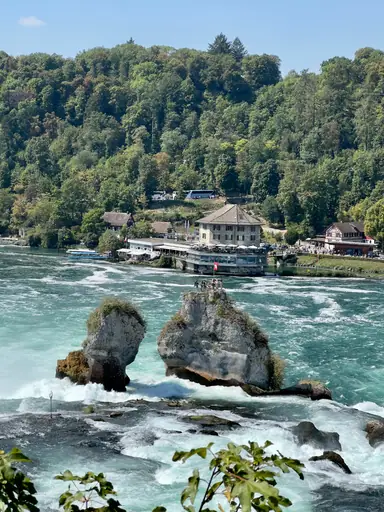
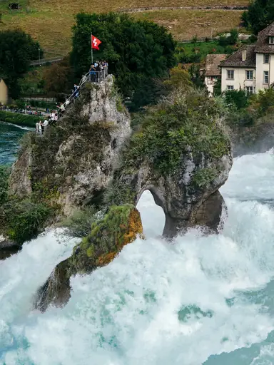
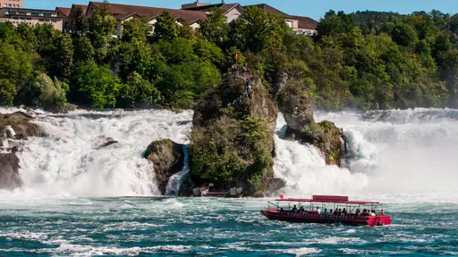
This ranks as the largest plain waterfall in Europe by volume, spreading nearly 150 metres wide. Boats ferry visitors close to the base and even onto a rock outcrop in the middle of the falls. Castles on both banks offer elevated viewpoints over the crashing water.
National Park in Brazil
Chapada Diamantina National Park
Waterfalls, Caves and Diamond History
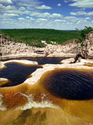
Cachoeira da Fumaca drops nearly 400 metres here, among the tallest waterfalls in Brazil. Wind often scatters the falling water into mist before it reaches the canyon floor below. Hikers can view the falls from the base after a long trek or from a clifftop lookout above. The name translates to Smoke Waterfall.
Waterfall in Bern
Staubbach Fall
Switzerland’s Majestic Free-Falling Waterfall
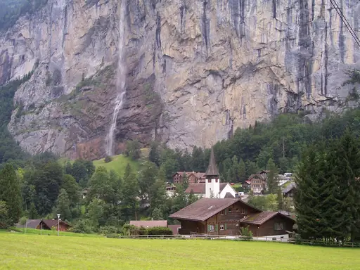
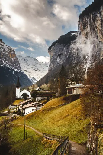
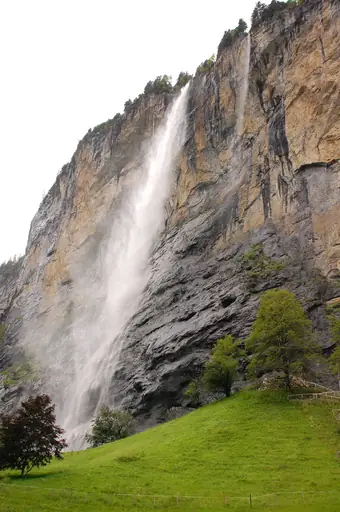
Water free-falls nearly 300 metres here, breaking into mist before reaching the valley floor below. This ranks among Switzerland's tallest waterfalls, visible from much of the village of Lauterbrunnen beneath it. Poet Johann Wolfgang von Goethe reportedly wrote about the falls after visiting in the 18th century.

Waterfall in Morocco
Ouzoud Falls
Morocco's thundering cascades of emerald
Water cascades down roughly 110 metres here in three separate tiers through the Moroccan Atlas foothills. Wild Barbary macaques roam the cliffs and trees surrounding the falls, often approaching visitors along the trails. Boats ferry visitors across the pool at the base for closer views. Rainbows regularly appear in the spray during sunny midday hours.
Waterfall in Laos
Khone Phapheng Falls
Majestic cascades echoing ancient jungle serenity
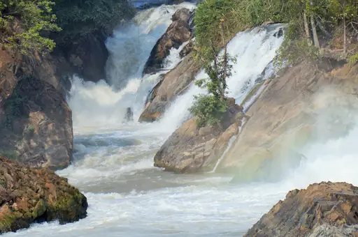
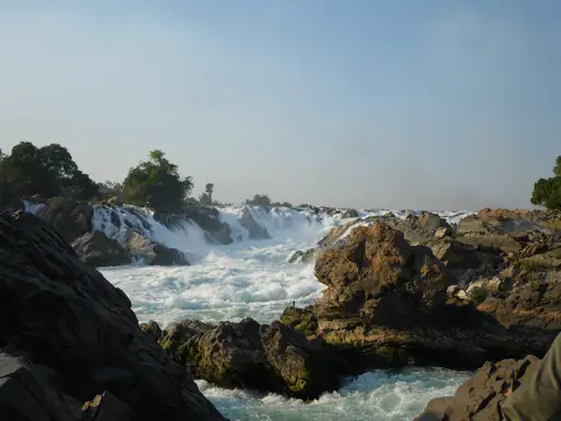
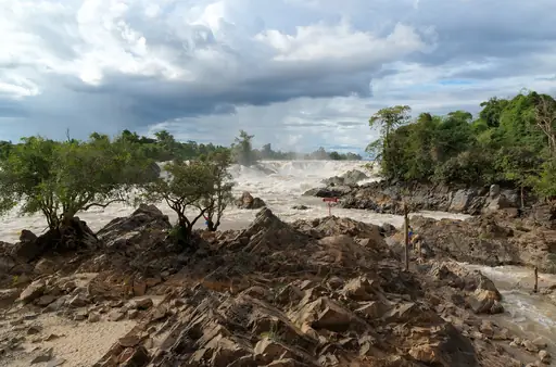
This waterfall spans more volume than any other in Southeast Asia, spreading across a wide stretch of the Mekong River. Rather than one tall drop, it forms a series of rapids and smaller cascades across the riverbed. Irrawaddy dolphins occasionally surface in calmer channels downstream.
Waterfall
Iguazu Falls
Breathtaking waterfalls spanning two countries
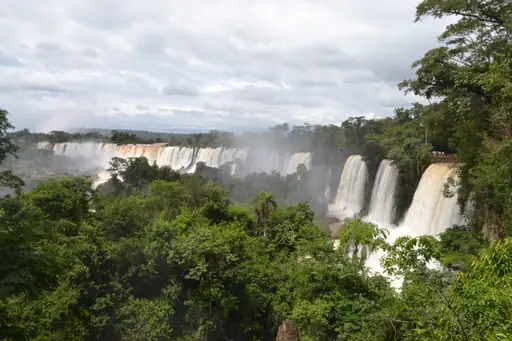
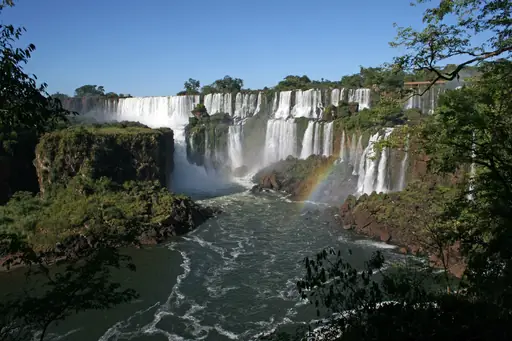
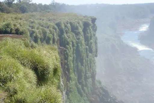
This waterfall system spans roughly 275 individual falls stretched across nearly two miles of jungle river. Brazil and Argentina each control a different side, offering distinct views of the same cascading water. The tallest section, called the Devil's Throat, drops water into a churning gorge below.
Fjord in New Zealand
Milford Sound
Breathtaking fiord of towering peaks
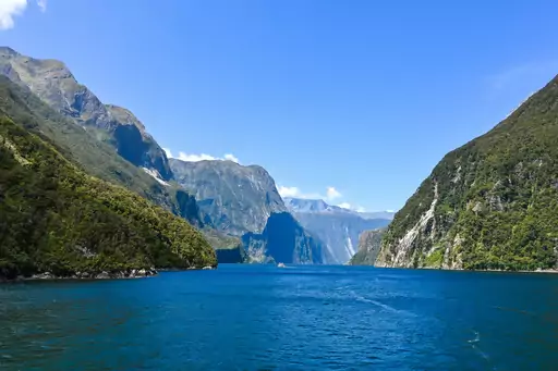
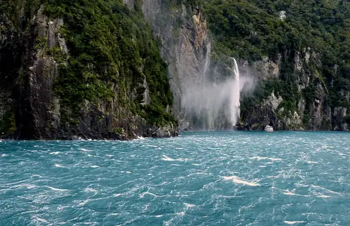
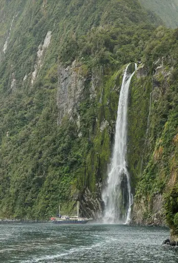
Stirling Falls drops 155 metres directly into this fjord, one of the few permanent waterfalls along the shoreline. Boat tours sometimes sail close enough for passengers to feel spray on their faces. Temporary waterfalls multiply across the cliffs after heavy rainfall, which the region receives often.
Town in Bosnia and Herzegovina
Jajce
Waterfalls, Fortress and Fairytale Views
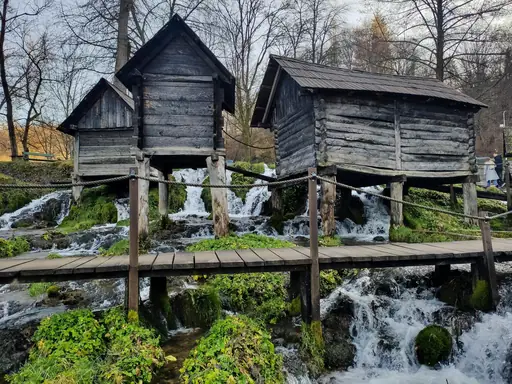
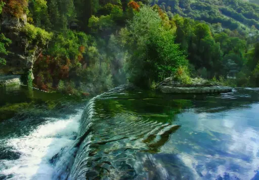
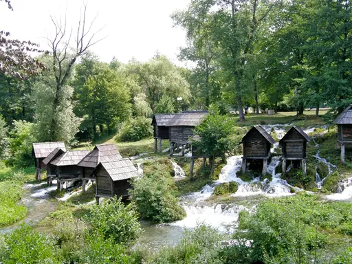
A waterfall drops right through the centre of this Bosnian town, where the Pliva River meets the Vrbas. Water plunges roughly 22 metres over the edge, visible from streets and bridges throughout town. Medieval fortress walls overlook the falls from a hill just above. Mills once powered by the current still stand nearby.
National Park in Australia
Kakadu National Park
Ancient Rock Art and Wild Wetlands
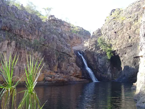
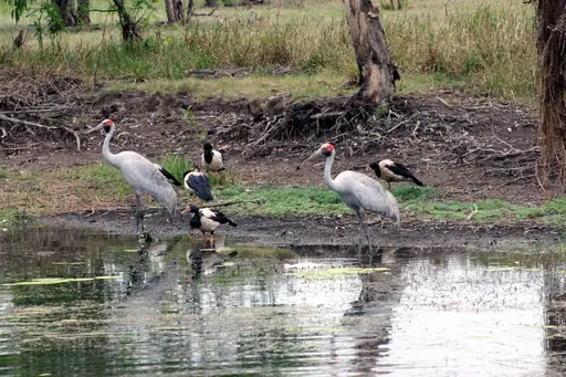
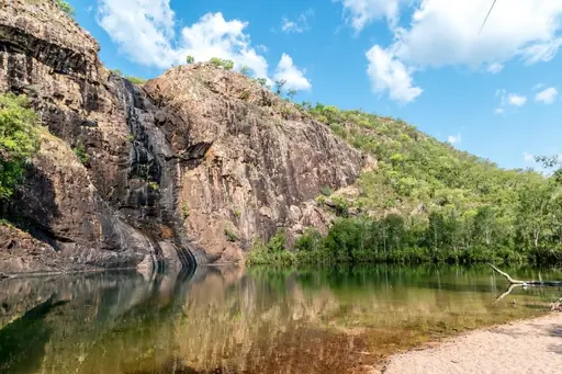
Jim Jim Falls drops from a sheer sandstone escarpment here, running strongest during the wet season each year. By the dry season the flow often stops entirely, leaving only a still plunge pool below. A rough four-wheel-drive track leads to the base, crossing several creek beds along the way.
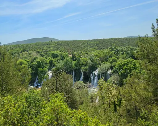
Waterfall in Bosnia and Herzegovina
Kravica Waterfall
Spectacular Cascade in Herzegovina
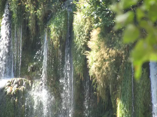
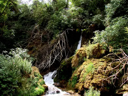
Water spreads across a wide, curved cliff face here, forming a shape often compared to a smaller Niagara. Swimmers gather in the pool below during summer months, when the water warms enough for a dip. The falls sit close to the border between Bosnia and Herzegovina and Croatia.
Waterfall in Bern
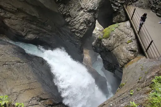
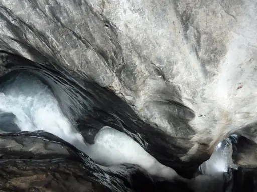
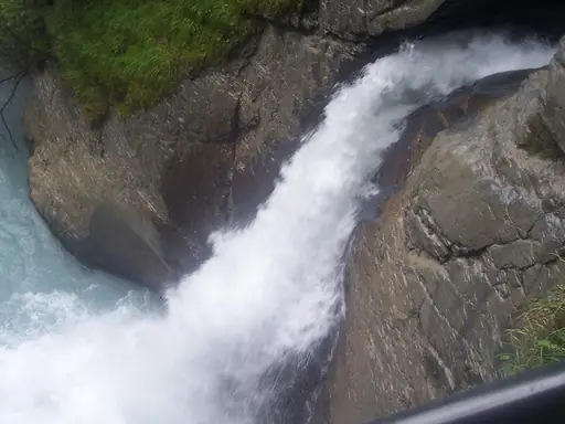
Trümmelbach Falls
Europe’s Largest Subterranean Waterfalls
Ten separate waterfalls run through tunnels carved inside a mountain here, fed by glacial meltwater from three nearby peaks. A funicular railway carries visitors partway up through the rock to viewing platforms near the water. Roughly 20,000 litres pass through the falls each second during peak summer melt.
Waterfall in Iceland
Skógafoss
Majestic cascade plunges into emerald canyon
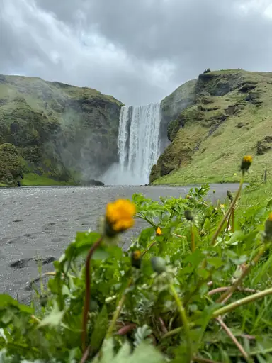
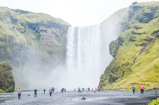
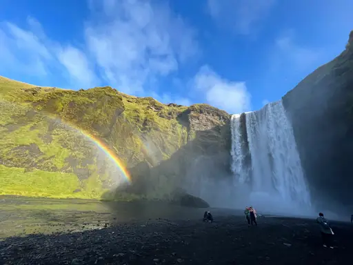
Local legend holds that a chest of gold sits hidden in a cave behind this waterfall. None has ever been found despite the story's popularity. Rainbows appear almost daily in the spray on sunny mornings and afternoons. A steep staircase climbs alongside the falls to a viewpoint over the coastline.
Country
Democratic Republic of the Congo
Wild heart of Central Africa
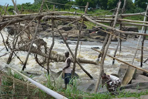
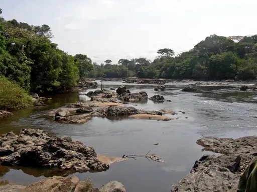
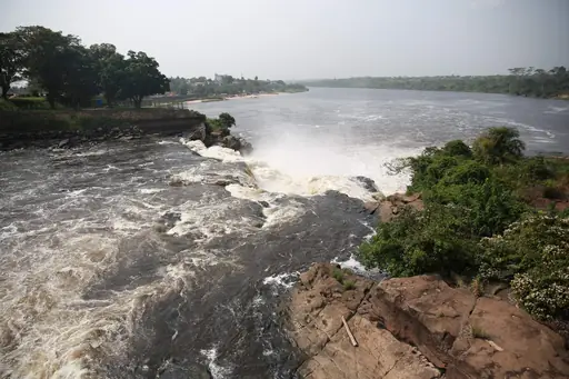
Boyoma Falls forms a series of seven cataracts along the Congo River near the city of Kisangani. By volume, this ranks among the largest waterfalls anywhere on Earth, though no single drop is especially tall. Local Wagenia fishermen still use traditional wooden platforms and basket traps to fish the rapids.
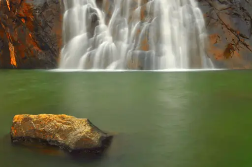
Waterfall in India
Dudhsagar Falls
Majestic cascades echo through lush jungle
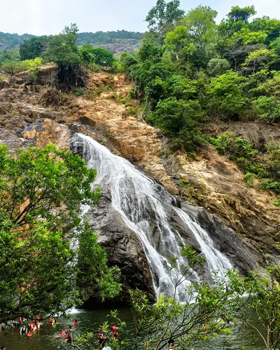
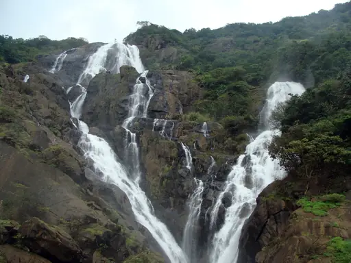
Local name translates to sea of milk, describing the white, foaming appearance of the falling water. This waterfall drops across four tiers, visible from a train line that runs directly alongside part of the falls. Monsoon season brings the heaviest flow, though trails can turn slippery then.
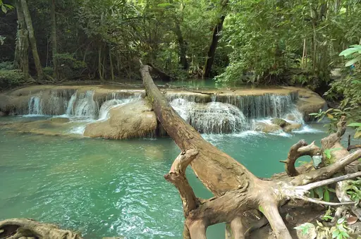
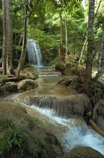
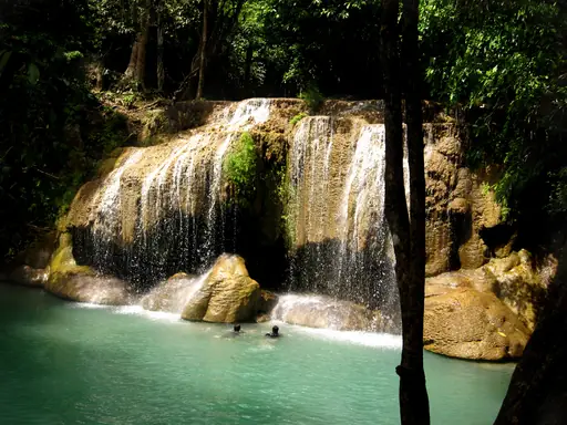
Waterfall in Thailand
Erawan Falls
Majestic cascades echoing jungle serenity
Water cascades through seven tiers here, each with its own turquoise pool suited for swimming. The falls take their name from a mythical three-headed elephant, which one of the upper tiers is said to resemble. Fish in the pools sometimes nibble gently at swimmers' feet.
Waterfall in Indonesia
Tumpak Sewu
Majestic cascades echo through lush jungle
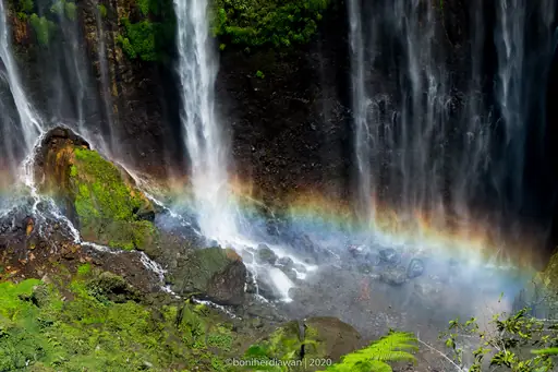
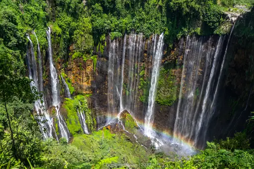
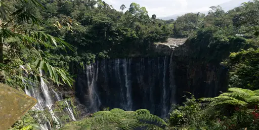
Dozens of separate streams pour over a single curved cliff here, giving this waterfall its nickname of a thousand falls. A steep, muddy trail descends through a canyon to reach the base, crossing a river along the way. Spray drifts across the entire amphitheatre-shaped cliff, soaking visitors who get close.
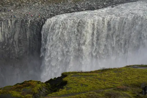
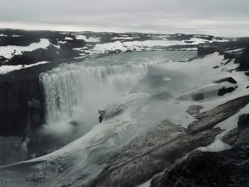
Waterfall in Iceland
Dettifoss
Majestic cascade plunges into crystal blue
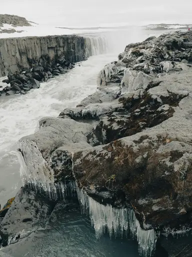
This waterfall carries more water than any other in Europe, fed by the glacial river Jokulsa a Fjollum. Grey, sediment-heavy water gives the falls a distinct colour compared to Iceland's clearer waterfalls. A canyon downstream shows evidence of catastrophic floods that reshaped the landscape thousands of years ago.
Waterfall
Niagara Falls
A Thundering Natural Wonder
Horseshoe Falls carries the largest share of water among the three falls that make up this famous crossing. Roughly six million cubic feet of water pass over the falls every minute during peak flow. Boat tours and observation towers on both the American and Canadian sides offer close views.
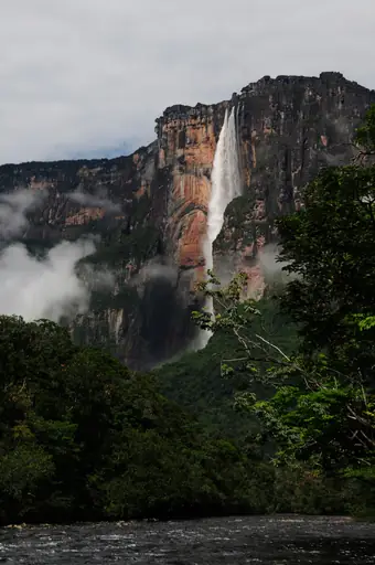
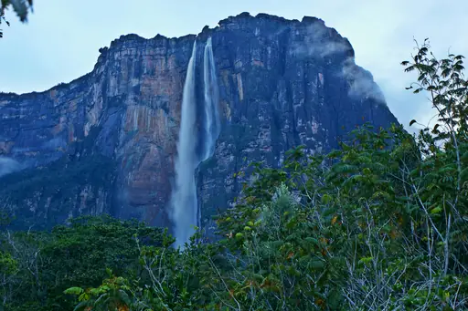
Waterfall in Venezuela
Angel Falls
Majestic cascades echoing tropical paradise
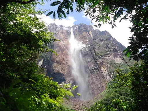
Water drops 979 metres here in an unbroken plunge, making this the tallest waterfall anywhere on Earth. Local indigenous people call it Kerepakupai Vena, meaning waterfall of the deepest place. The falls drop from Auyan-tepui, a flat-topped mountain rising from the surrounding jungle. Much of the water turns to mist before ever reaching the base.
Waterfall in Luang Prabang
Kuang Si Falls
Turquoise Tiers in Lush Jungle
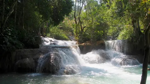
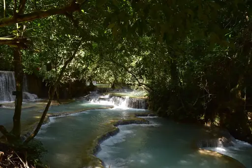
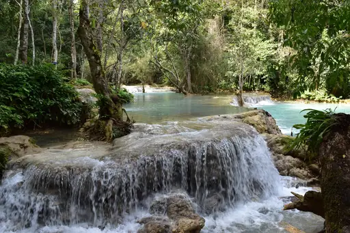
Turquoise pools step down this waterfall's base, coloured by dissolved limestone deposits in the water. Visitors can swim in several of the calmer lower pools beneath the main cascade. A rescue centre near the entrance houses sun bears saved from poachers. The main falls drop around 50 metres.
Waterfall
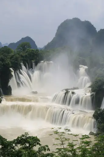
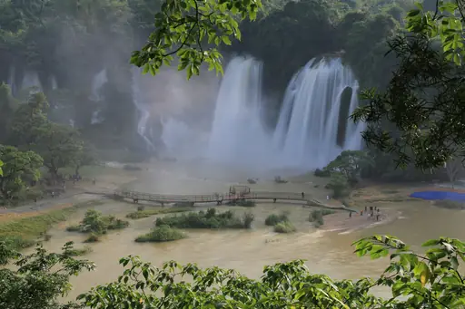
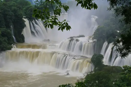
Ban Gioc - Detian Falls
Majestic cascades echo through misty valleys
This waterfall straddles the border between Vietnam and China, split into sections controlled by each country. Limestone karst peaks rise behind the falls, framing the wide, multi-tiered cascade. Bamboo rafts carry visitors across the calmer water near the base for closer views. The falls run especially full during the summer rainy season.
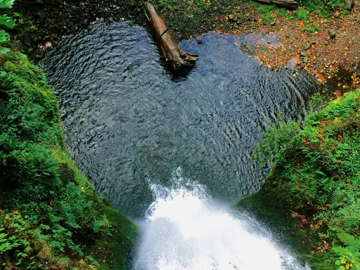
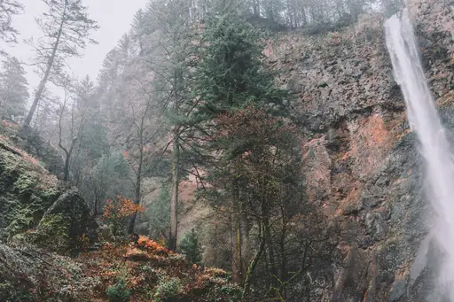
Waterfall in United States
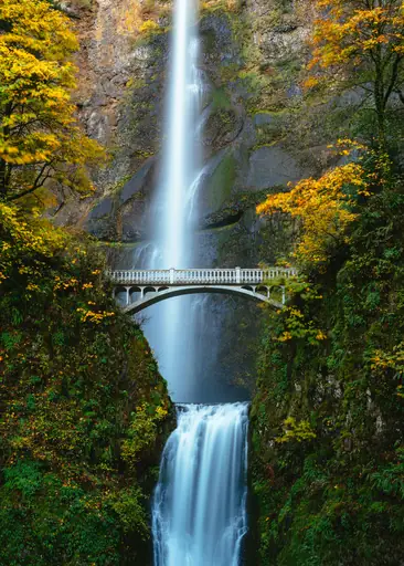
Multnomah Falls
Majestic cascades echo through lush forest
This waterfall drops in two tiers, connected by a stone footbridge called Benson Bridge built in the 1910s. It ranks among Oregon's most visited natural landmarks, reachable just off the highway through the Columbia River Gorge. A trail continues above the bridge to an overlook at the top.
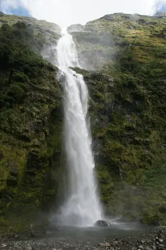
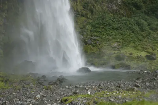
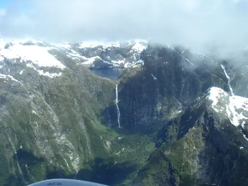
Waterfall in New Zealand
Sutherland Falls
Majestic cascade plunges through lush rainforest
Water drops in three stages here, combining for one of the tallest total waterfall heights in the world. This sits along the Milford Track, a multi-day hiking route through Fiordland National Park. A side trail branches off the main track, adding roughly an hour of walking to reach the base.
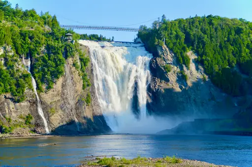
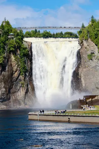
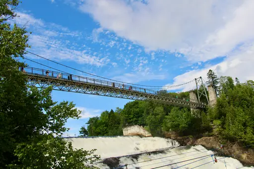
Waterfall in Quebec City
Montmorency Falls
Majestic cascade shrouded in misty splendor
This waterfall stands taller than Niagara Falls, though it carries far less water across its single drop. A cable car and suspension bridge both offer views from above, crossing directly over the falling water. Stairs alongside the falls let visitors descend closer to the base for a different angle.
Waterfall in United States
Vernal Fall
Powerful Waterfall with Misty Trails
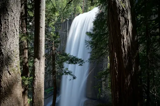
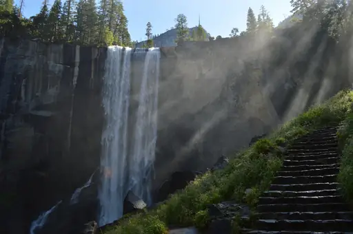
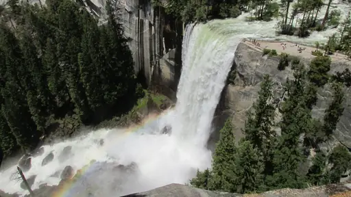
The Mist Trail climbs granite steps alongside this waterfall, often soaking hikers in spray on the way up. Rainbows form in that mist on sunny afternoons, visible from several points along the path. Water drops about 300 feet over a sheer cliff into a pool below.
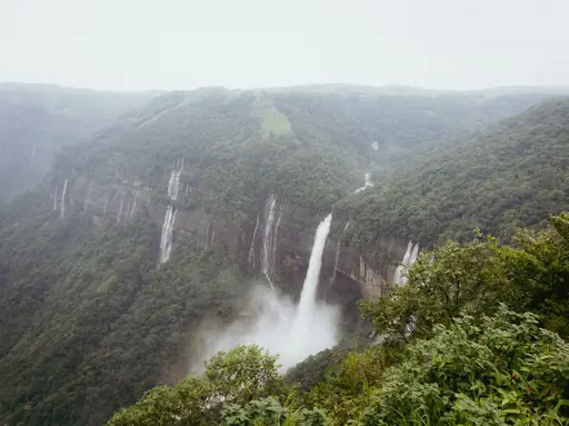
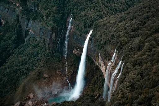
Waterfall in India
Nohkalikai Falls
Majestic cascades echoing ancient river myths
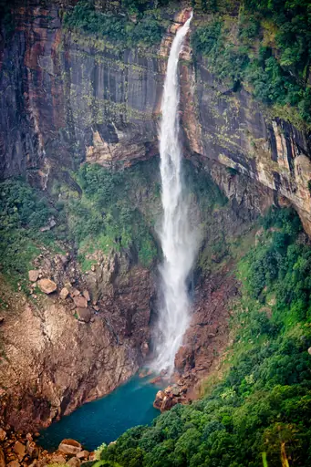
This ranks as India's tallest plunge waterfall, dropping in a single unbroken fall near the town of Cherrapunji. A pool at the base turns an unusual green colour, attributed to mineral content in the water. This region receives some of the highest rainfall totals recorded anywhere on Earth.
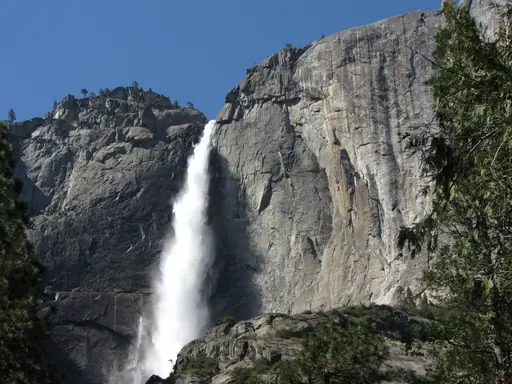
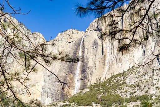
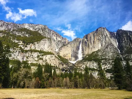
Waterfall in United States
Yosemite Falls
Majestic Waterfall in Yosemite National Park
Water drops in three stages here, combining for a height that makes this the tallest waterfall in North America. By late summer the flow often slows to a trickle, fed mostly by spring snowmelt. A short paved trail leads to the base, while a longer route climbs to the top tier.

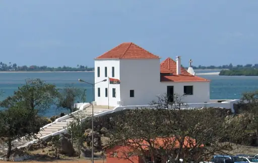
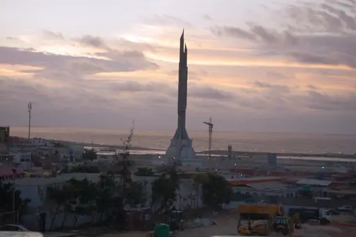
Country
Angola
Waterfalls, wildlife and colonial heritage
Ruacana Falls sits along the border with Namibia, once ranking among Africa's largest waterfalls before a dam altered its flow. Water only spills over in full force now during periods of heavy release from the upstream reservoir. The Kunene River feeds the falls, carving a gorge through the dry terrain.
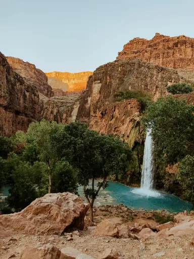
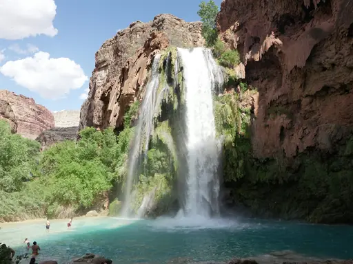
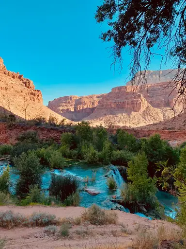
Waterfall in United States
Havasu Falls
Crimson cascades shimmer beneath desert skies
Turquoise water pools beneath this waterfall, coloured by high mineral content unusual for a desert canyon. The falls sit on Havasupai tribal land within the Grand Canyon, reachable only by a long hike or helicopter. Permits are required well in advance, as visitor numbers are strictly limited.
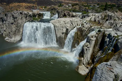
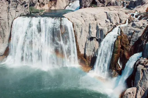
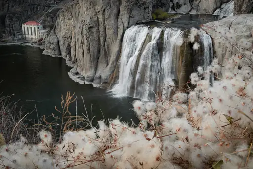
Waterfall in United States
Shoshone Falls
Majestic cascades echoing Idaho’s hidden gem
This waterfall drops higher than Niagara Falls, earning it a local nickname as the Niagara of the West. Water flow varies heavily by season, since much of the river gets diverted upstream for irrigation. Spring snowmelt typically produces the fullest and most dramatic flow over the falls.
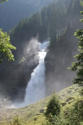
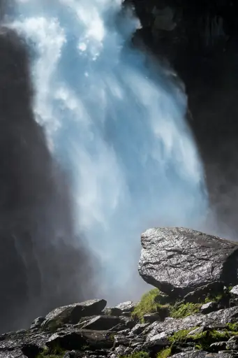
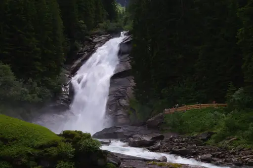
Waterfall in Salzburg
Krimml Waterfalls
Majestic cascades echo through alpine valleys
Water drops nearly 380 metres here across three tiers, ranking as Austria's tallest waterfall system. A trail winds alongside the falls, passing several viewpoints that get closer with each switchback. This sits within Hohe Tauern National Park, the largest protected area in the Alps, drawing hikers year round.
Waterfall in Uganda
Murchison Falls
Majestic cascades echoing untamed wilderness
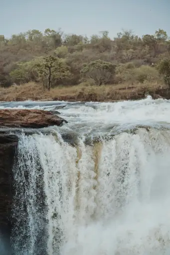
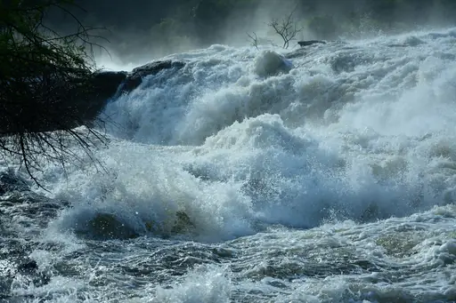
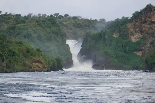
The Nile River squeezes through a gap just seven metres wide here before dropping into the gorge below. That narrow channel forces the entire river's volume through a small opening, creating intense pressure and spray. Boat safaris on the river below bring visitors close to hippos and crocodiles near the base.
Waterfall in Iceland
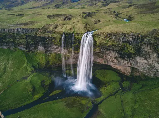
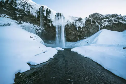
Seljalandsfoss
Majestic cascade framed by misty cliffs
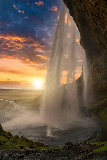
A path leads behind this waterfall, letting visitors walk in a full circle around the falling water. It drops about 60 metres from a cliff that once formed part of Iceland's coastline. Spray from the falls soaks the path year round, so waterproof gear is essential.
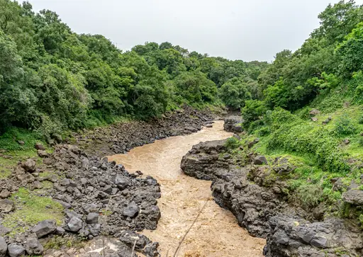
Waterfall in Ethiopia
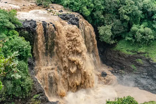
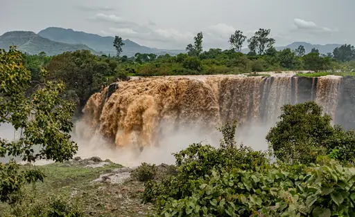
Blue Nile Falls
Majestic cascades echo ancient river legends
Local name Tis Issat translates to smoking water, describing the mist this waterfall throws into the air. The Blue Nile River drops here before continuing its long journey towards Sudan and eventually Egypt. A hydroelectric dam upstream has reduced the falls' flow compared to earlier decades.
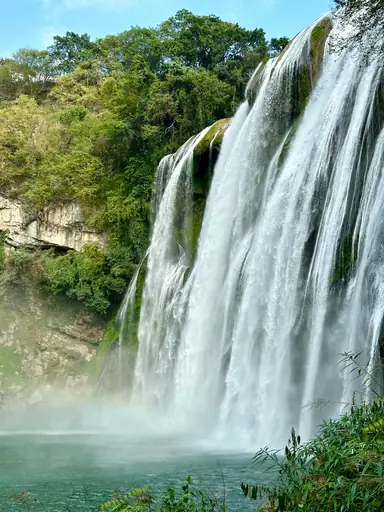
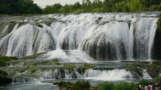
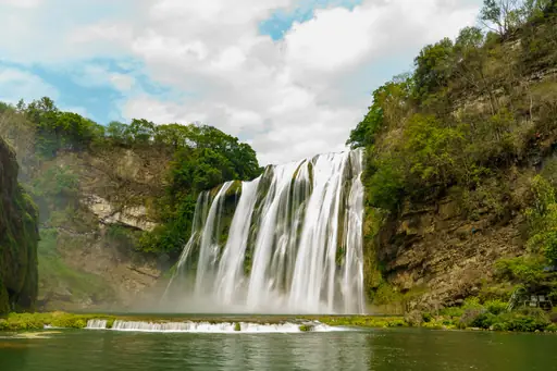
Waterfall in China
Huangguoshu Waterfall
Majestic cascades echo through misty valleys
This waterfall ranks among the largest in Asia, dropping 77 metres across a wide limestone cliff. A cave behind the falls lets visitors walk through a passage directly behind the falling water. Six other waterfalls sit within the surrounding scenic area, connected by a network of trails.
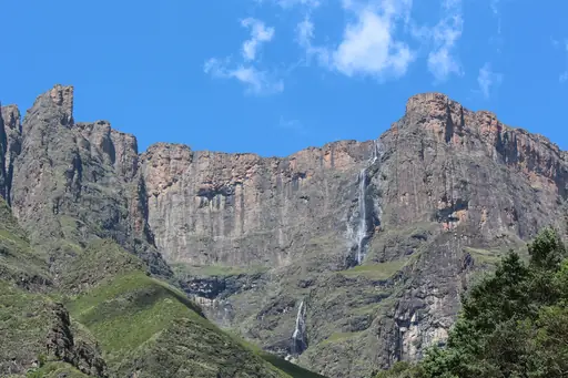
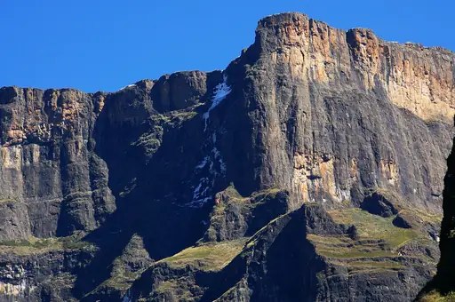
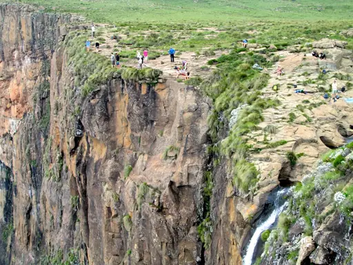
Waterfall in South Africa
Tugela Falls
Majestic cascades echoing ancient rhythms
Water drops in five stages here, combining for one of the tallest total waterfall heights anywhere in the world. The falls only run at full force after heavy rain, since the river feeding them is relatively small. A long hike across the Drakensberg escarpment leads to a viewpoint above the falls.
Other lists you may like
Discover
Best waterfall destinations in Africa
Africa's waterfalls are distributed across the continent's great river systems and escarpment zones, with the highest concentrations found in central and southern Africa where…
Read more
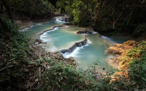
Discover
Best waterfall destinations in Asia
Asia's waterfalls are distributed across some of the continent's most biodiverse landscapes, with the highest concentrations found in the tropical rainforest zones of Southeast…
Read more
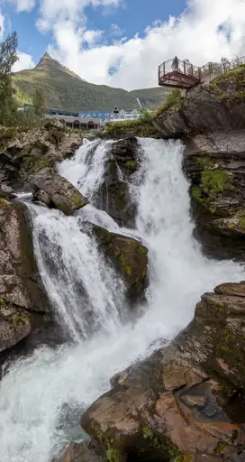
Discover
Best waterfall destinations in Europe
Asia's waterfalls are distributed across some of the continent's most biodiverse landscapes, with the highest concentrations found in the tropical rainforest zones of Southeast…
Read more
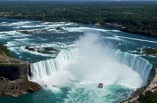
Discover
Best waterfall destinations in North America
North America's waterfalls range from the thundering glacially-fed cascades of the Pacific northwest and the iconic falls of the Great Lakes region to the seasonal desert slot…
Read more
Discover
Best waterfall destinations in South America
South America's waterfalls include some of the highest volume and most dramatic cascade systems in the world, with the continent's vast river networks and abrupt plateau and…
Read more
Discover
Best waterfall destinations in Oceania
New Zealand's South Island holds an unusually high concentration of waterfalls fed by glacial melt and heavy rainfall, including some of the tallest in the world. Australia's…
Read more
What other users say about travelfilters
“travelfilters made it easy for me to find ski areas and compare what else they offer, so that I could find the best place for my personal travel style.”

Chris
Snowboarding & Onsen trip to Japan
“I love how transparent the data feels. There is no pushy upsell, just honest information and settings I can tune to my own travel style.”

Maria
After booking her 2027 winter escape
“The level of detail for each destination and how well those are displayed, make planning feel confident instead of overwhelming.”

Mina
Planned a week in New York City
“We used travelfilters for our planning from start to end. The trip turned out even better than expected, thanks to all their tools and customisation options.”

Allan & Etienne
Trip to Japan to see autumn foliage
“Thanks to travelfilters, I found some hidden gems to see. Being able to filter for exactly your interests is a game changer for my travel planning.”

Michael
Tour through the old cities of Northern Italy
“The customizable filters helped me find a quiet beach town with good wifi and low season crowds in under five minutes.”

Diego
Weekend Escape to Llanes, Spain
“The airport connection map saved me hours by showing good flight options from my home airport to lesser-known cities.”

Nguyen
Planning a 2027 trip to France
“The website is clean, fast and focused on the search itself, which makes travelfilters feel more like a professional tool than an ad-heavy booking site.”

Hassan
Christmas Market trip, Germany
