



Was this page helpful?

| Power Grid: |
120 V, 60 Hz Plug: Type A , Type B
Type A:
  Read about power adapters |
|---|---|
| Currency: |
US Dollar (USD) £1 ≈ US$1.33 |
| Cashless info: |
Rating 5/5
The U.S. is highly cashless, with credit and debit cards accepted almost everywhere. Mobile payment options like Apple Pay and Google Pay are widely used.
Save with a travel credit card |
| eSIM providers: |
Best value: Saily Flexibility: Airalo Read our in-depth comparison |
| Tipping: | Tipping is customary and expected in the U.S. In restaurants, 15-20% is standard. Taxi drivers, hotel staff, and tour guides also expect tips, usually around 10-20% depending on the service. |
|---|---|
| Public drinking: | Public drinking laws vary by state, but it is generally prohibited in public spaces without a permit. |
| Public smoking: | Smoking is restricted in most indoor public spaces and some outdoor areas. Local laws vary. |
| Etiquette: | Greet with a firm handshake, maintain eye contact, respect personal space, and avoid discussing politics or income unless invited to share opinions. Politeness and friendliness are appreciated. |
| Thanksgiving (November) |
A major holiday with closures and domestic travel surges. |
|---|---|
| Independence Day (July) |
Expect parades, fireworks, and celebrations nationwide. |
| Christmas (December) |
Markets, festive events, and crowded tourist spots. |
| Emergency contact: | Emergency Number: 911 (Police, Fire, Ambulance) |
|---|---|
| Taxi apps: | Uber, Lyft, Bolt |
| Helpful links: |
Wikipedia Visa regulations Customs & border control Travel with medicine |
| Other: | The U.S. is known for its diverse landscapes, cultural experiences, and regional cuisines. Public transport is efficient in cities but less so in rural areas. Renting a car is recommended for exploring national parks. |
The best times to travel section shows how the months compare for a visit, so you can find the time of year that fits what you want to do.
Background colours of the months:
The colour shows the typical temperature: yellow (hot), green (mild) and blue (cold). How strong the colour is shows the travel season: full colour means high season, soft colour means shoulder season and soft-striped means off season.
Weather symbols:
Each month has one symbol showing what the weather is typically like, such as hot and sunny, freezing or a rainy or snowy season. Use them to quickly spot months that match the weather you want, or to avoid the ones that don't.
Crowdedness:
The people icon shows how busy the place usually is. The more people, the more crowded it gets.
Additional notes:
The grey info boxes point out special things worth knowing, like recurring weather issues or seasonal events.
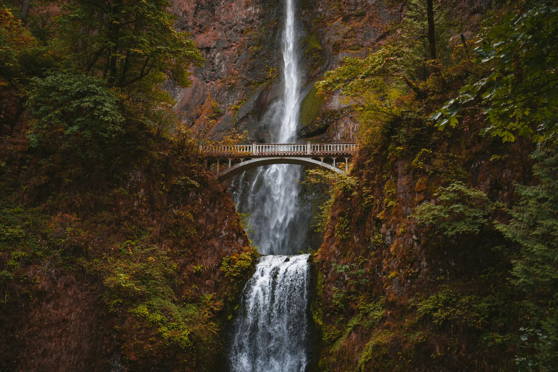
Multnomah Falls stands as a prominent natural landmark in Oregon. Flowing down a steep basalt cliff the water reaches a height of about 620 feet making it one of the tallest falls in the region. The trail leading to the base provides clear views and allows visitors to experience its power up close.
The surrounding area features lush greenery and dense forests that frame the cascade. In spring snowmelt and rain swell the water creating a thunderous sound that echoes through the canyon. Hikers often pause at viewpoints to watch droplets mist their faces while birds call from nearby trees adding layers of natural sound.
Visitors can explore several paths around the falls including a short loop that brings them close to the lower drop. The area is well maintained with benches and informational signs explaining local geology and plant life. Photography opportunities abound especially during early morning light when fog rises from the water creating soft glows.
Nearby towns such as Troutdale provide lodging food options and easy access to parking. Public transit connects major cities like Portland making day trips practical for those interested in seeing this feature without long drives. Seasonal changes bring different colors to the landscape offering varied scenery throughout the year.
Multnomah Falls, located in Oregon’s Columbia River Gorge, is accessible via several routes. The nearest major highway is Interstate 84, with Exit 28 leading to Multnomah Falls Lodge Road. From Portland, the falls are approximately 30 miles east, reachable by car within a 45-minute drive along Highway 30 or through the scenic Columbia River Gorge Scenic Byway (Highway 26). Public transit options include regional buses operated by TriMet and Jefferson Transit, connecting Portland to the area. A short walking trail leads from the parking area to the falls’ base. Bicycle routes follow paved paths along the river, while seasonal road closures may affect access during winter months.
Nestled in the Columbia River Gorge, the area around Multnomah Falls offers a mix of rustic lodges and modern inns that cater to both budget travelers and those seeking luxury. Rustic cabins and B&Bs line the scenic roads, often featuring wood‑fire fireplaces and panoramic views, with nightly rates ranging from US$80 (£59.81) to US$150 (£112.14). For higher-end stays, boutique hotels provide spa amenities, gourmet dining and easy access to hiking trails, typically priced between US$200 (£149.52) and US$350 (£261.66) per night. Campers can pitch tents at nearby campgrounds or opt for glamping pods that combine comfort with nature. Many accommodations emphasize eco‑friendly practices, reflecting the region’s commitment to preserving its natural beauty.
Log in to add this place to a travel list and get a summary of all recommended items for your whole trip.
We calculate the average costs when travelling to destinations and compare those with the living costs at your home. With this you can get an estimate of how expensive or cheap the destination is for you.
To customise this, you can set up which location and price level are used for the calculations in your account settings.
The exchange rate price factor shows how expensive or cheap a currency currently is compared to its historical average. It's a quick way to see if a country is currently more or less affordable due to exchange rate changes.
