





Was this page helpful?

| Public website: | www.nps.gov |
|---|
| Power Grid: |
120 V, 60 Hz Plug: Type A , Type B
Type A:
  Read about power adapters |
|---|---|
| Currency: |
US Dollar (USD) £1 ≈ US$1.33 |
| Cashless info: |
Rating 5/5
The U.S. is highly cashless, with credit and debit cards accepted almost everywhere. Mobile payment options like Apple Pay and Google Pay are widely used.
Save with a travel credit card |
| eSIM providers: |
Best value: Saily Flexibility: Airalo Read our in-depth comparison |
| Tipping: | Tipping is customary and expected in the U.S. In restaurants, 15-20% is standard. Taxi drivers, hotel staff, and tour guides also expect tips, usually around 10-20% depending on the service. |
|---|---|
| Public drinking: | Public drinking laws vary by state, but it is generally prohibited in public spaces without a permit. |
| Public smoking: | Smoking is restricted in most indoor public spaces and some outdoor areas. Local laws vary. |
| Etiquette: | Greet with a firm handshake, maintain eye contact, respect personal space, and avoid discussing politics or income unless invited to share opinions. Politeness and friendliness are appreciated. |
| Thanksgiving (November) |
A major holiday with closures and domestic travel surges. |
|---|---|
| Independence Day (July) |
Expect parades, fireworks, and celebrations nationwide. |
| Christmas (December) |
Markets, festive events, and crowded tourist spots. |
| Emergency contact: | Emergency Number: 911 (Police, Fire, Ambulance) |
|---|---|
| Taxi apps: | Uber, Lyft, Bolt |
| Helpful links: |
Wikipedia Visa regulations Customs & border control Travel with medicine |
| Other: | The U.S. is known for its diverse landscapes, cultural experiences, and regional cuisines. Public transport is efficient in cities but less so in rural areas. Renting a car is recommended for exploring national parks. |
The best times to travel section shows how the months compare for a visit, so you can find the time of year that fits what you want to do.
Background colours of the months:
The colour shows the typical temperature: yellow (hot), green (mild) and blue (cold). How strong the colour is shows the travel season: full colour means high season, soft colour means shoulder season and soft-striped means off season.
Weather symbols:
Each month has one symbol showing what the weather is typically like, such as hot and sunny, freezing or a rainy or snowy season. Use them to quickly spot months that match the weather you want, or to avoid the ones that don't.
Crowdedness:
The people icon shows how busy the place usually is. The more people, the more crowded it gets.
Additional notes:
The grey info boxes point out special things worth knowing, like recurring weather issues or seasonal events.
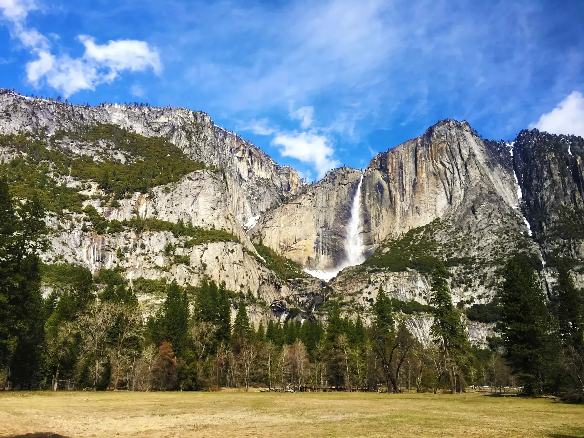
Yosemite Falls is an iconic feature of Yosemite National Park and the tallest waterfall in North America. It plunges a total of 2,425 feet, with three tiers: Upper, Middle Cascades and Lower Falls. The falls are at their most powerful in late spring, due to snowmelt.
The Yosemite Falls Trail offers hikers stunning views from base to summit. The climb is strenuous and requires good physical condition, as it includes several steep switchbacks. While the trail is popular, crowds tend to thin out early or late in the day. Visitors should stay on marked trails and be cautious near cliffs.
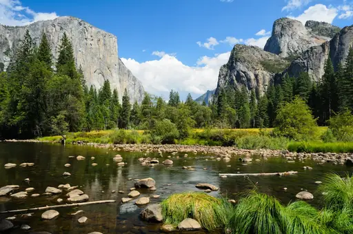
Aside from the waterfall itself, Yosemite Valley and nearby landmarks like Columbia Rock provide postcard-perfect photo opportunities. The park's climate features warm summers and chilly winters, with a Mediterranean classification (Csb). Visitors should be prepared for varying temperatures and possible snow at higher elevations.
Visiting during the shoulder seasons of spring and fall offers the best balance of water flow, fewer crowds and comfortable weather. Safety tips include carrying plenty of water, wearing sturdy footwear and being mindful of weather changes during the hike.
Yosemite Falls is situated within Yosemite National Park in California. The nearest airports are Fresno Yosemite International and San Francisco International. Visitors typically rent a car or take shuttles into the park. Access to Yosemite Valley is mainly via the park's shuttle system or hiking trails.
Accommodation options near Yosemite Falls range from campgrounds and rustic lodges in Yosemite National Park to hotels and inns in nearby towns like Mariposa and El Portal.
Log in to add this place to a travel list and get a summary of all recommended items for your whole trip.
We calculate the average costs when travelling to destinations and compare those with the living costs at your home. With this you can get an estimate of how expensive or cheap the destination is for you.
To customise this, you can set up which location and price level are used for the calculations in your account settings.
The exchange rate price factor shows how expensive or cheap a currency currently is compared to its historical average. It's a quick way to see if a country is currently more or less affordable due to exchange rate changes.
