



Was this page helpful?

| Power Grid: |
120 V, 60 Hz Plug: Type A , Type B
Type A:
  Read about power adapters |
|---|---|
| Currency: |
US Dollar (USD) £1 ≈ US$1.33 |
| Cashless info: |
Rating 5/5
The U.S. is highly cashless, with credit and debit cards accepted almost everywhere. Mobile payment options like Apple Pay and Google Pay are widely used.
Save with a travel credit card |
| eSIM providers: |
Best value: Saily Flexibility: Airalo Read our in-depth comparison |
| Tipping: | Tipping is customary and expected in the U.S. In restaurants, 15-20% is standard. Taxi drivers, hotel staff, and tour guides also expect tips, usually around 10-20% depending on the service. |
|---|---|
| Public drinking: | Public drinking laws vary by state, but it is generally prohibited in public spaces without a permit. |
| Public smoking: | Smoking is restricted in most indoor public spaces and some outdoor areas. Local laws vary. |
| Etiquette: | Greet with a firm handshake, maintain eye contact, respect personal space, and avoid discussing politics or income unless invited to share opinions. Politeness and friendliness are appreciated. |
| Thanksgiving (November) |
A major holiday with closures and domestic travel surges. |
|---|---|
| Independence Day (July) |
Expect parades, fireworks, and celebrations nationwide. |
| Christmas (December) |
Markets, festive events, and crowded tourist spots. |
| Emergency contact: | Emergency Number: 911 (Police, Fire, Ambulance) |
|---|---|
| Taxi apps: | Uber, Lyft, Bolt |
| Helpful links: |
Wikipedia Visa regulations Customs & border control Travel with medicine |
| Other: | The U.S. is known for its diverse landscapes, cultural experiences, and regional cuisines. Public transport is efficient in cities but less so in rural areas. Renting a car is recommended for exploring national parks. |
The best times to travel section shows how the months compare for a visit, so you can find the time of year that fits what you want to do.
Background colours of the months:
The colour shows the typical temperature: yellow (hot), green (mild) and blue (cold). How strong the colour is shows the travel season: full colour means high season, soft colour means shoulder season and soft-striped means off season.
Weather symbols:
Each month has one symbol showing what the weather is typically like, such as hot and sunny, freezing or a rainy or snowy season. Use them to quickly spot months that match the weather you want, or to avoid the ones that don't.
Crowdedness:
The people icon shows how busy the place usually is. The more people, the more crowded it gets.
Additional notes:
The grey info boxes point out special things worth knowing, like recurring weather issues or seasonal events.
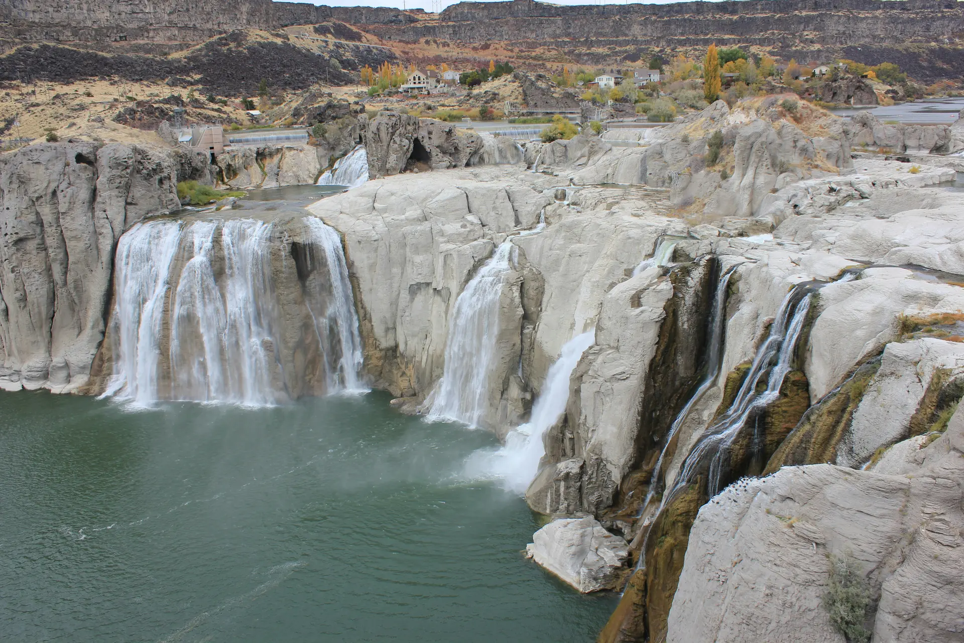
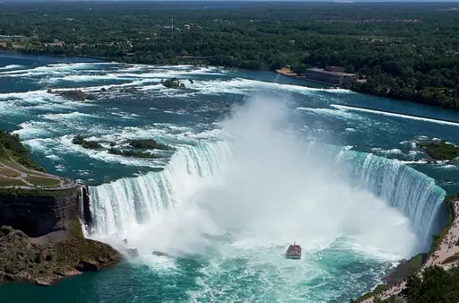
Shoshone Falls stands as a powerful example of natural force in Idaho’s landscape. The waterfall drops over 200 feet creating a thunderous sound that travelers recognize from afar. Visitors often notice the mist rising early in morning hours making the area feel alive with energy and cool spray.
The trail leading to the falls provides clear views without demanding advanced hiking skills. Many people stop at viewing platforms for photos or simply sit on rocks to listen to water crash against stone. The path stays flat allowing families and individuals alike to enjoy the scenery comfortably throughout the year.
Seasonal changes shape how Shoshone Falls looks across months. In spring snowmelt the flow grows strong while summer brings calmer streams that still feel impressive. Autumn adds colors to surrounding trees making reflections in water shimmer with orange and red tones. Winter sometimes freezes parts of the falls creating icy shapes that last until warmer days arrive.
Nearby towns such as Twin Falls provide basic lodging food options and local history about the region’s development. Guides recommend bringing sturdy shoes rain gear and enough water for short walks. Park rangers share safety tips about slippery rocks and changing weather to keep every visit safe and pleasant.
Shoshone Falls is located in the U.S. state of Idaho, approximately 45 miles southwest of the city of Twin Falls. The falls are accessible via a network of paved and unpaved trails within Shoshone Falls State Park. Visitors can reach the area by driving along Highway 21 or taking a detour from Interstate 84. Public transportation options to the site are limited, though local tour services occasionally offer guided trips. Parking is available near the falls, with designated lots accommodating cars and buses. The location is open daily during daylight hours, with seasonal variations affecting accessibility due to weather conditions such as snow or ice in winter months.
Shoshone Falls sits in a rural corridor where lodging ranges from rustic cabins to modest motels and campgrounds. The town of Twin Falls offers a handful of mid‑priced inns that emphasize local charm, often featuring wood‑fire fireplaces and views of the Snake River. For travelers seeking higher comfort, a few upscale resorts on the riverbank provide spa amenities, heated pools and gourmet dining with panoramic vistas of the falls. Campers can pitch tents or rent RV sites at nearby state parks, enjoying easy access to hiking trails and scenic overlooks. The area is renowned for its “riverfront” accommodations that blend natural beauty with cozy hospitality, catering to both budget‑conscious visitors and those desiring a luxurious retreat.
Log in to add this place to a travel list and get a summary of all recommended items for your whole trip.
We calculate the average costs when travelling to destinations and compare those with the living costs at your home. With this you can get an estimate of how expensive or cheap the destination is for you.
To customise this, you can set up which location and price level are used for the calculations in your account settings.
The exchange rate price factor shows how expensive or cheap a currency currently is compared to its historical average. It's a quick way to see if a country is currently more or less affordable due to exchange rate changes.
