
Best natural wonder destinations in Europe
Best natural wonder destinations in Europe
Scenic fjords, valleys, and physical landmarks across Europe
Europe's natural wonders tend toward the intimate rather than the epic, but the continent has landscapes and natural phenomena that are genuinely extraordinary on any global scale. Ancient geological forces, glacial activity, volcanic systems and the meeting of different climatic zones have produced a remarkable variety of natural environments within a relatively compact geography.
The range covers active volcanic landscapes, ancient cave systems, glacial fjords, vast wetland ecosystems and atmospheric light phenomena in the far north. Some of Europe's most remarkable natural sites are well known and well visited. Others remain relatively obscure despite offering experiences that match anything the continent's more famous destinations have to offer.
Seasonality is particularly important for several of Europe's natural wonders. Northern light phenomena require winter darkness, glacial landscapes are most accessible in summer and certain geological and coastal sites are dramatically affected by seasonal weather. Timing a visit correctly and arriving with an understanding of what conditions to expect makes a significant difference to the quality of the experience.
Lists by region
National Park in Norway
Jotunheimen
Home of giants and glaciers
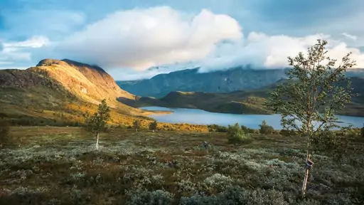
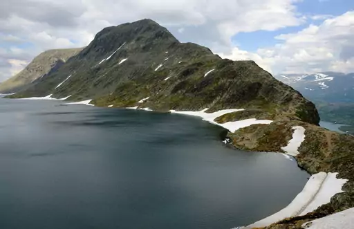
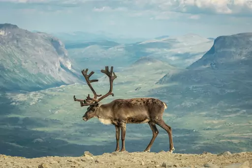
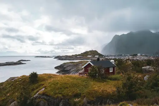
Norway's tallest peaks rise within Jotunheimen, a mountain range whose name means home of the giants. Glaciers cling to the higher summits, feeding streams that cut through the valleys below. Besseggen ridge narrows between two lakes of strikingly different colour. Hikers cross exposed terrain here with sweeping views in every direction.
Village in Norway
Reine
Lofoten’s Iconic Fjord Village
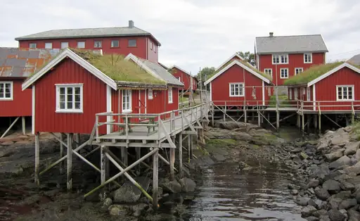
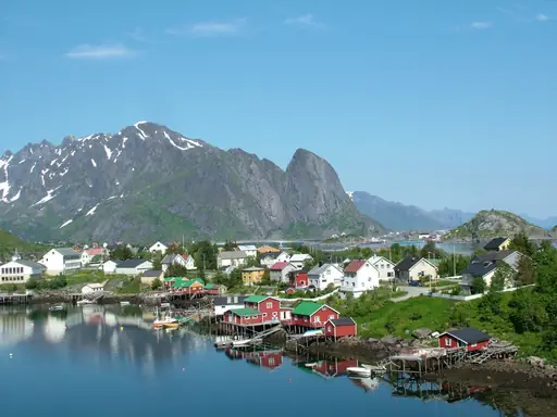
Reine's red fishing cabins sit beneath jagged peaks rising straight from the fjord. Steep granite mountains ring the village, among the most photographed in Lofoten. Cod hung to dry on wooden racks lines the shore each winter season. Calm water reflects the surrounding peaks on still mornings near the harbour.
National Park in Iceland
Vatnajökull National Park
Glaciers, Volcanoes and Ice Caves
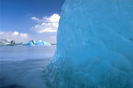
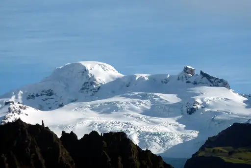
Vatnajokull covers roughly eight percent of Iceland, the largest glacier in Europe. Ice caves form beneath the glacier each winter, their walls glowing pale blue. Volcanoes lie hidden beneath the ice, occasionally triggering sudden floods when they erupt. Diamond Beach glitters with ice chunks washed ashore near the glacier's edge.
Town in Slovenia
Postojna
Caves, Castles and Karst Wonders
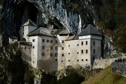
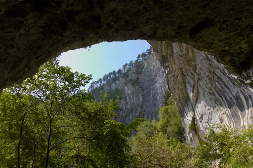
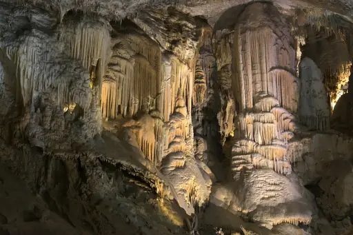
Postojna Cave stretches more than 24 kilometres through limestone, among Europe's largest cave systems. A small train carries visitors deep into the cave past stalactites and stalagmites. Olms, blind cave salamanders, live in the cave's underground pools. Predjama Castle sits built directly into a cliff face nearby.
Island in United Kingdom
Isle of Skye
Dramatic Landscapes and Ancient Legends
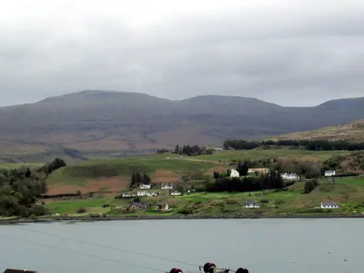
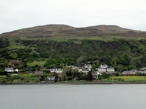
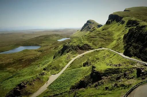
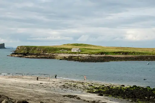
The Old Man of Storr's rock pinnacle rises above Skye's Trotternish Peninsula. Fairy Pools' clear blue water pools beneath a series of small waterfalls nearby. The Quiraing's landslip terrain shifts the ground slightly each year. Cuillin's jagged ridge dominates the island's southern skyline, ringed by cloud.
Town in Iceland
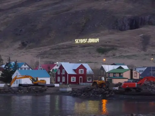
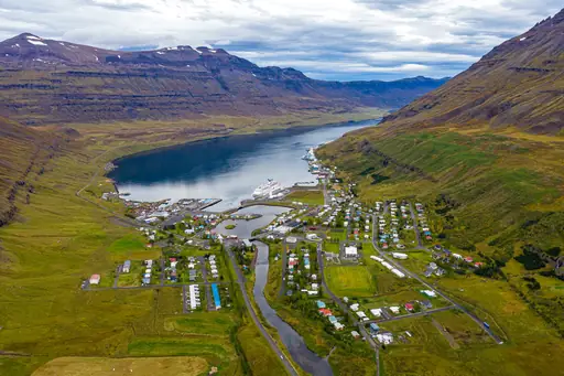
Seydisfjordur
Colorful Fjord Village of the East
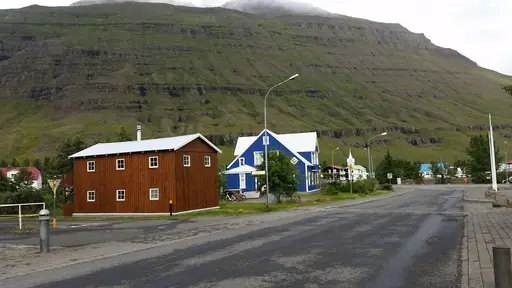
Waterfalls drop down the mountainsides surrounding Seydisfjordur's narrow fjord. Colourful wooden buildings line the town's main street, built during a herring boom decades ago. A rainbow-painted road leads from downtown towards the town's blue church. Snow often lingers on the surrounding peaks well into summer.
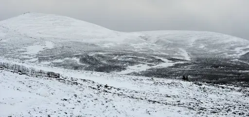
National Park in United Kingdom
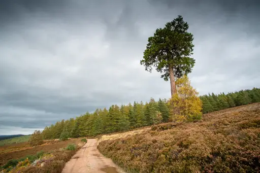
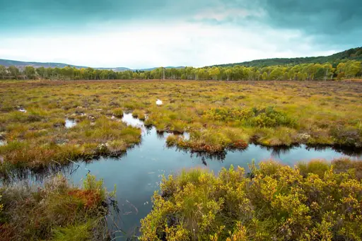
Cairngorms National Park
Scotland’s Wild Heart of Adventure
Ancient pine forest covers parts of the Cairngorms, remnants of an old Caledonian woodland. Five of Scotland's six highest peaks rise within the park's boundaries. Reindeer roam the high plateau, reintroduced to the Cairngorms decades ago. Golden eagles nest in the park's remote glens and cliffs.
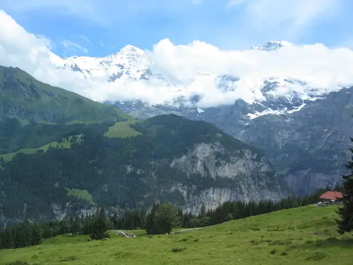
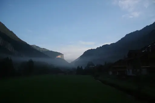
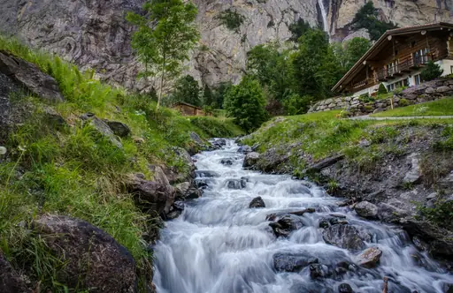
Village in Switzerland
Lauterbrunnen
Valley of 72 waterfalls
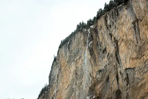
Waterfalls line Lauterbrunnen's steep-walled valley, with more than seventy dropping from the surrounding cliffs. Staubbach Falls plunges almost 300 metres straight down near the village. Trummelbach Falls cuts through the rock inside the mountain, reached by a tunnel lift. Jungfrau's peak rises at the valley's far end, visible from the village streets.
National Park in Croatia
Plitvice Lakes National Park
Cascading Waterfalls and Turquoise Lakes
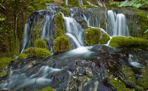
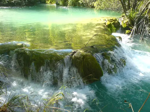
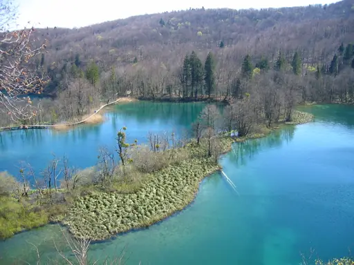
Sixteen terraced lakes cascade into one another at Plitvice, linked by waterfalls and travertine dams. Mineral-rich water shifts the lakes between shades of blue, green and turquoise. Wooden boardwalks wind directly over parts of the water and falls. Forested hills surround the lakes, home to wolves and brown bears.
Town in Italy
Tropea
Italy's Coastal Hidden Gem
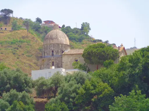
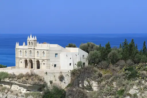
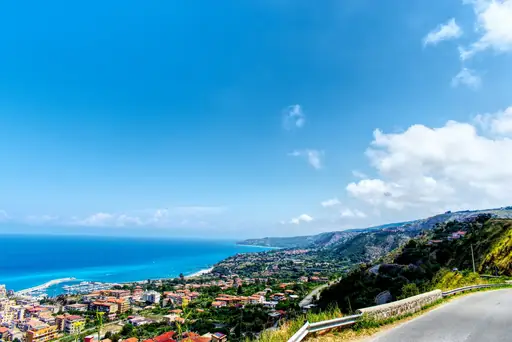
Tropea's old town sits atop a cliff overlooking a beach of fine golden sand. A small church perched on an offshore rock marks the edge of the bay. Red onions grown in the surrounding fields are prized across southern Italy. Clear turquoise water laps the coastline below the cliffside streets.
Village in Switzerland
Wengen
Car-Free Alpine Bliss and Epic Views
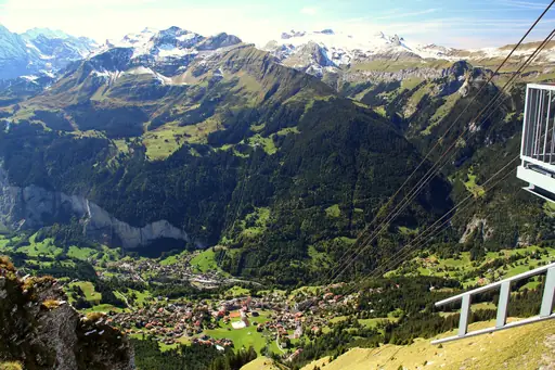
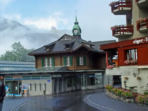
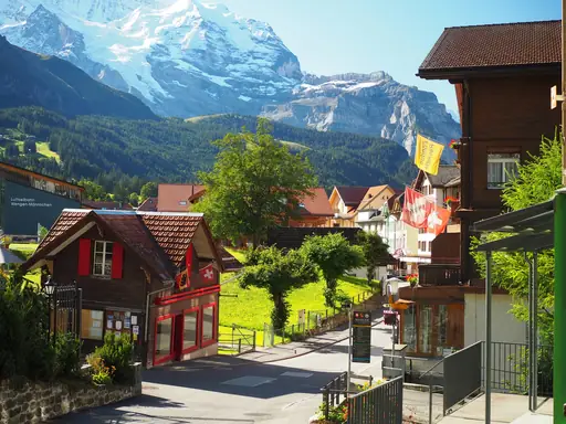
Wengen sits on a car-free ledge above Lauterbrunnen's valley, reached only by mountain train. Jungfrau's snow-capped peak rises directly across the valley from the village. The Lauberhorn ski run drops from the village towards the valley floor below. Waterfalls are visible from town, dropping from cliffs on the opposite wall.
Nature Reserve in Greece
Meteora
Monasteries Suspended in the Sky
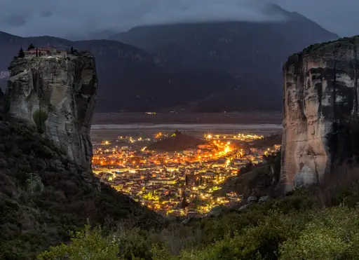
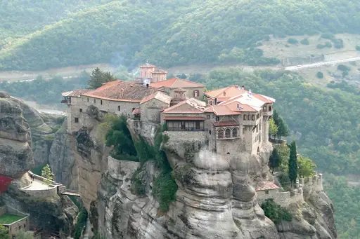
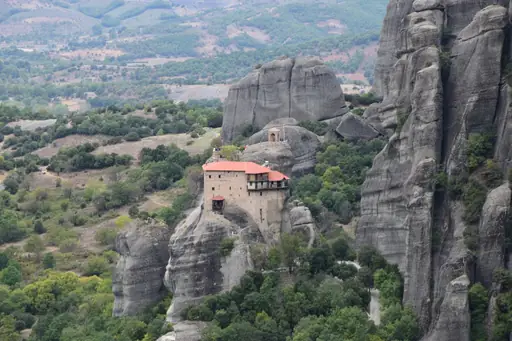
Monasteries perch atop sheer sandstone pillars at Meteora, some rising over 400 metres. Monks once reached the summits only by rope baskets hauled up the cliff face. Erosion shaped the rock formations over millions of years into their current towers. Six monasteries remain active today, open to visitors along steep stone stairways.
National Park in Iceland
Þingvellir National Park
Where History Meets Nature’s Power
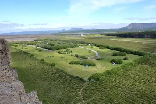
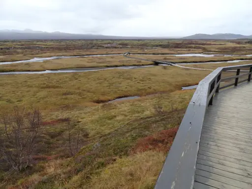
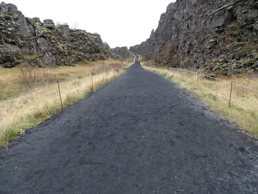
Thingvellir sits in a rift valley where the North American and Eurasian plates pull apart. Cracks and fissures split the ground, some filled with startlingly clear glacial water. Divers can swim through the Silfra fissure between the two continents. Iceland's medieval parliament once met on the plain beside the rift.
Town in Austria
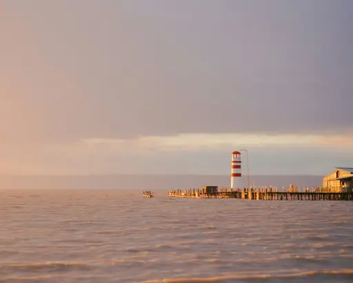
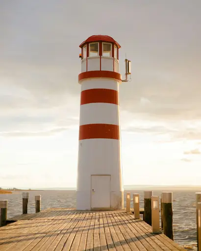
Neusiedl am See
Lakeside Charm and Panonnian Wines
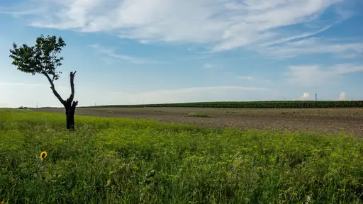
Reed beds line much of Lake Neusiedl's shore, among the largest wetlands in Central Europe. The shallow, salty lake attracts more than 300 recorded bird species. Windsurfers use steady winds that sweep across the lake's open water. Vineyards cover the gentle hills surrounding the lake's Austrian shore.
Island in Ireland
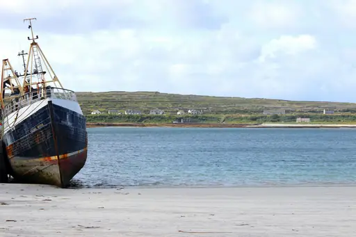
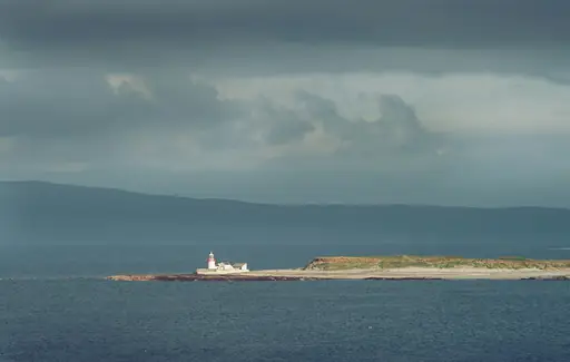
Inishmore
Stone Forts, Cliffs and Celtic Spirit
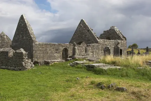
Dun Aonghasa's stone fort sits atop a sheer cliff, dropping straight to the Atlantic below. Limestone pavement covers much of Inishmore, crisscrossed by centuries-old dry stone walls. The Worm Hole, a rectangular natural pool, cuts into rock near the southern shore. Currachs, traditional rowing boats, are still built on the island by hand.
Archipelago in Portugal
Azores
Volcanic Isles of Atlantic Wonders
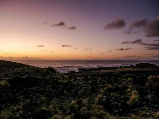
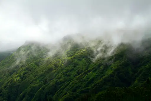
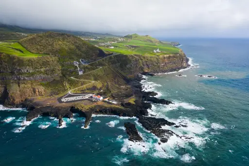
Twin crater lakes fill Sete Cidades, one blue and one green, set inside a dormant volcano. Whales and dolphins pass close to the islands, drawing boats out from several ports. Hot springs bubble through the ground at Furnas, hot enough to cook food underground. Volcanic cliffs drop into the Atlantic along much of the coastline.
Region in Finland
Lapland
Northern lights and midnight sun
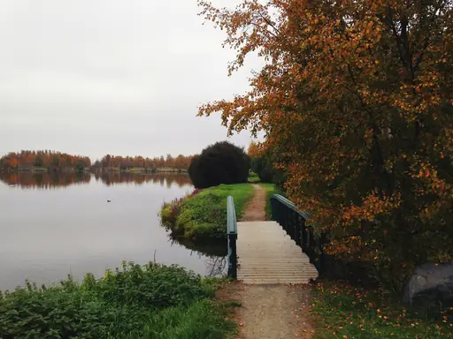
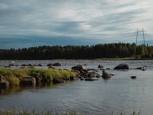
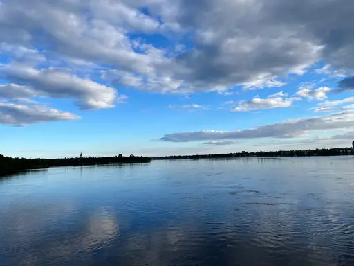
The northern lights flicker over Finnish Lapland on clear nights through much of winter. Snow covers the region for roughly six months, drawing skiers and reindeer sleds alike. Midnight sun replaces the darkness each summer, keeping the sky bright around the clock. Vast pine forest and frozen lakes stretch across the sparsely populated region.
National Park in Italy
Dolomites National Park
Towering peaks and pristine wilderness
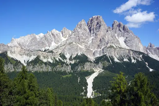
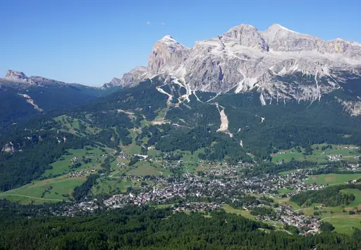
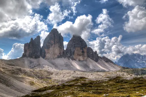
Pale limestone peaks rise sharply across the Dolomites, glowing pink at sunset most evenings. Tre Cime di Lavaredo's three distinct towers rank among the range's most photographed formations. Via ferrata routes climb fixed cables once used by soldiers during wartime. Alpine meadows fill the valleys between peaks each summer season.
Nature Reserve in Portugal
Sintra-Cascais Nature Park
Where Europe meets the Atlantic
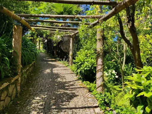
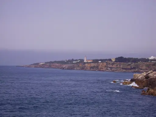
Cabo da Roca marks continental Europe's westernmost point within this park's boundaries. Cliffs drop sharply into the Atlantic along much of the protected coastline. Misty forest covers the hills around Sintra, cooler than the surrounding lowlands. Palaces and castles sit scattered through the park's hilltop woodland.
Region in United Kingdom
Scottish Highlands
Rugged Beauty and Ancient Legends
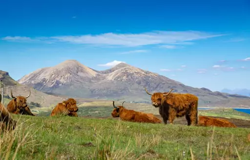
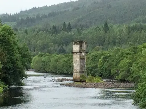
Glen Coe's steep valley cuts through the Highlands, framed by peaks shaped by ancient glaciers. Loch Ness stretches through the Great Glen, deep enough to hide much of the mountain above it. Ben Nevis rises nearby, the tallest peak in the British Isles. Red deer roam the open moorland across much of the region.
Mountain in Slovakia
Vysoké Tatry
Slovakia’s Majestic Alpine Playground
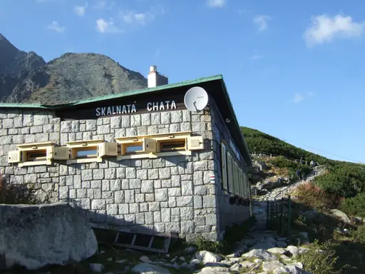
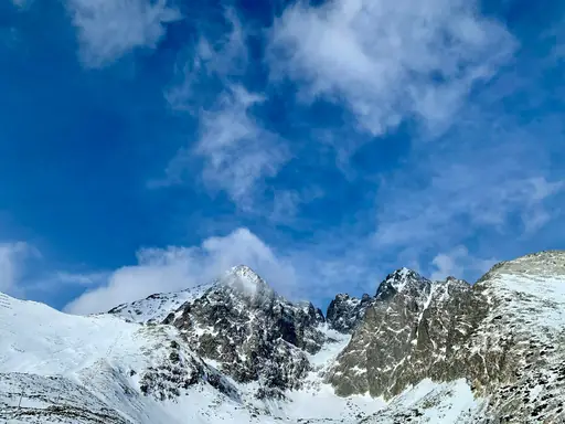
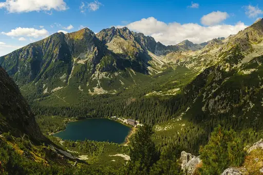
Jagged granite peaks rise sharply from Vysoke Tatry, the tallest range in the Carpathians. Glacial lakes called plesa sit beneath the summits, coloured deep blue on clear days. Cable cars climb towards Lomnicky Stit, one of the range's highest points. Marked trails cross alpine terrain past waterfalls and rocky ridgelines.
Village in Austria
Lech and Zürs am Arlberg
Alpine luxury meets skiing heritage
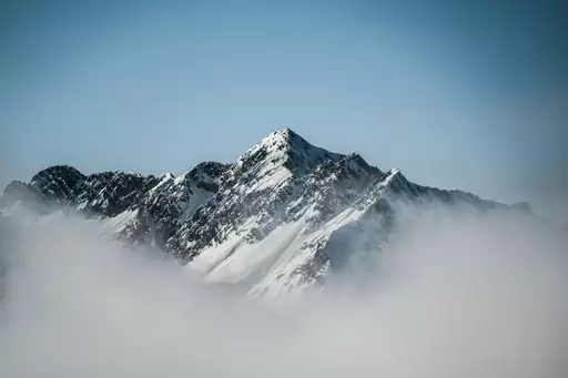
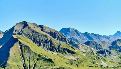
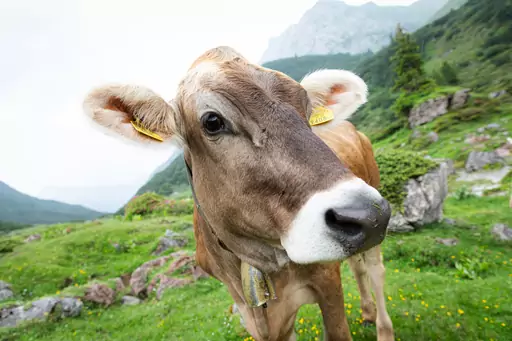
Deep powder snow covers Lech and Zurs most winters, among the snowiest resorts in the Alps. Interconnected lifts link the two villages across the Arlberg's high terrain. Alpine meadows fill the valley each summer once the snow melts away. Skiing here traces back to the early 1900s, among Austria's oldest resorts.
Island in Croatia
Brač
Island of Sun, Stone and Sea
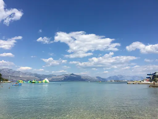
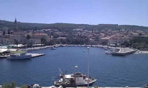
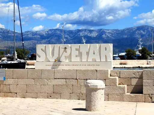
Zlatni Rat's pebble beach curves out into the Adriatic, shifting shape with the wind and current. Pine forest backs the shoreline, offering shade just steps from the water. Vidova Gora, Brac's highest peak, looks down over the beach from above. White limestone quarried on the island once supplied stone for distant buildings.
City in Italy
Como
Lakeside charm meets mountain views
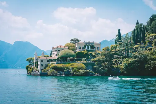
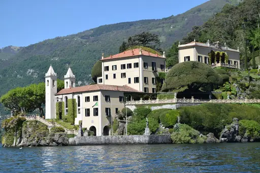
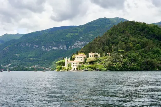
Lake Como stretches in a Y shape beneath the southern edge of the Alps. Villas with manicured gardens line much of the lakeshore near Bellagio. Ferries cross between towns, offering views of snow-capped peaks reflected in the water. Funiculars climb from lakeside towns to mountain viewpoints above the shore.
Town in Italy
Cortina d'Ampezzo
Dolomite Peaks, Alpine Glamour, Adventure
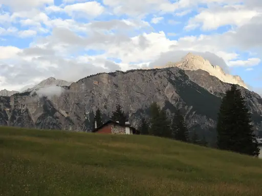
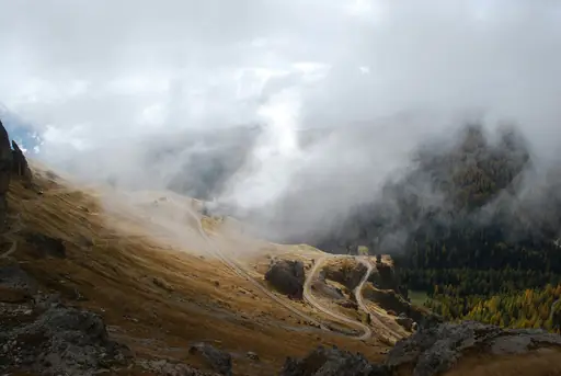
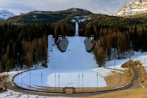
Jagged Dolomite peaks surround Cortina, their pale rock glowing pink at sunset in an effect called enrosadira. Via ferrata routes climb fixed cables up cliffs once used by wartime soldiers. Deep valleys separate the peaks, carved by glaciers over the last ice age. Snow reliably covers the surrounding slopes from December through spring.
Island in Portugal
São Miguel
Volcanic Wonders in the Atlantic
Sete Cidades crater holds two lakes of different colour inside a single volcanic caldera. Furnas Valley bubbles with hot springs, some used to slow-cook a traditional stew underground. Waterfalls drop through Salto do Prego's fern-covered ravine on the island's northeast side. Tea plantations grow on hillsides near Gorreana, among Europe's few working estates.
Village in Switzerland
Grindelwald
A Majestic Swiss Mountain Village
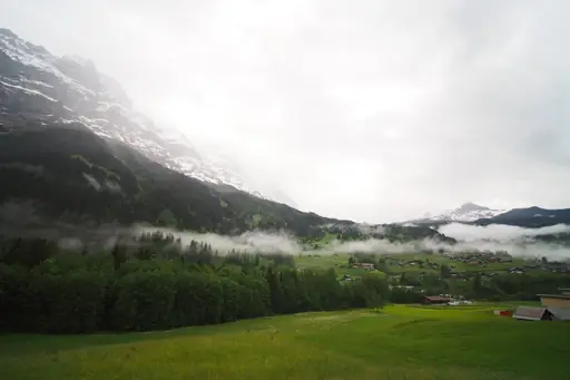
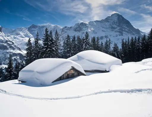
The Eiger's north face towers above Grindelwald, among the most famous climbing routes in the Alps. Glaciers once carved the valley, leaving cliffs and hanging ridges visible from town. A cable car climbs to First, opening onto views across three connected peaks. Hiking trails wind below the Eiger past streams fed by melting snow.
Town in Finland
Kittilä
Lapland’s Arctic Playground Year-Round
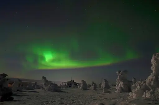
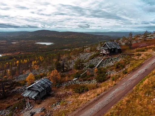
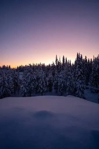
The northern lights appear over Kittila roughly 150 to 200 nights a year in winter. Levi's fell rises above the town, a rounded peak popular for skiing and hiking. Snow blankets the region for months, drawing visitors to husky and reindeer sled rides. Midnight sun keeps the sky bright through much of the short summer.
Island in Greece
Milos
Volcanic Beauty with Hidden Coves
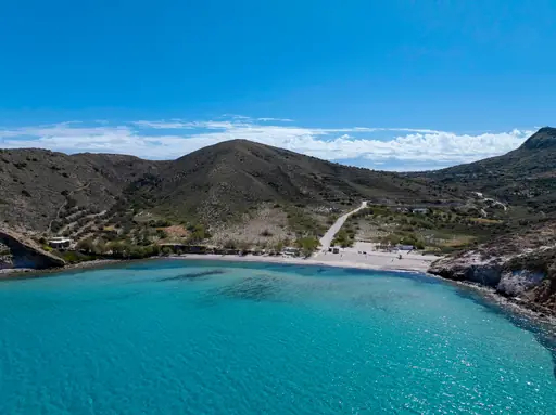
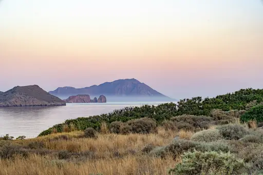
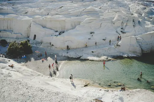
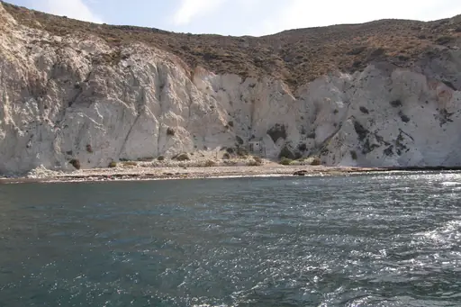
Sarakiniko's white volcanic rock forms a lunar-like landscape along Milos's northern coast. Wind and waves carved the smooth surface into curved basins and hidden coves. Kleftiko's sea caves and rock arches sit accessible only by boat. Colourful fishing villages called syrmata line the island's sheltered bays.
National Park in United Kingdom
Snowdonia National Park
Mythic Peaks and Wild Welsh Beauty
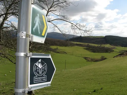
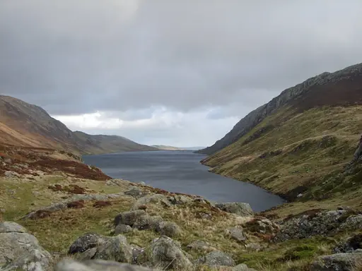
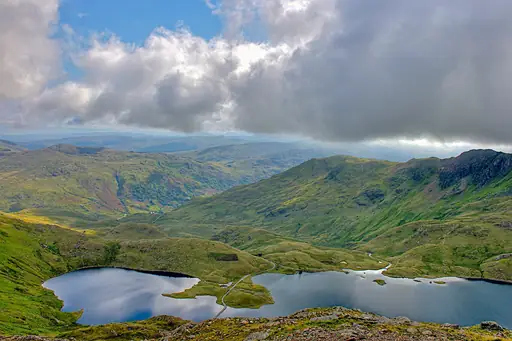
Snowdon rises to 1,085 metres, the highest peak in Wales within its namesake park. A mountain railway climbs to the summit, running since the late 1800s. Waterfalls drop through Aberglaslyn's narrow gorge near the park's southern edge. Slate quarries once shaped the region's valleys, now reclaimed by forest.
Outer Territory in Norway
Svalbard
Arctic wilderness at Earth's edge
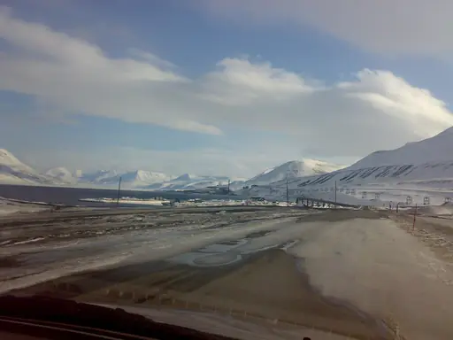
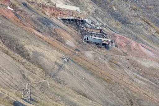
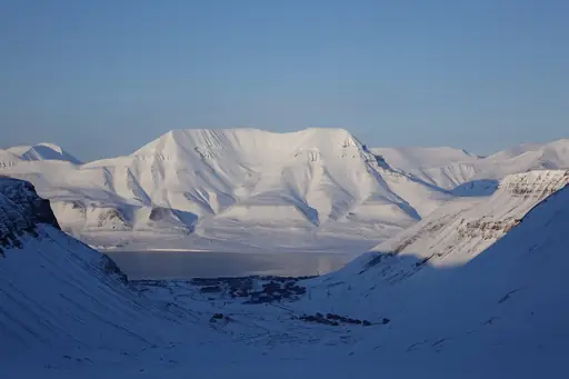
Polar bears roam Svalbard's icy terrain in greater numbers than the archipelago's human residents. Glaciers cover roughly sixty percent of the islands, calving directly into fjords. The sun stays above the horizon continuously through much of summer. Arctic foxes and reindeer move across the tundra during the brief snow-free months.
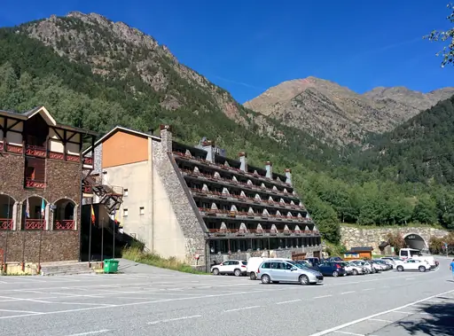
Country
Andorra
Mountain paradise between France and Spain
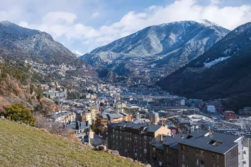
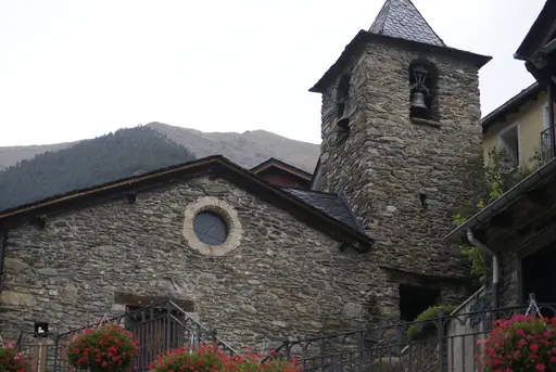
The Pyrenees rise steeply around Andorra, tucked into a high mountain valley between France and Spain. Snow covers the peaks much of the year, feeding ski resorts across the country. Hiking trails climb past glacial lakes in the Madriu-Perafita-Claror valley, a UNESCO site. Thermal springs near Escaldes warm visitors after a day on the trails.
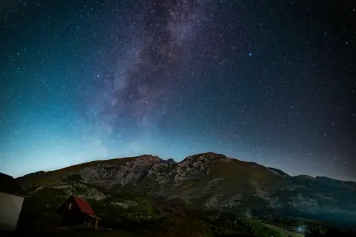
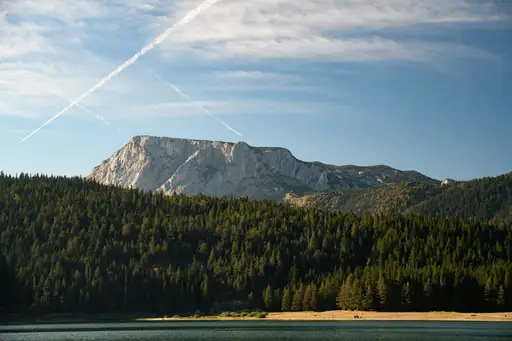
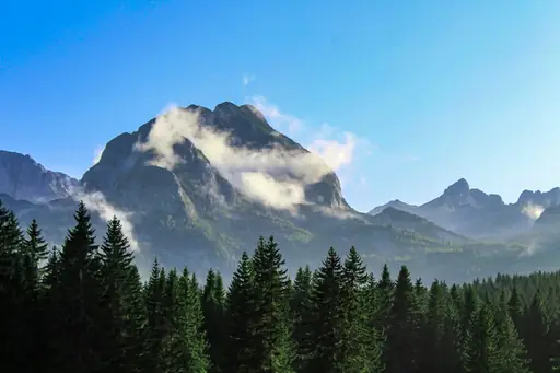
National Park in Montenegro
Durmitor National Park
Montenegro’s Wild Peaks and Deep Canyons
Glacial lakes nicknamed mountain eyes dot Durmitor's high alpine terrain. Tara River Canyon cuts through the park, among the deepest gorges in Europe. Black Lake sits beneath jagged peaks, reflecting the surrounding cliffs on calm days. Rafters navigate the Tara's rapids between steep forested canyon walls.

Region in Iceland
Landmannalaugar
Colorful mountains and natural pools
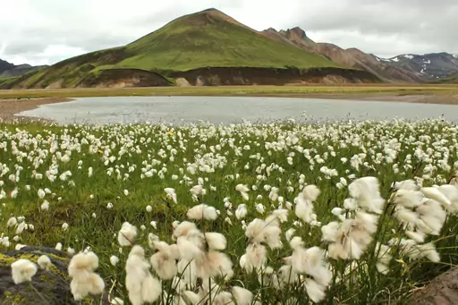
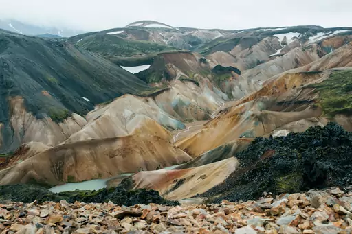
Rhyolite mountains streak red, yellow and green across Landmannalaugar's remote highland terrain. Hot springs near the campsite let hikers soak after crossing the surrounding lava fields. Steam rises from vents scattered across the valley's volcanic ground. A network of trails connects Landmannalaugar to other highland routes through Iceland's interior.
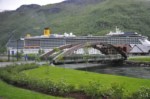
Fjord in Norway
Sognefjorden
Majestic waters framed by towering cliffs
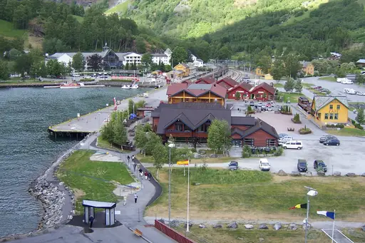
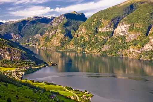
Sognefjorden cuts more than 200 kilometres inland, Norway's longest and deepest fjord. Cliffs rise over a thousand metres above the water along several stretches. Nærøyfjord, a narrow arm of the fjord, squeezes between walls just 250 metres apart. Waterfalls drop directly into the fjord from hanging valleys above.
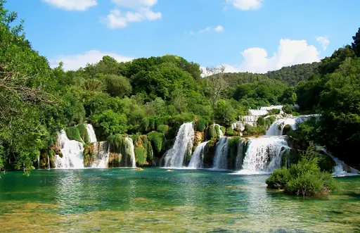
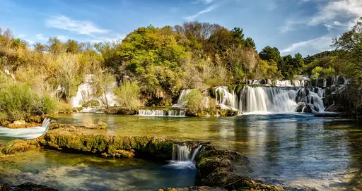
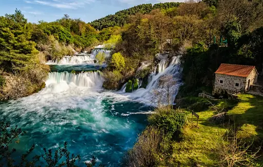
National Park in Croatia
Krka National Park
Waterfalls and Pristine Nature
Waterfalls cascade through travertine terraces at Krka, similar in style to nearby Plitvice. Skradinski Buk, the park's largest falls, spreads across a wide series of cascading pools. Swimmers once cooled off in the pool beneath the falls before rules changed. Boats carry visitors along the river past forested limestone canyon walls.
Island in Spain
La Palma
Volcanic beauty under starry skies
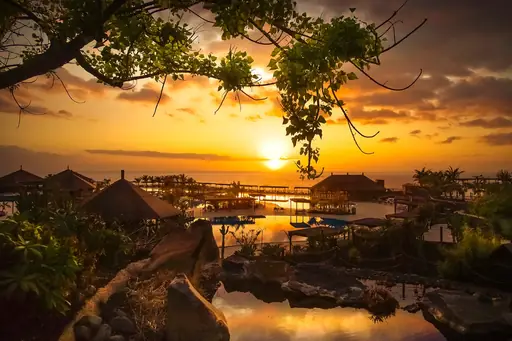
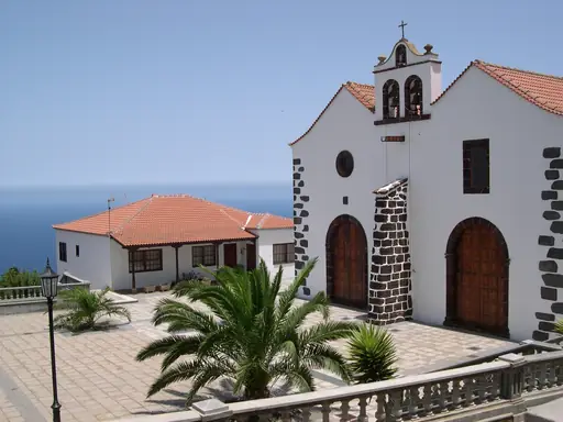
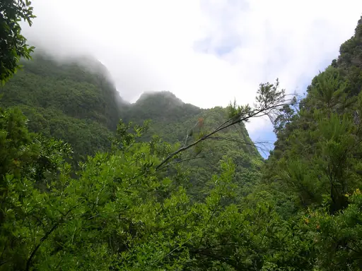
A massive volcanic crater called the Caldera de Taburiente dominates La Palma's northern half. Pine forest covers much of the island's steep slopes below the rim. Observatories sit atop the island's peaks, drawn by clear night skies rare in Europe. A 2021 eruption on the Cumbre Vieja ridge reshaped part of the southern coast.
Region in Germany
Bavaria
Alps, castles, beer gardens and old towns
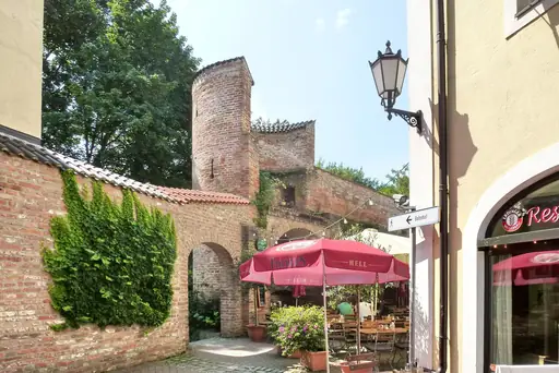
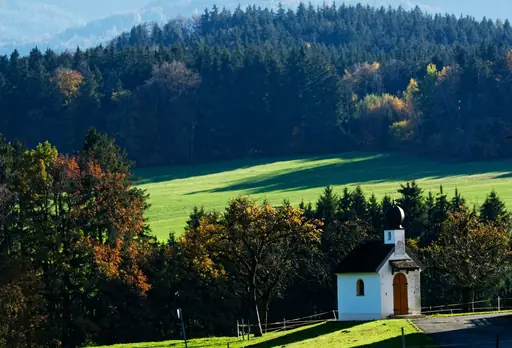
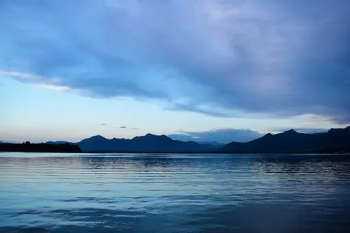
The Alps rise sharply along Bavaria's southern border, framing lakes and forested foothills. Zugspitze, Germany's tallest peak, offers views stretching across four countries on clear days. Königssee's still water reflects cliffs so precisely that boats stop mid-lake for an echo. Dense forest covers much of the Bavarian countryside beyond the mountains.
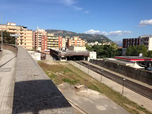
Island in Italy
Sardinia
Turquoise seas and ancient secrets
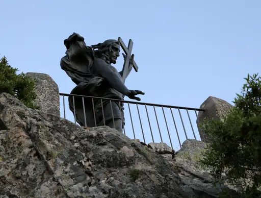
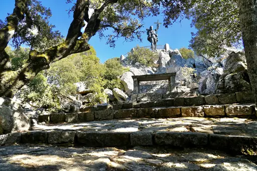
Granite formations rise across Sardinia's interior, shaped into unusual forms by centuries of wind erosion. Cala Goloritze's beach sits beneath a limestone spire, reachable only by boat or trail. Su Gologone's underground river feeds one of the island's deepest known caves. Nuraghe stone towers, built thousands of years ago, still dot the countryside.
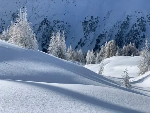
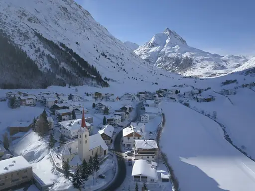
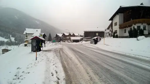
Town in Austria
Ischgl
Alpine Thrills and Après-Ski Legends
Glaciated peaks surround Ischgl, connected by lifts crossing into neighbouring Austrian and Swiss valleys. Snow reliably covers the slopes from late November to early May most seasons. A cable car links Ischgl directly to Samnaun across the border. Alpine pastures below the resort turn green each summer once the snow clears.
Island in Greece
Kefalonia
Wild Beauty of the Ionian Sea
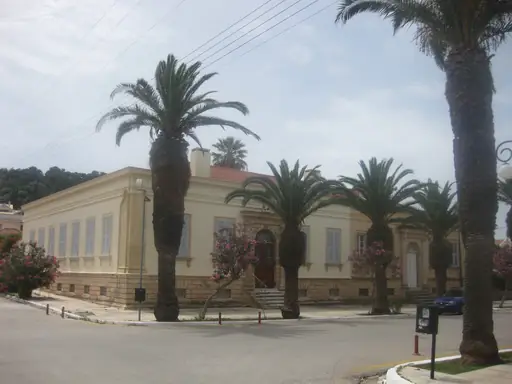
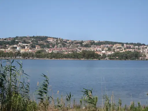
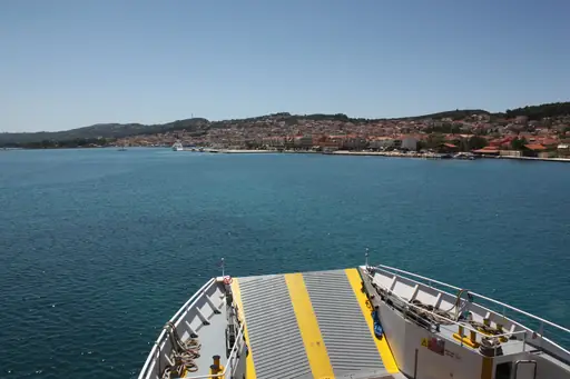
Melissani Cave holds an underground lake lit by sunlight through a collapsed section of roof. Boats drift across the cave's blue-green water beneath stalactites overhead. Myrtos Beach curves between steep limestone cliffs on the island's northwest coast. Drogarati Cave nearby holds a chamber known for its natural acoustics.
National Park in Italy
Vesuvius National Park
Walk the Rim of a Volcano
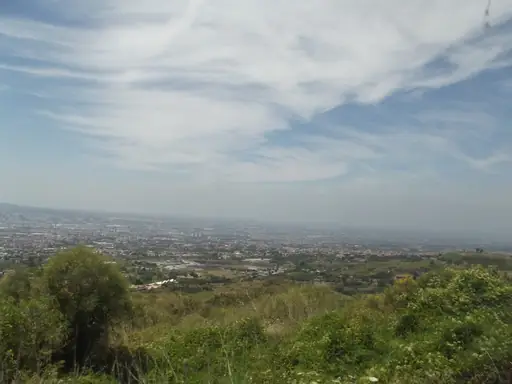
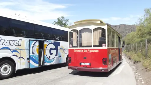
Mount Vesuvius rises above the Bay of Naples, the volcano that buried Pompeii in 79 AD. A trail circles the crater's rim, open to visitors along a marked path. Vineyards grow on the volcano's fertile lower slopes, fed by mineral-rich soil. Steam still vents occasionally from cracks near the crater's edge.
Town in Greece
Oia
Sunsets Over Whitewashed Cliffs
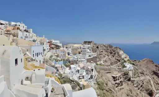
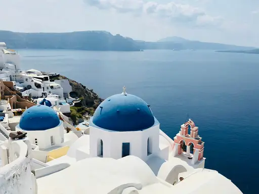
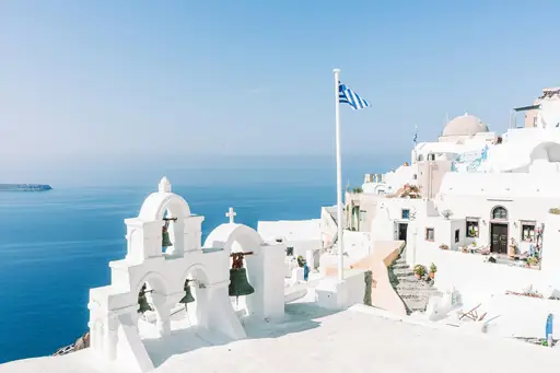
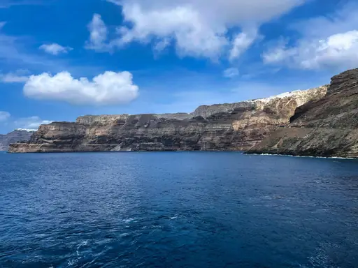
Whitewashed houses cascade down Oia's cliffs, overlooking Santorini's flooded volcanic caldera. The caldera formed after a massive eruption thousands of years ago reshaped the island. Crowds gather each evening along the cliff path to watch the sunset over the water. Blue-domed churches punctuate the village's narrow, winding streets.
Region in United Kingdom
Cotswolds National Landscape
Honey-Colored Villages and Rolling Hills
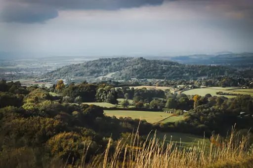
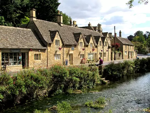
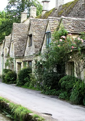
Honey-coloured limestone villages dot the Cotswolds, built from stone quarried across the region for centuries. Rolling hills and hedgerows separate the towns along a network of walking paths. Bourton-on-the-Water's shallow river runs beneath a row of low stone bridges. Sheep have grazed these hills since medieval wool trade built the region's wealth.
National Park in Slovenia
Triglav National Park
Slovenia’s Natural Beauty
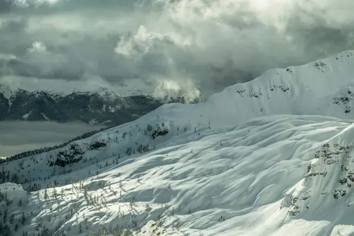
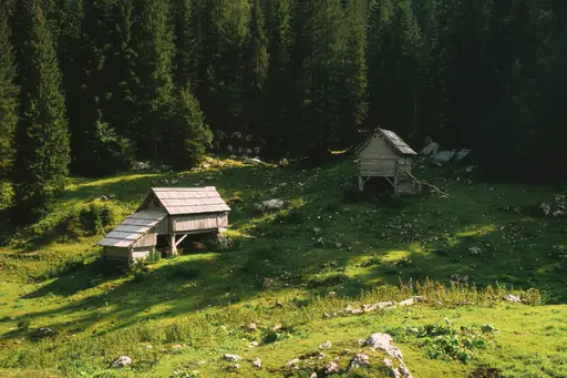
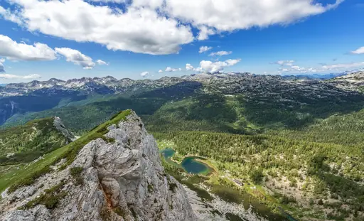
Mount Triglav rises to 2,864 metres, Slovenia's tallest peak and namesake of the park. Lake Bohinj sits within the park's boundaries, quieter than the nearby Lake Bled. Savica Waterfall drops in two tiers into a narrow gorge below. Trails cross alpine meadows scattered with wildflowers each summer.
Region in Switzerland
Graubünden
Alpine wonderland with pristine lakes and trails
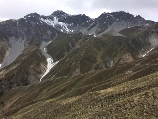
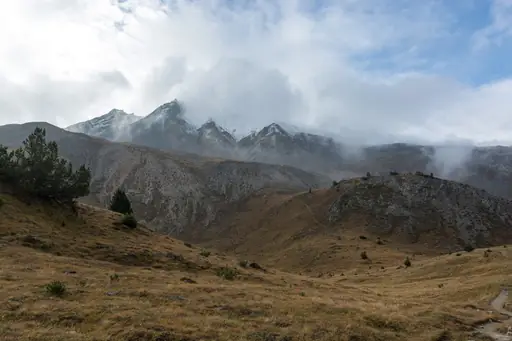
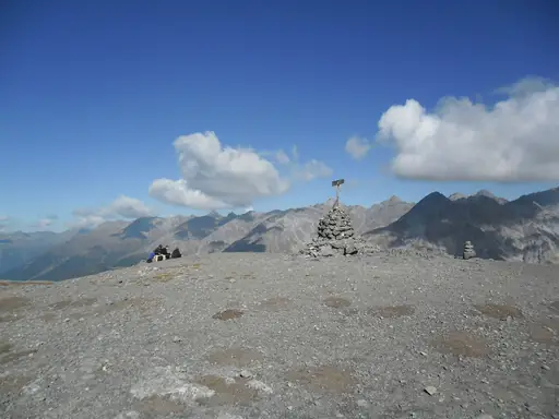
Glaciers and jagged peaks cover much of Graubünden, Switzerland's largest and least populated canton. The Rhine's source lies high in the canton's mountains near the Oberalp Pass. Swiss National Park protects untouched alpine terrain within Graubünden's eastern reaches. Larch forests turn golden each autumn across the canton's high valleys.
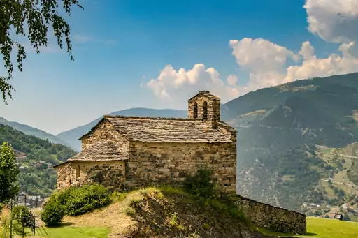
Mountain
Pyrenees
Where France meets Spain majestically
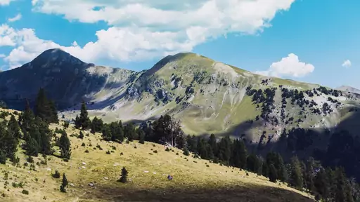
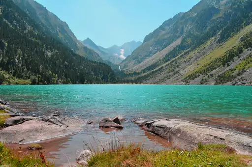
Glacial cirques and jagged peaks line the Spanish Pyrenees along the French border. Ordesa Valley's limestone walls rise steeply above forested river gorges. Waterfalls drop through the valley, fed by snowmelt from the surrounding summits. Chamois graze the high alpine meadows across the range's remote reaches.
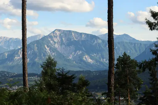
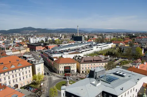
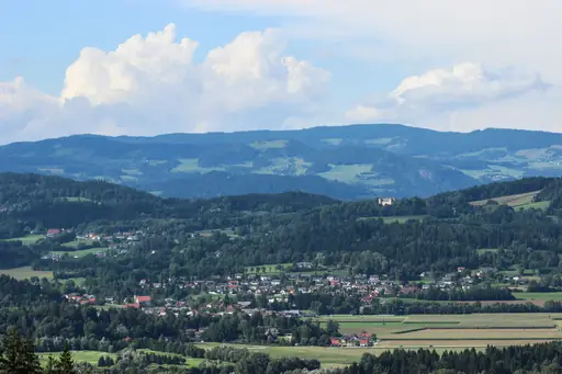
Region in Austria
Carinthia
Land of Lakes and Alpine Beauty
Lake Worthersee's warm alpine water draws swimmers through much of the summer season. Snow-capped peaks of the Alps rise above the lake's southern shore. Nockberge's rounded mountains, worn smooth by glaciers, roll across Carinthia's high country. Waterfalls drop through gorges in the region's less-visited mountain valleys.
Region in Austria
Tyrol
Alpine paradise in all seasons
Glaciers and jagged peaks cover much of Tyrol, part of Austria's central Alpine region. The Zillertal valley holds glacier skiing available even through summer months. Waterfalls drop through narrow gorges across the region's forested lower valleys. Alpine huts connect a network of high trails between Tyrol's mountain ranges.
National Park in Switzerland
Swiss National Park
Majestic alpine wilderness, untouched and serene
Switzerland's only national park protects untouched alpine terrain in the canton of Graubünden. Ibex and chamois roam freely across steep slopes left undisturbed since 1914. Bearded vultures, reintroduced after disappearing decades ago, now nest on the park's cliffs. Marked trails follow valleys where hunting and picking plants remain strictly banned.
Town in United Kingdom
Portree
Colorful Harbour in the Scottish Highlands
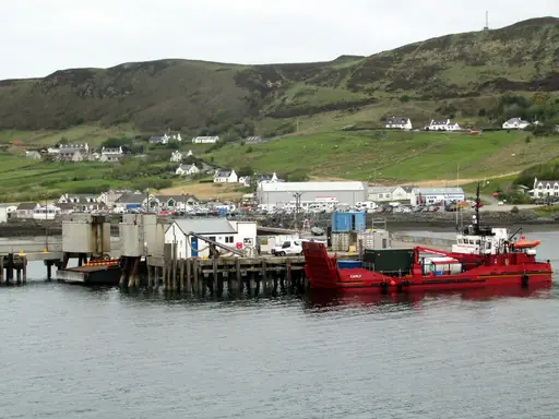
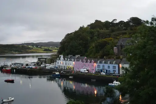
Colourful harbour buildings line Portree's waterfront beneath the cliffs of Skye's Trotternish Peninsula. The Old Man of Storr's rock pinnacle rises above the town in the distance. Fishing boats still dock in the harbour each morning below the painted houses. Ferries once linked Portree to the Scottish mainland across the water.
Town in Ireland
Dingle
Wild Atlantic Views, Music & Craic
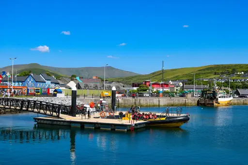
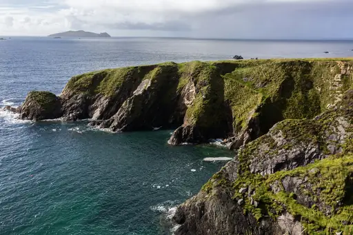
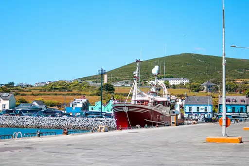
Cliffs along the Dingle Peninsula drop sharply into the Atlantic near Slea Head. Beehive-shaped stone huts, built by early monks, still dot the peninsula's hillsides. Fungie the dolphin drew visitors to Dingle's harbour for decades before vanishing in 2020. Mount Brandon rises above the peninsula, Ireland's second-highest peak.
Town in Italy
Riva del Garda
Lakeside beauty meets mountain adventure
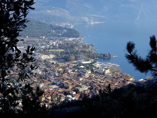
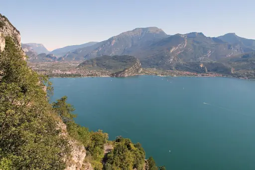
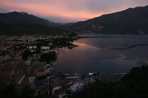
Cliffs rise sharply above Riva del Garda at the lake's northern tip. Steady winds funnel down the valley each afternoon, drawing windsurfers and sailors. Ponale trail traces an old road cut into the cliffside above the water. Mountains ring the town on three sides, framing views across the lake.
Region in Austria
Salzkammergut
Alpine lakes meet imperial heritage
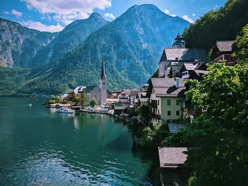
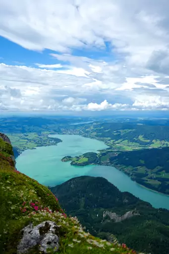
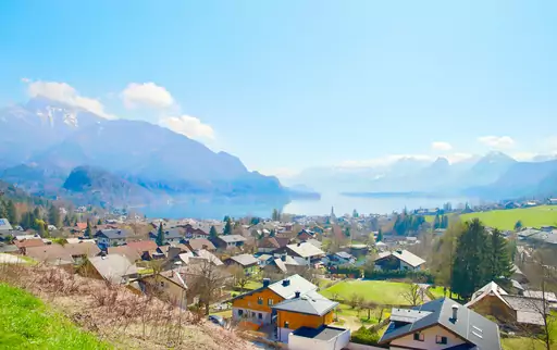
Alpine lakes fill Salzkammergut's valleys, ringed by limestone peaks across the region. Hallstatt's lakeside village sits among the most photographed of more than seventy lakes here. Salt mining shaped the region's economy for thousands of years, giving it its name. Cable cars climb from lakeside towns to viewpoints over the surrounding ranges.
Town in Switzerland
Saas-Fee
Glaciers, Peaks and Alpine Serenity
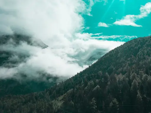
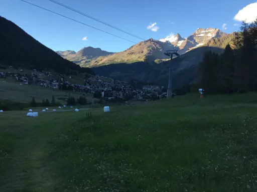
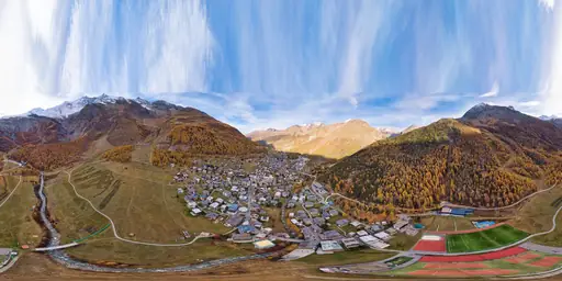
Thirteen peaks above 4,000 metres ring Saas-Fee, earning it the nickname the pearl of the Alps. Glaciers cover much of the surrounding terrain, feeding a network of high mountain trails. A car-free village centre keeps the resort quiet beneath the towering summits. Ice caves carved into the Feegletscher glacier open to visitors in summer.
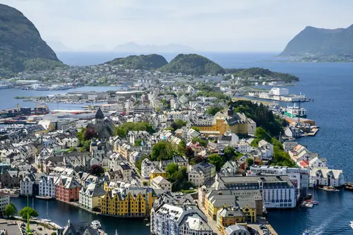
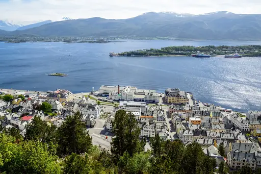
City in Norway
Ålesund
Art Nouveau Gem by the Fjords
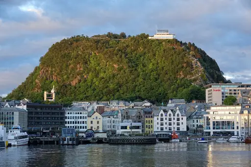
Art nouveau buildings line Alesund's harbour, rebuilt in matching style after a fire in 1904. Mount Aksla rises above downtown, reached by a stairway of several hundred steps. Fjords branch out from the town towards jagged coastal peaks nearby. The view from the summit takes in scattered islands and open sea.
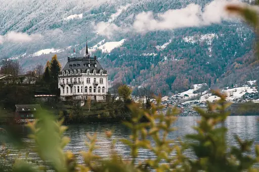
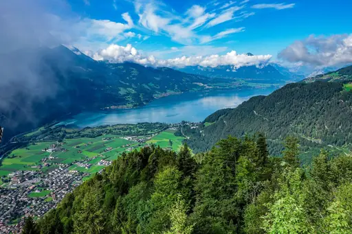
Town in Switzerland
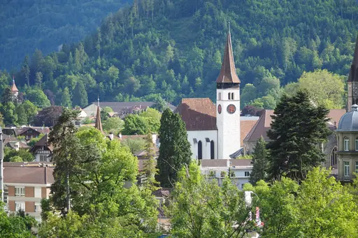
Interlaken
Adventure, Lakes and Alpine Magic
Two lakes flank Interlaken, set between the peaks of the Bernese Alps. Eiger, Monch and Jungfrau rise visibly from town on clear days. A cogwheel railway climbs to Jungfraujoch, Europe's highest railway station. Paragliders launch from nearby ridges, drifting over the town and lakes below.
City in Switzerland
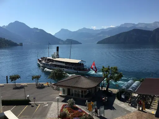
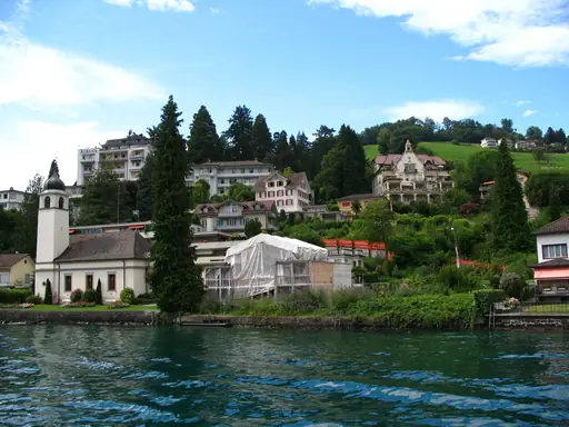
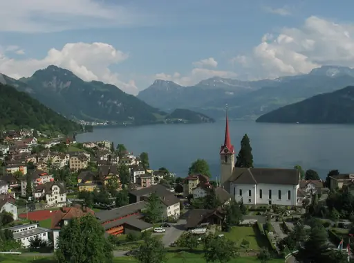
Lucerne
Alpine Beauty Meets Medieval Charm
Mount Pilatus rises above Lucerne, reached by the world's steepest cogwheel railway. Lake Lucerne stretches south from the city, ringed by peaks on several sides. A wooden covered bridge, the Chapel Bridge, has crossed the river here since the 1300s. Rigi's summit nearby offers views across several connected alpine lakes.
Island in Greece
Santorini
Breathtaking Views and Blue Domes
Santorini's caldera formed after a massive volcanic eruption reshaped the island thousands of years ago. Cliffside villages overlook the flooded crater from hundreds of metres above the water. Red and black sand beaches nearby formed from volcanic rock unique to the island. Hot springs still warm patches of the sea near the caldera's centre.
Village in Norway
Geiranger
Majestic Fjords and Dramatic Waterfalls
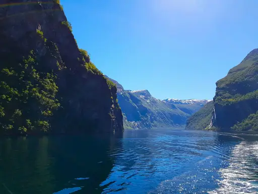
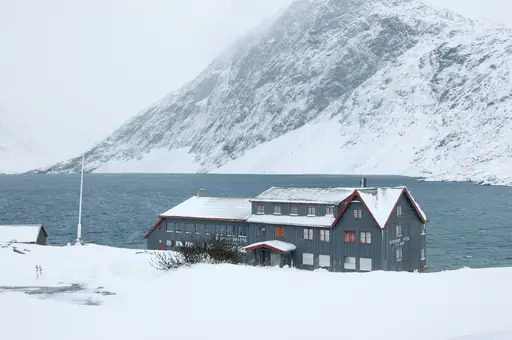
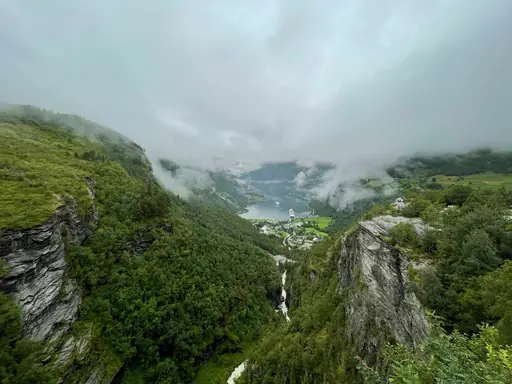
Waterfalls with names like the Seven Sisters pour down cliffs into Geirangerfjord's narrow channel. Cruise ships pass beneath sheer rock walls rising more than a thousand metres. Abandoned farms cling to ledges partway up the fjord's steep sides. A winding mountain road climbs to viewpoints looking straight down over the water.
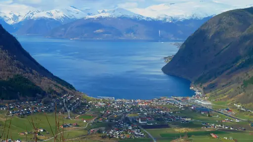
Village in Iceland
Vík í Mýrdal
Black Sands, Puffins and Volcano Views
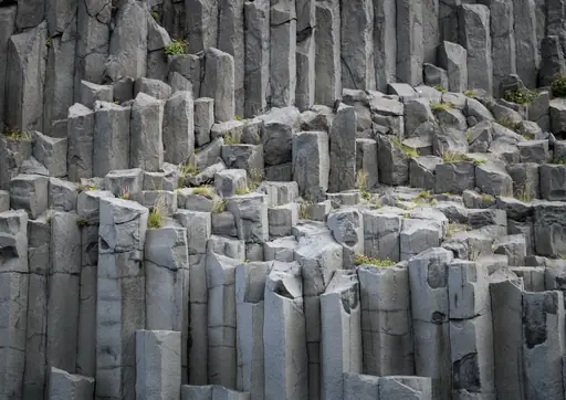
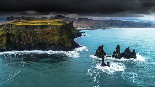
Basalt columns rise from the black sand beach at Reynisfjara, near the village of Vik. Sea stacks called Reynisdrangar stand offshore, formed by trolls turned to stone in local legend. Powerful waves make the beach dangerous for wading despite its striking appearance. Glaciers and green cliffs rise inland behind the village.
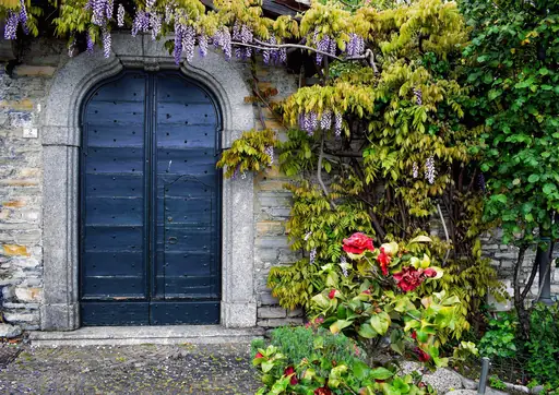
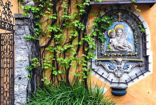
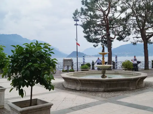
Lake in Italy
Lake Como
Alpine elegance meets Italian charm
Ferries cross Lake Como between towns tucked beneath steep, forested hillsides. Bellagio sits where the lake's two southern branches meet, framed by mountains. Villa gardens along the shore have drawn visitors here since the 1800s. Funiculars climb from the lakeshore to viewpoints looking down over the water.
Island in Greece
Zakynthos
Turquoise Waters and Hidden Caves
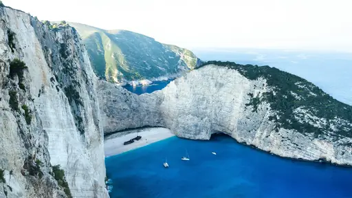
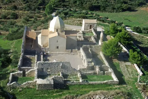
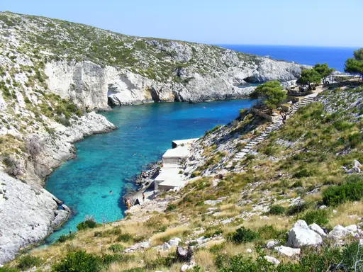
A rusted shipwreck sits beached in Navagio Bay, framed by white limestone cliffs. Turquoise water surrounds the cove, reachable mainly by boat tours from nearby towns. Blue Caves along the northern coast glow bright where sunlight filters through the water. Loggerhead turtles nest on beaches along the island's southern shore each summer.
Island in Spain
Canary Islands
Spain's volcanic paradise year-round
Mount Teide rises from Tenerife, Spain's tallest peak and a still-active volcano. Black volcanic sand covers beaches across several of the islands. Lanzarote's Timanfaya park sits over lava fields from eruptions in the 1700s. Laurel forest on La Gomera survives from an era before the last ice age.
Town in Slovenia
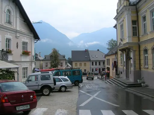
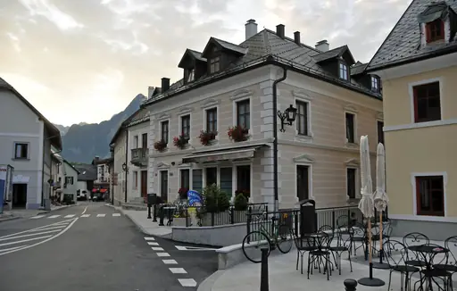
Bovec
Slovenia’s Adventure Capital
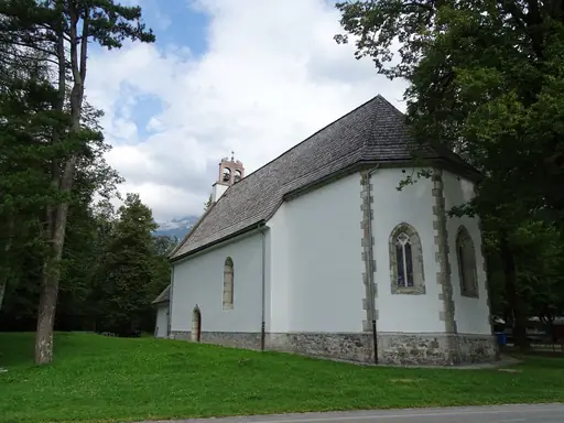
The Soca River runs a striking turquoise through Bovec's valley, fed by glacial meltwater. Rafters and kayakers paddle its rapids beneath steep, forested mountainsides. Vintgar Gorge cuts nearby, its walls carved smooth by centuries of rushing water. Julian Alps peaks rise around the town, drawing hikers into the surrounding trails.
City in Norway
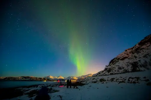
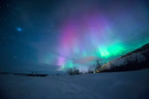
Tromsø
Arctic Lights, Culture and Wild Beauty
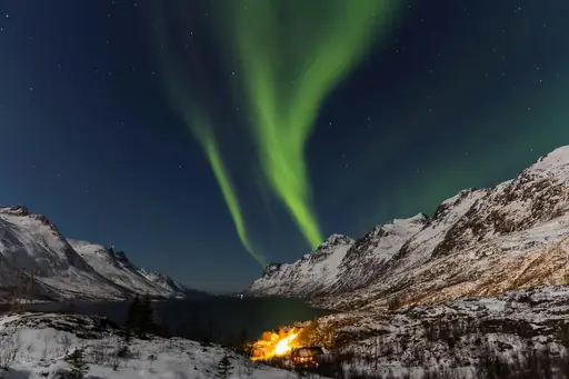
The northern lights appear over Tromso through much of the dark winter months. Fjords and jagged peaks surround the city, reachable by cable car from downtown. Polar night keeps the sun below the horizon here for weeks each winter. Midnight sun replaces it in summer, keeping the sky bright around the clock.
Valley in Austria
Ötztal
Majestic alpine valley with crystal lakes
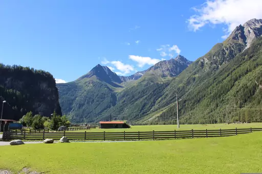
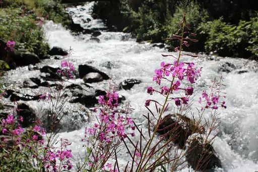
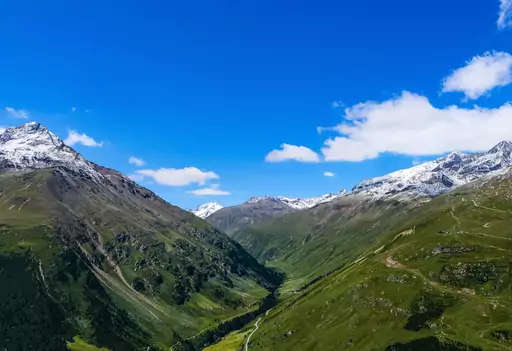
Glaciers cover the high peaks ringing Oetztal, one of the Alps' longest side valleys. Otzi the Iceman was found preserved in ice near the valley's high border ridge. Waterfalls drop through side gorges cut by centuries of glacial meltwater. Thermal baths near Langenfeld warm hikers after a day on mountain trails.
Region in Austria
Styria
Green Heart of Alpine Austria
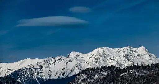
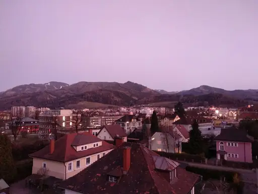
Forested hills cover much of Styria, earning it the nickname Austria's green heart. Gesause National Park's limestone peaks rise above the rushing Enns River. Lipizzaner horses have been bred in Styria's Piber stud farm for centuries. Thermal springs warm several towns scattered across the region's southern valleys.
Region in Italy
Cinque Terre
Colorful Cliffs and Coastal Charm
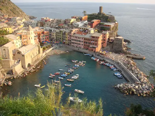
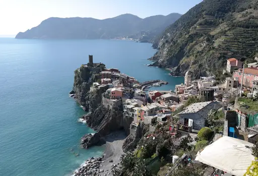
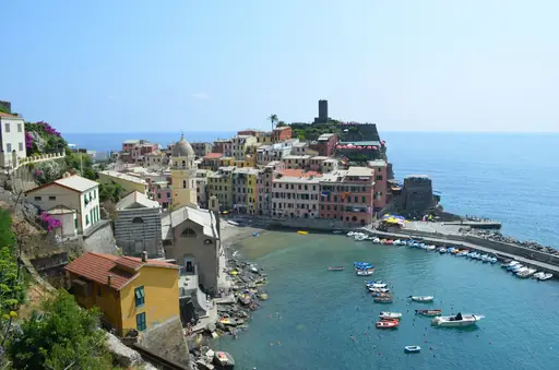
Five villages cling to Cinque Terre's steep coastline, connected by cliffside trails above the sea. Terraced vineyards climb the hillsides between colourful houses stacked towards the water. Manarola's harbour turns pink and orange at sunset against the cliffs. Boats link the villages along a coast with no direct road access.
National Park in Spain
Teide National Park
Mars-Like Landscapes and Epic Views
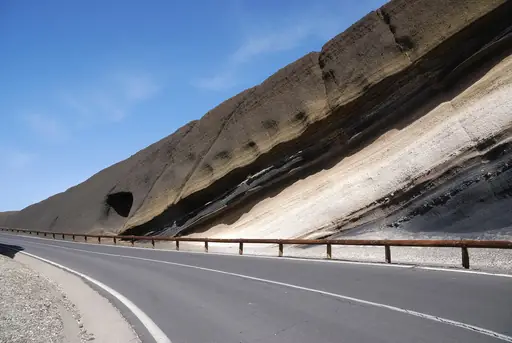
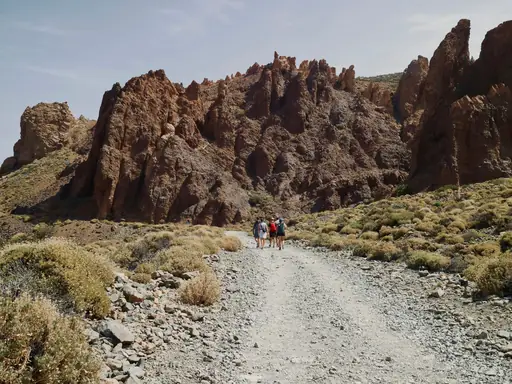
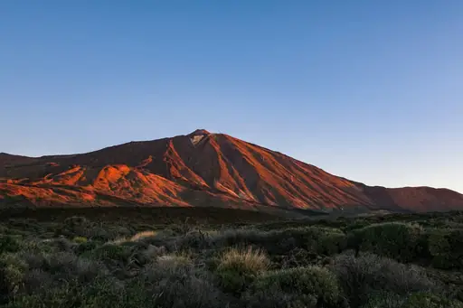
Mount Teide's crater dominates the park, Spain's tallest peak at 3,715 metres. A cable car climbs most of the way to the summit for panoramic views. Lava fields spread across the park's floor, shaped by eruptions over thousands of years. Rock formations called Los Roques rise in odd shapes near the visitor centre.
City in France
Chamonix-Mont-Blanc
Alpine thrills beneath Mont Blanc
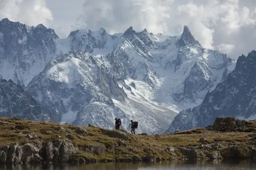
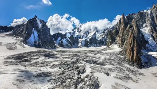
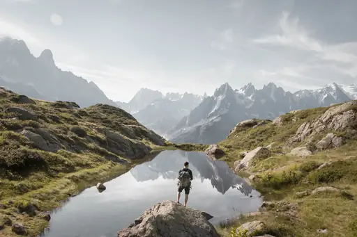
Mont Blanc rises above Chamonix, western Europe's tallest peak at over 4,800 metres. A cable car climbs to the Aiguille du Midi, opening onto glacier views close to the summit. Mer de Glace, France's largest glacier, winds through the valley below. Climbers have used Chamonix as a base for Alpine ascents since the 1700s.
Town in Norway
Longyearbyen
The Edge of the Arctic Wild
Polar bears outnumber people across Svalbard, making Longyearbyen the world's northernmost town of its size. Glaciers cover roughly sixty percent of the surrounding archipelago's land area. The sun never sets here through much of summer, nor rises through winter. Coal mining shaped the settlement's early history, visible in old structures around town.
Region in Austria
Wachau
UNESCO Heritage along the Danube
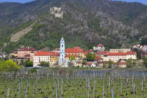
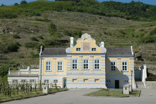
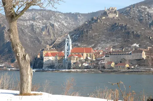
The Danube winds through Wachau's valley, lined with vineyards on terraced hillsides. Medieval castle ruins overlook the river from clifftop perches along the winding route. Apricot orchards blossom pink and white each spring across the valley's lower slopes. Cycling paths trace the riverbank between small wine-producing villages and old market towns.
Island in Spain
Tenerife
Volcanoes, Beaches and Endless Sun
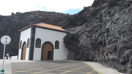
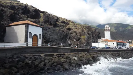
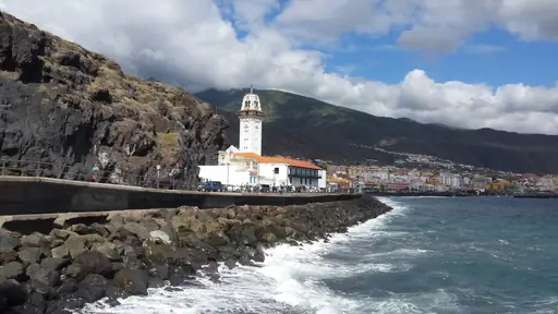
Anaga's laurel forest covers the island's northeastern tip, a remnant of ancient subtropical woodland. Los Gigantes cliffs drop hundreds of metres straight into the Atlantic on the western coast. Mount Teide rises at the island's centre, visible from beaches on clear days. Black volcanic sand covers several beaches along Tenerife's southern shore.
National Park in Ireland
Connemara National Park
Wild Bogs, Peaks and Ponies
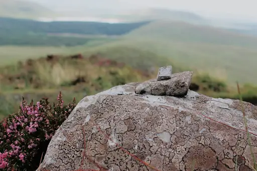
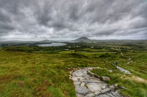
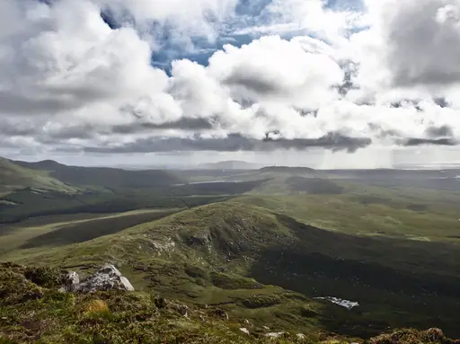
Quartzite peaks called the Twelve Bens rise above Connemara's boglands and heath. Diamond Hill's summit trail loops through the park with views over the coast. Wild Connemara ponies graze freely across the open moorland. Lakes scattered through the park reflect the surrounding mountains on calm days.
Region in Italy
South Tyrol
Alpine culture where worlds collide
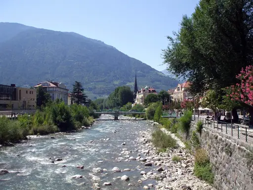
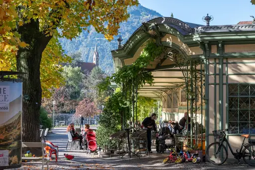
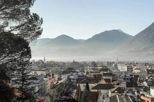
Jagged Dolomite peaks rise above South Tyrol's forested valleys near the Austrian border. Alpe di Siusi's high meadow ranks among Europe's largest alpine pastures. Lake Braies reflects the surrounding cliffs in strikingly still, turquoise water. Vineyards climb the lower slopes of valleys below the mountain terrain.
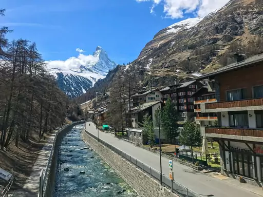
Town in Switzerland
Zermatt
Alpine Magic and the Matterhorn
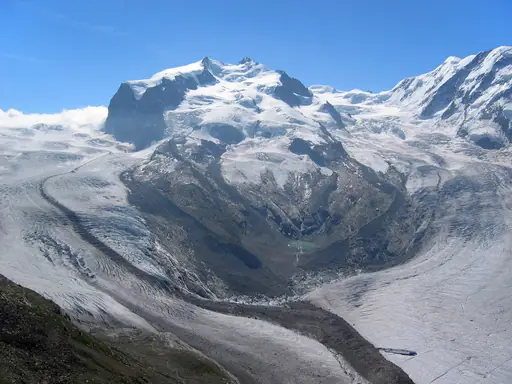
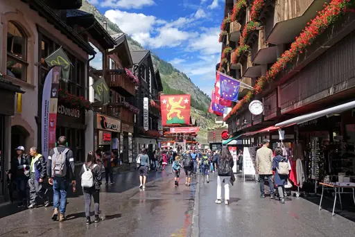
Zermatt stays car-free, its narrow streets reached only by train or electric vehicle. The Matterhorn's pyramid peak looms over town from nearly every angle. Gornergrat railway climbs above the village, opening onto views of dozens of glaciers. Hiking trails wind past glacial streams towards viewpoints beneath the peak.
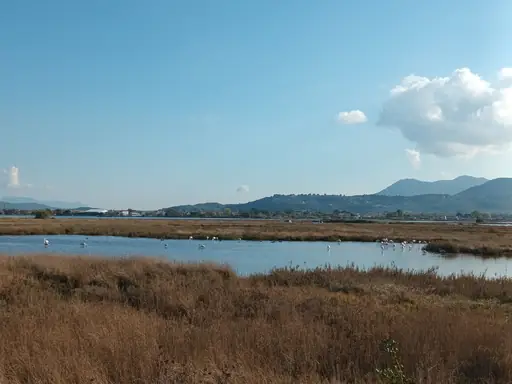
Island in Greece
Lefkada
Ionian Gem with Pristine Beaches
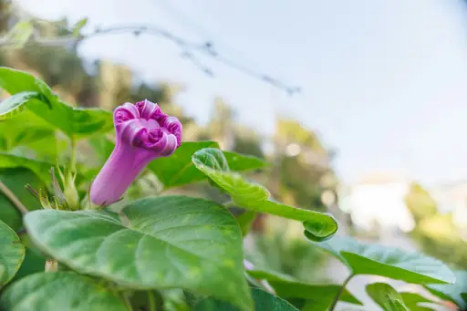
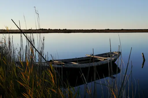
Porto Katsiki's cliffs drop dramatically to a narrow strip of white sand below. Turquoise water rings much of Lefkada's western coastline, fed by limestone runoff. A causeway connects the island to the mainland, unlike most Ionian islands. Egremni Beach sits beneath cliffs reshaped by an earthquake in 2015.
Town in Slovenia
Kranjska Gora
Alpine Adventure at Slovenia’s Edge
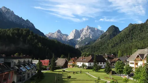
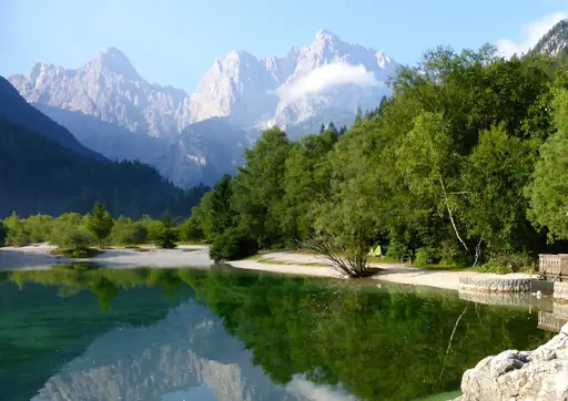
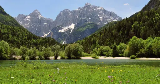
Julian Alps peaks rise steeply above Kranjska Gora, framing Slovenia's best-known ski resort. Lake Jasna's turquoise water sits at the base of the mountains near town. Vrsic Pass climbs in hairpin turns towards views over the surrounding valleys. Waterfalls and gorges cut through the forest on trails just outside town.
Town in Ireland
Killarney
Ireland’s Adventure Gateway Town
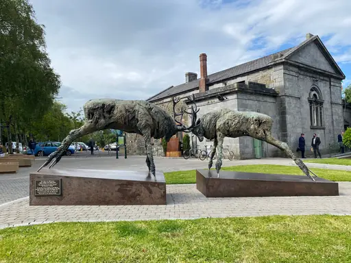
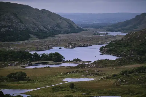
Three lakes fill Killarney National Park's valley, framed by Ireland's highest mountain range. Torc Waterfall drops through oak woodland a short walk from the main road. Red deer roam the park, among the last wild herds native to Ireland. Ross Castle sits on the lake's edge, reflected in calm morning water.
Island in Norway
Lofoten
Dramatic Peaks and Northern Lights
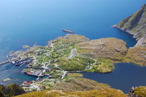
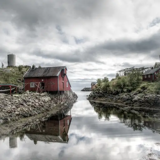
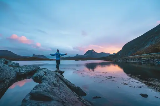
Jagged peaks rise straight from the sea across Lofoten's chain of islands. Fishing villages with red cabins called rorbuer line sheltered bays beneath the mountains. The midnight sun keeps the sky bright through much of the Lofoten summer. Cod hung on wooden racks to dry has supplied trade here for centuries.
Island in Italy
Capri
Mediterranean Elegance and Natural Beauty
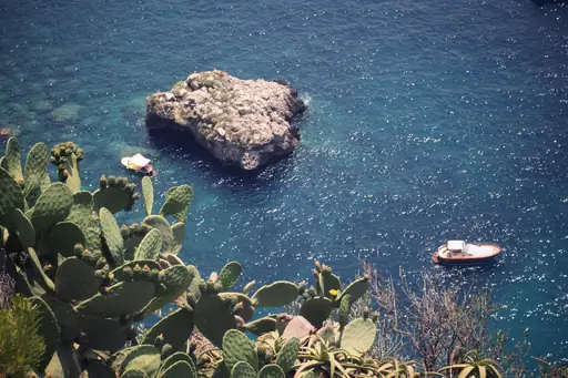
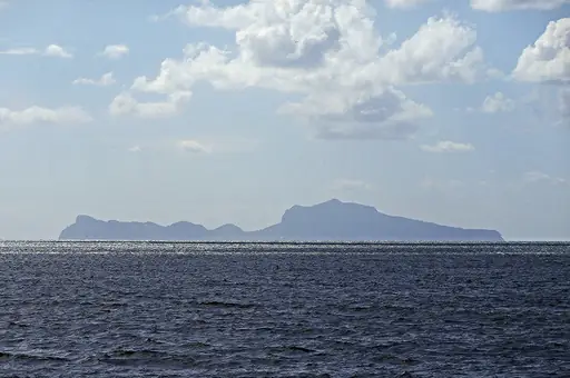
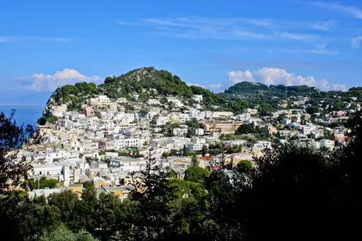
The Blue Grotto's sea cave glows bright blue, lit by sunlight passing through the water below. Small rowboats squeeze through a narrow entrance to reach the cavern inside. Faraglioni, three limestone sea stacks, rise offshore near the island's southern tip. Cliffside paths wind above the water between Capri's two main towns.
Country
Faroe Islands
Dramatic cliffs meet misty landscapes
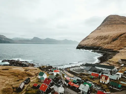
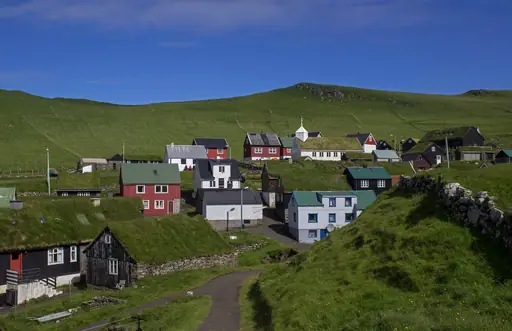
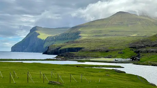
Grass-roofed houses dot the Faroe Islands, set against steep green cliffs dropping into the sea. Mulafossur waterfall pours directly off a cliff into the ocean near Gasadalur. Sheep graze on impossibly steep slopes across the islands' eighteen landmasses. Fog and shifting weather can transform the same view within minutes.
Island in Spain
Lanzarote
Volcanic Landscapes and Sunny Shores
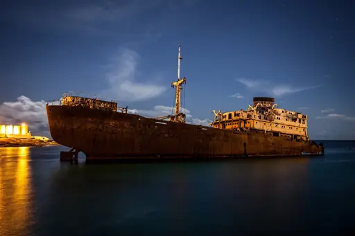
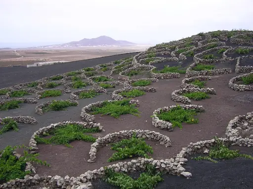
Timanfaya National Park covers lava fields left by eruptions that reshaped Lanzarote in the 1730s. Geothermal heat still warms the ground enough to roast food over natural vents. Black volcanic soil supports vineyards grown in individual stone-walled pits. Cesar Manrique's architecture across the island echoes the surrounding volcanic landscape.
Lake in Italy
Lake Garda
Italy's largest lake of wonders
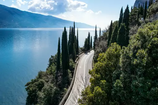
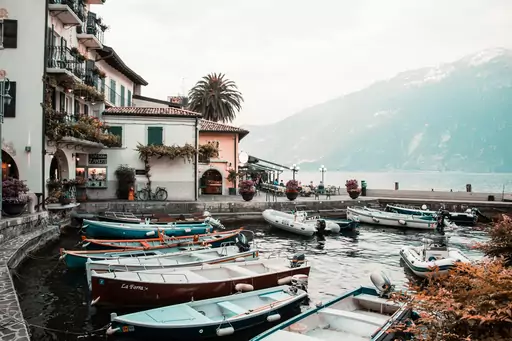
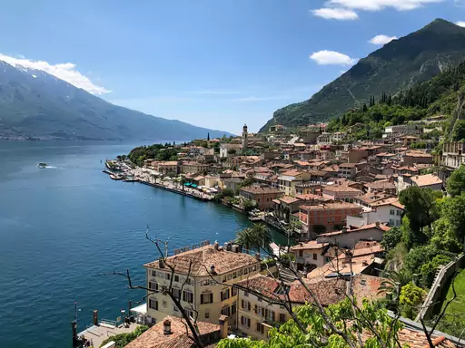
Lake Garda stretches as Italy's largest lake, ringed by mountains on its northern end. Cliffs and olive groves line the shore near Limone, a town once reachable only by boat. Sirmione's thermal springs sit on a narrow peninsula jutting into the lake. Windsurfers use steady afternoon winds that funnel down the lake's northern arm.
National Park in Bulgaria
Pirin National Park
Alpine Peaks, Glacial Lakes, Wild Beauty
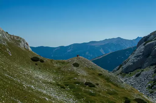
Glacial lakes dot Pirin's high granite peaks, formed as ice retreated after the last ice age. Vihren, Bulgaria's second-highest summit, rises above forested valleys within the park. Centuries-old Bosnian pine trees grow on the park's higher slopes. Marked trails connect mountain huts across Pirin's rugged interior.
Island in France
Corsica
Island of Beauty and Contrast
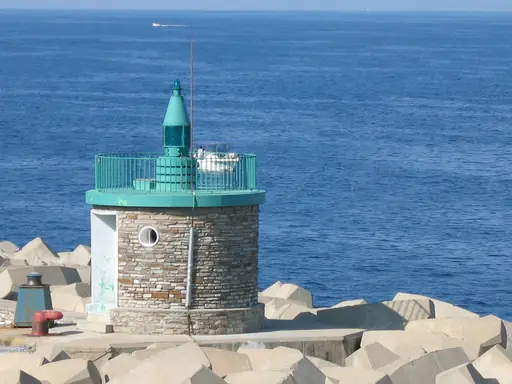
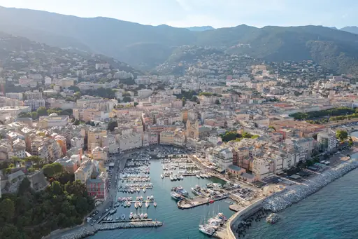
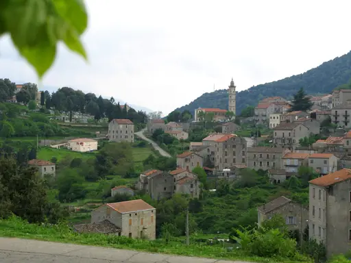
Red granite cliffs plunge into the sea at Corsica's Calanques de Piana on the west coast. Mountains rise steeply inland, snow-capped through much of the year despite the Mediterranean coastline. The GR20 trail crosses the island's spine, ranked among Europe's toughest long-distance hikes. Beaches near Bonifacio sit beneath dramatic white limestone cliffs.
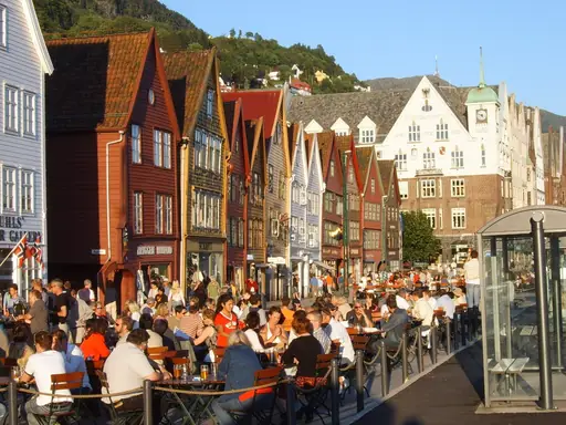
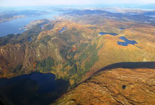
Town in Norway
Bergen
The gateway to the fjords
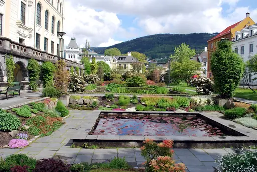
Seven mountains surround Bergen, reachable by cable car or on foot from the city centre. Fjords branch out from the coast nearby, cutting deep into the surrounding cliffs. Floibanen funicular climbs Mount Floyen in minutes, opening onto views over the harbour. Rainfall keeps the hillsides green through much of the year.
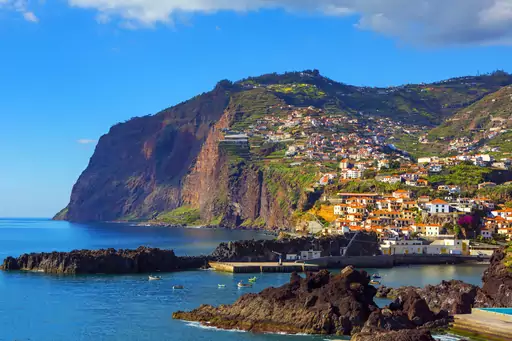
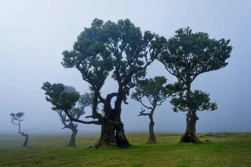
Island in Portugal
Madeira
Dramatic Cliffs and Eternal Spring
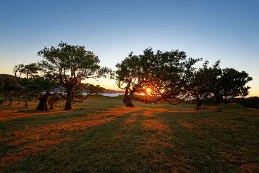
Levada trails follow centuries-old irrigation channels through Madeira's mountainous, forested interior. Laurel forest covers much of the island, a remnant of woodland dating back millions of years. Cabo Girao's cliff drops more than 500 metres straight to the sea. Volcanic peaks rise above clouds that often settle over the island's centre.
Village in Austria
Hallstatt
A Fairytale Village by the Lake
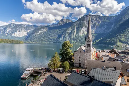
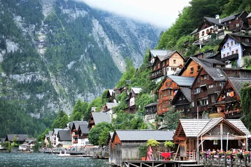
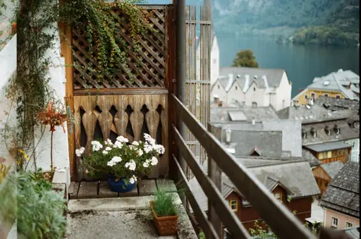
Hallstatt sits on the edge of an alpine lake, squeezed between steep mountains and the water. Salt has been mined from the surrounding hills for more than 7,000 years. A funicular climbs to skywalk views overlooking the village and lake below. Ice caves nearby hold frozen formations that never fully melt.
Village in Italy
Manarola
Enchanting Cliffside Coastal Village
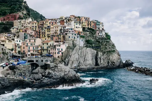
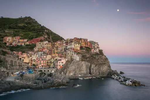
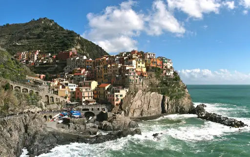
Pastel houses stack above Manarola's small harbour, built into cliffs along Cinque Terre's coast. Vineyards climb terraced slopes above the village, tended for centuries on narrow ledges. A coastal path links Manarola to neighbouring Riomaggiore along the cliffside. Sunset turns the harbour's water shades of orange and pink most evenings.
Region in Ireland
County Mayo
Wild Atlantic beauty and sacred peaks
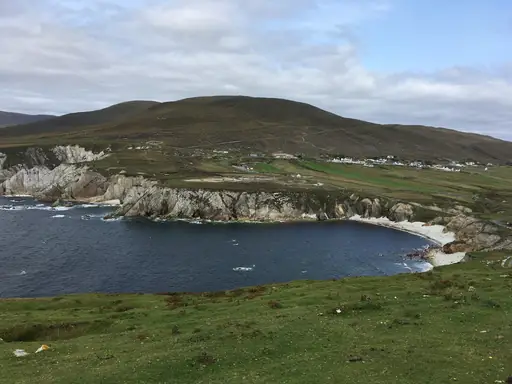
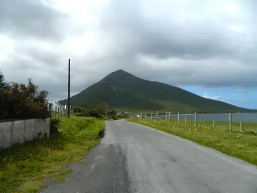
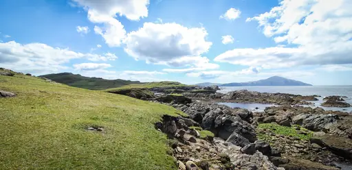
Cliffs at Achill Island drop hundreds of metres into the Atlantic along Mayo's rugged coast. Croagh Patrick's cone-shaped peak rises above Clew Bay, dotted with dozens of small islands. Wild Atlantic Way drivers stop at viewpoints overlooking sheer sea cliffs and empty beaches. Blanket bog covers much of the county's inland moorland.
Town in Slovenia
Bled
Fairytale Lake and Alpine Beauty
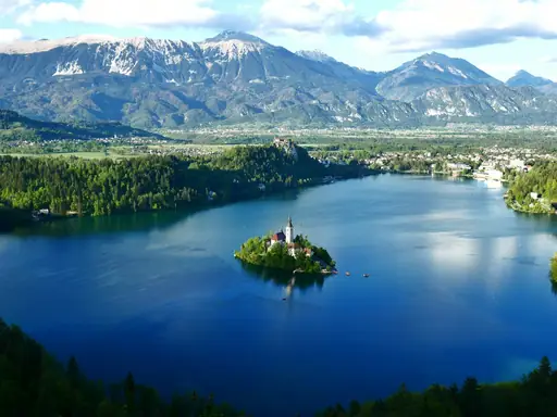
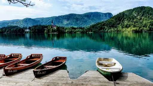
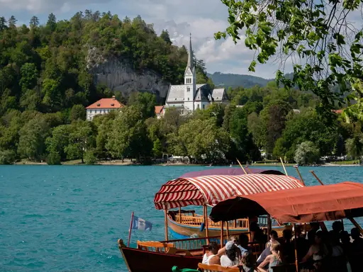
Lake Bled's emerald water surrounds a small island topped by a single white church. Rowers pull traditional wooden boats called pletna across the lake to reach it. A medieval castle sits on a cliff above the northern shore. Julian Alps rise behind the lake, snow-capped for much of the year.
Village in Italy
Positano
Cliffside Beauty on Amalfi Coast
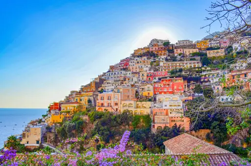
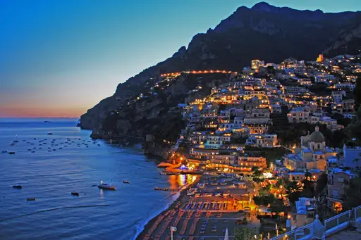
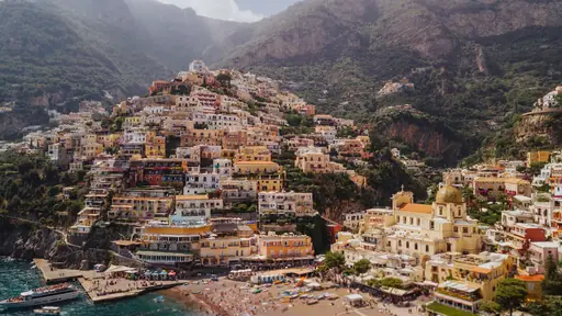
Pastel houses stack steeply above Positano's harbour on the Amalfi Coast. Cliffs drop directly to the water, leaving little flat ground for building. Path of the Gods trail traces the mountainside high above the coastline. Boats ferry visitors between Positano and nearby coves inaccessible by road.
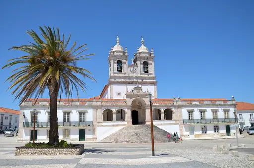
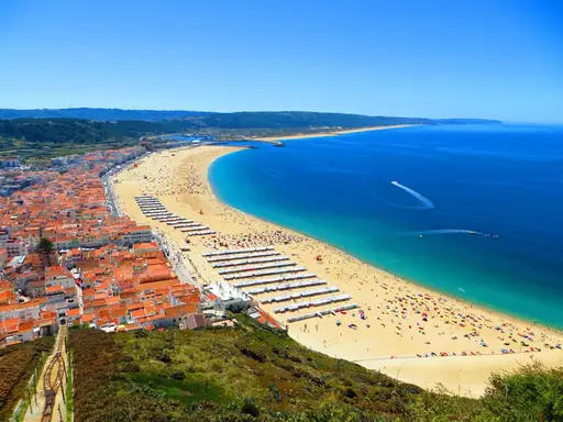
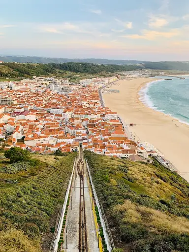
Town in Portugal
Nazaré
Giant Waves and Coastal Charm
Nazare's underwater canyon channels swells into some of the largest waves ever surfed. Big-wave surfers have ridden walls of water here exceeding 20 metres. A lighthouse on the clifftop overlooks the break where the record waves form. Fishing boats still launch from the older, calmer beach in town.
City in Norway
Kristiansand
Coastal charm meets vibrant cultural scene
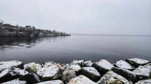
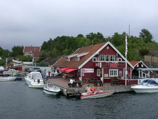
Rocky islets and skerries scatter along the coast near Kristiansand, linked by ferries and bridges. Bystranda beach sits within walking distance of the compact city centre. Setesdal valley stretches north from town through forested hills and old timber villages. Odderoya's former fort grounds now offer coastal walking trails near the harbour.
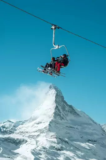
Mountain in Italy
Matterhorn
Majestic peak echoing alpine legends
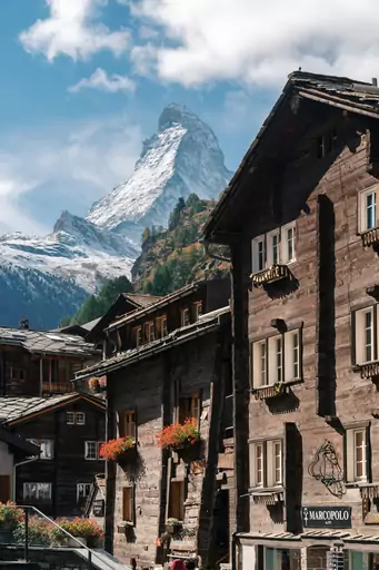
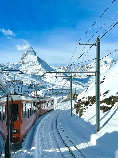
The Matterhorn's pyramid-shaped peak rises sharply above Zermatt, among the most recognised mountains on Earth. Its steep faces resisted climbers longer than most Alpine summits nearby. A cable car climbs towards Klein Matterhorn, Europe's highest cable car station. Glaciers cling to the mountain's shaded northern slopes year-round.
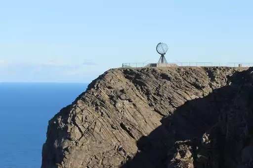
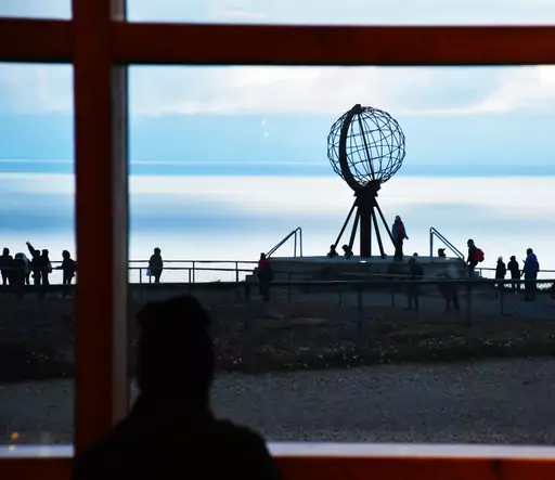
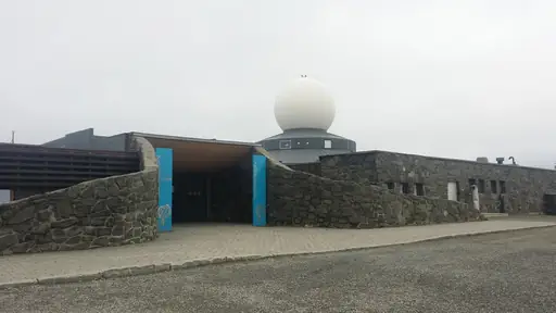
Cape in Norway
North Cape
Standing at Europe’s Edge
Cliffs at North Cape drop more than 300 metres straight into the Arctic Ocean. Midnight sun stays visible here continuously from May to late July. Polar night reverses the effect each winter, keeping the sun below the horizon for weeks. A visitor centre perched on the cliff overlooks open water towards the pole.
Other lists you may like
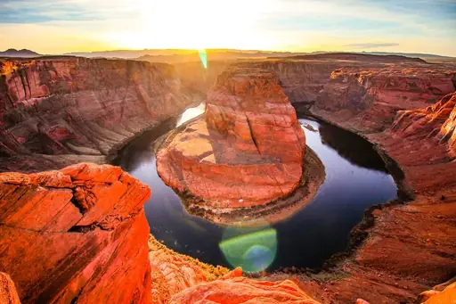
Discover
Extraordinary natural wonders and scenic landscapes
Natural wonders occupy a different category from other travel destinations. They are places where the scale, the geology, the light or the sheer improbability of what exists there…
Read more
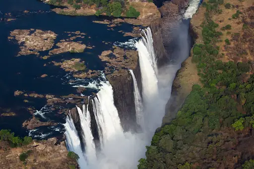
Discover
Best natural wonder destinations in Africa
Africa's natural wonders are as varied as the continent itself, shaped by ancient geology, vast tectonic forces and climatic extremes that have produced landscapes of extraordinary…
Read more
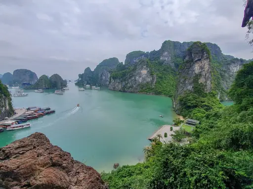
Discover
Best natural wonder destinations in Asia
Asia contains some of the most extraordinary natural wonders on earth, shaped by the collision of tectonic plates, vast river systems, volcanic activity and climatic extremes that…
Read more
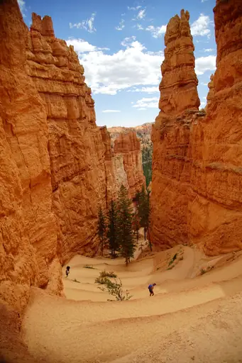
Discover
Best natural wonder destinations in North America
North America's natural wonders operate at a scale that can be genuinely difficult to comprehend until you are standing in front of them. The continent's geological history has…
Read more
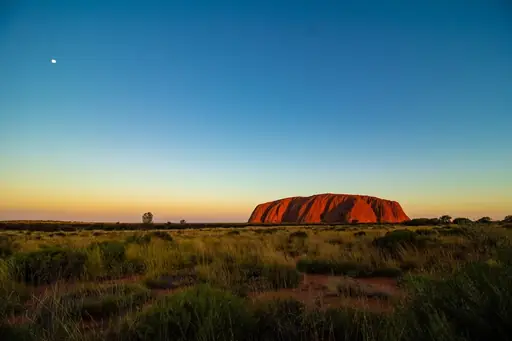
Discover
Best natural wonder destinations in Oceania
Oceania's natural wonders reflect the region's extraordinary geological and biological diversity, shaped by volcanic activity, ancient erosion and the forces that have kept island…
Read more
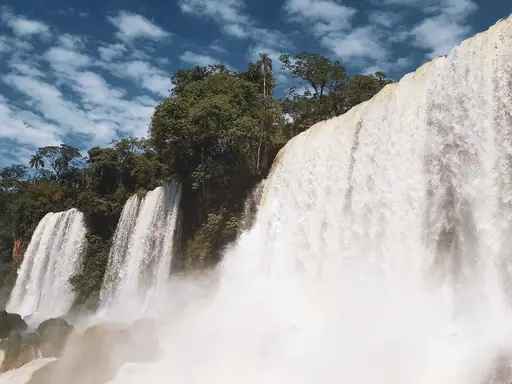
Discover
Best natural wonder destinations in South America
South America holds natural wonders on a genuinely extraordinary scale, from waterfall systems among the most dramatic on earth to vast desert landscapes known for extraordinarily…
Read more
What other users say about travelfilters
“travelfilters made it easy for me to find ski areas and compare what else they offer, so that I could find the best place for my personal travel style.”

Chris
Snowboarding & Onsen trip to Japan
“I love how transparent the data feels. There is no pushy upsell, just honest information and settings I can tune to my own travel style.”

Maria
After booking her 2027 winter escape
“The level of detail for each destination and how well those are displayed, make planning feel confident instead of overwhelming.”

Mina
Planned a week in New York City
“We used travelfilters for our planning from start to end. The trip turned out even better than expected, thanks to all their tools and customisation options.”

Allan & Etienne
Trip to Japan to see autumn foliage
“Thanks to travelfilters, I found some hidden gems to see. Being able to filter for exactly your interests is a game changer for my travel planning.”

Michael
Tour through the old cities of Northern Italy
“The customizable filters helped me find a quiet beach town with good wifi and low season crowds in under five minutes.”

Diego
Weekend Escape to Llanes, Spain
“The airport connection map saved me hours by showing good flight options from my home airport to lesser-known cities.”

Nguyen
Planning a 2027 trip to France
“The website is clean, fast and focused on the search itself, which makes travelfilters feel more like a professional tool than an ad-heavy booking site.”

Hassan
Christmas Market trip, Germany
