

Asia › Japan › Toyama › Chūbu-Sangaku National Park

Chūbu-Sangaku National Park

Scroll
Northern Alps peaks, snow walls and onsen

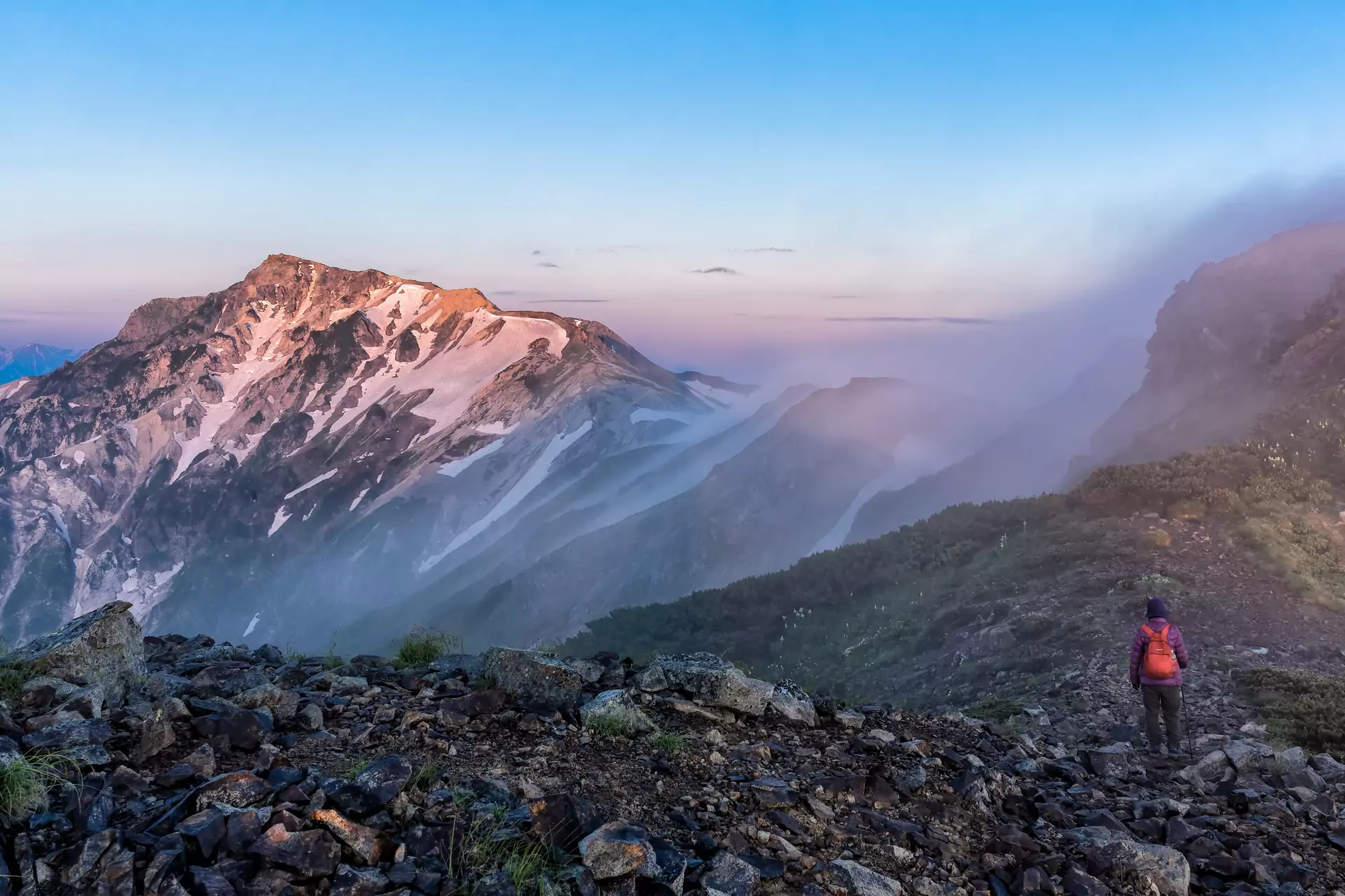
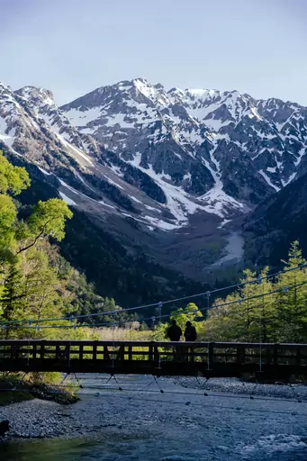
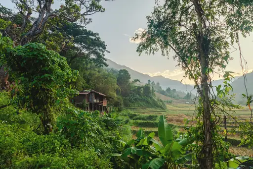
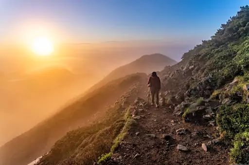
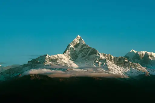
Chubu-Sangaku National Park covers 1,743.23 km² of the Northern Japan Alps across Toyama, Nagano, Gifu and Niigata prefectures and was designated in 1934, among Japan's first national parks. Many of its peaks rise to about 3,000 m. Visitors can ride the Tateyama Kurobe Alpine Route between Toyama and Nagano, walk the river valley of Kamikochi or soak in hot spring villages such as Okuhida. Hiking trails and the Alpine Route open only in the warmer months so plan around snow. Allow at least two days to see one area well and expect transport to take real time between the Toyama, Matsumoto and Takayama sides.

National Park in Japan
Climate zone: Warm continental

Warm continental: Humid continental climates with warm summers, cold winters and evenly distributed precipitation, typical of northern interior mid-latitudes.

See climate table
Price level: $$$
$Cheap
$$Medium
$$$Expensive, upscale
$$$+Very expensive, luxury
See price details
Safety: 7.8
General Safety:9
Health & medical:6
Accessibility:4
Tap water:9
Read details
Tourist English: 3/5
English is spoken at major hotels, visitor centres and some mountain huts. Signage is good on main trails, but limited in remote areas. Staff are helpful, but a translation app is useful for rural spots.
Last update: 21 Oct 2026
* We earn a commission from some links on this page.
Chūbu-Sangaku National Park Summary

These place ratings give you a quick overview of how well a destination matches different types of trips.

‘Best for’ scores:
The specific interest scores show where this place really shines – whether it's ideal for hiking, food & drink experiences, museums or other activities. These highlights help you understand what makes the destination special at a glance.

‘Your personal’ scores:
This reflects how well a place matches your personal preferences. You can adjust the importances of travel topics or other personal requirements categories in your account settings.

‘Suited for’ badges:
These give you a quick overview of how well a destination suits specific types of travellers, to help you find the places that match your lifestyle, preferences or travel situation.

Read how our scores work
Outstanding for alpine landscapes and hiking. Trek high mountain trails, see glaciers and peaks, enjoy panoramic viewpoints and visit remote mountain huts.
Place score
8.5
Best at:
Mountains
10
Snow
9
Spotless
9
Natural sites
9
Autumn foliage
9
Personal score
?
Log in to see how this place matches your personal travel interests.
Suited for
👶 6
Families
🧓 4
Seniors
👩 7
Solo
♻️ 7
Sustainability
Japan – Quick facts
Power Grid: 100 V, 50 Hz
Plug: Type A
Type A:
Diagram of a Type A power plug

Read about power adapters
Currency: Japanese Yen (JPY)
£1 ≈ JP¥210
Cashless info: Rating 4/5
Cashless payments are becoming more common, especially in cities, with some shops still preferring cash. Be prepared for occasional cash-only situations in rural areas.

Save with a travel credit card
eSIM providers: Best value: Saily
Flexibility: Airalo
Read our in-depth comparison
Tipping: Tipping is not customary in Japan and can be considered rude. Excellent service is the norm, and tipping is unnecessary in most places.
Public drinking: Public drinking is legal and commonly accepted, particularly during festivals and events.
Public smoking: Smoking is prohibited in indoor public places but allowed in designated outdoor areas. Some restaurants may have smoking sections.
New Year
(January)
One of the most important holidays, expect crowded temples and high prices. Plan ahead.
Golden Week
(April-May)
The busiest travel time, expect high demand for accommodation and transport.
Obon
(August)
A time to honour ancestors, many businesses close, and transport can be crowded.
Emergency contact: Emergency Number: 110 (Police), 119 (Fire & Ambulance)
Taxi apps: Uber, JapanTaxi, DiDi
Other: Japan is a country of respect, so understanding local customs and etiquette is important. Public transport is efficient, but can be crowded during peak hours.
Best times to travel

The best times to travel section shows how the months compare for a visit, so you can find the time of year that fits what you want to do.

Background colours of the months:
The colour shows the typical temperature: yellow (hot), green (mild) and blue (cold). How strong the colour is shows the travel season: full colour means high season, soft colour means shoulder season and soft-striped means off season.

Weather symbols:
Each month has one symbol showing what the weather is typically like, such as hot and sunny, freezing or a rainy or snowy season. Use them to quickly spot months that match the weather you want, or to avoid the ones that don't.

Crowdedness:
The people icon shows how busy the place usually is. The more people, the more crowded it gets.

Additional notes:
The grey info boxes point out special things worth knowing, like recurring weather issues or seasonal events.

for Chūbu-Sangaku National Park, Japan
🌨️
Jan
🌨️
Feb
🌨️
Mar
🌤️
Apr
☀️
May
🌦️
Jun
⛈️
Jul
🌦️
Aug
🌤️
Sep
🌦️
Oct
☀️
Nov
🌨️
Dec
High season: April - May, July - Oct.
Shoulder season: June
Crowdedness: 7 (Many tourists)
Tap on a month for more info Hover over a month for more info
Tateyama Kurobe Alpine Route open mid April to end of November, closed in winter
Yuki-no-Otani snow wall walk mid April to late June, Golden Week extremely crowded
Mountain huts and high trails usually open July to September, snow-free only from mid July

Why travel to Chūbu-Sangaku National Park?

The Tateyama Kurobe Alpine Route crosses the mountains between Toyama and Nagano on a chain of cable cars, ropeways and buses with a maximum elevation difference of 1,975 m. It runs from mid-April to the end of November. In spring the road near Murodo is cut through deep snow, which leaves walls of snow on both sides. Kamikochi is a flat river valley below the peaks with walking paths that suit a short stroll or a longer hike on to lodges at Tokusawa and Yokoo. Private cars are kept out of the valley, which keeps it quiet and easy to enjoy on foot. Experienced hikers come for the high routes around Mt. Yarigatake and Mt. Tsurugi and for the Kita Alps traverse, where rock ptarmigan and alpine plants live on the upper slopes. After a day outdoors you can soak in the hot spring villages of Okuhida, Hirayu and Fukuchi. The Alpine Route plus one other area makes a good trip of two or three days. Snow lingers in the valleys into summer and the high trails are usually walkable only in the warmer months.

🏯Places worth seeing
  • 1 Kappa Bridge
  • 2 Shinhotaka Ropeway
  • 3 Kamikochi
  • 4 Tateyama Kurobe Alpine Route
🎡Places for activities
  • 1 Nishiyama Ski Resort
  • 2 平湯温泉
🏞️Natural landmarks
  • 1 Taisho Pond
  • 2 Mt. Yari
  • 3 Myojin Pond
  • 4 Mount Okuhotaka
  • 5 Azusa River
🍽️Eat & Drink
  • 1 Restaurant Tateyama
    Himi udon, thin smooth noodles, plus a kakiage rice bowl of white shrimp, a small local shrimp. The restaurant is on the second floor of Murodo Terminal, 2,450 metres above sea level.
  • 2 Tateyama Soba
    Soba, buckwheat noodles, with tempura of firefly squid from Toyama Bay. The standing counter is on the ground floor of Murodo Terminal, next to the ticket gates for the Tateyama buses.
  • 3 Kurobe Dam Rest House
    Kurobe Dam Curry, rice shaped like a dam with a green spinach roux as the lake and coconut milk to mellow the spice. The restaurant is on the second floor of the rest house and overlooks the dam lake.
  • 4 Rest Inn Kurobe
    Toyama black ramen, a dark soy sauce ramen with plenty of black pepper, plus white shrimp kakiage udon and Himi udon. It is inside Unazuki Station of the Kurobe Gorge trolley train and open only during its season.
  • 5 Charumera Soba-ya Men-ya Maruha
    Light ramen in a chicken bone broth, topped with tororo kombu, shaved kelp and pork belly chashu simmered for three hours. The shop opens for lunch at weekends only and is a 2-minute walk from Unazuki Onsen Station.
  • 6 Sake to Sakana to Ramen Okamen
    Ramen with a seafood-based broth and local Toyama sake, at a shop that is a ramen restaurant at lunch and an izakaya, a Japanese pub, at night. It is a 2-minute walk from Unazuki Onsen Station.
  • 7 Sasaya Shokudo
    Chuka soba, light ramen in a chicken bone broth, with chashu from Kurobe Meisui pork, plus a meaty katsu sandwich. The diner has run for more than 50 years and serves lunch and dinner.
  • 8 Kajika
    Kamameshi, rice cooked in a pot after each order, which takes about 15 minutes, plus Toyama oden with whelk, tororo kombu, Kurobe Meisui pork and local eel. The restaurant is a 1-minute walk from Unazuki Onsen Station.
🎈Events
  • Kamikochi Opening Festival (April)
  • Norikura Kogen Flower Festival (June)
  • Hakuba Mountain Festival (July)
  • Tateyama Kurobe Alpine Route Snow Wall Walk (April–June)
  • Autumn Leaves Viewing (October)
  • Shinhotaka Ropeway Night Tours
  • Mountain Hut Opening Season (July)
  • Karasawa Cirque Autumn Festival
  • Hakuba Snow Festival (January)
  • Guided Birdwatching Weeks

Knowledge before you go

  • Both the Alpine Route and Kamikochi close for winter, so check dates.
  • The Alpine Route works in either direction, so pick the end that suits your onward train.
  • Kamikochi's visitor centres provide trail maps plus weather and safety advisories, so stop in first.
  • A regional tourist pass covers the Alpine Route plus the Takayama and Matsumoto areas, so compare it with single tickets.

How to travel to Chūbu-Sangaku National Park

The park has several gateways and the right one depends on the area you want. Toyama is the hub for the Tateyama side, Matsumoto for Kamikochi and Takayama for the Hirayu and Okuhida side. From Tokyo the Hokuriku Shinkansen reaches Toyama Station in about 2 hours 45 minutes. The JR Azusa limited express reaches Matsumoto in about 2 hours 30 minutes. From Osaka the Thunderbird limited express and the Hokuriku Shinkansen reach Toyama in about 3 hours 20 minutes. For Takayama from Osaka, take the Tokaido Shinkansen to Nagoya and then the Hida limited express, about 3 hours 20 minutes in total. For Kamikochi from Matsumoto, take the Alpico Kamikochi Line to Shin-Shimashima in about 30 minutes and then a bus for about 60 minutes. Toyama Airport (TOY) and Matsumoto Airport (MMJ) have limited domestic flights. Most overseas visitors arrive via Tokyo or Osaka. Driving is practical to the Toyama and Hakuba sides but not into Kamikochi.

Access summary

  • From Matsumoto Airport: Bus to Matsumoto, then bus to Kamikochi, about 2–3 hours.
  • From Tokyo: JR or highway bus to Matsumoto/Takayama, then local buses, roughly 4–5 hours.
  • From Takayama: Nohi/Alpico buses to Hirayu or Kamikochi trailheads, usually 1.5–2 hours.

Where to stay in Chūbu-Sangaku National Park

Most people stay in hot spring villages and mountain lodges. Okuhida Onsengo, Hirayu Onsen and Fukuchi Onsen have ryokan and inns with open-air baths on the Gifu side. Kamikochi has more than 20 lodgings and three campsites in the valley, which puts you on the trails early before day visitors arrive. Higher up, mountain huts serve hikers on the ridge routes. Book those well ahead for summer weekends, as space is limited. If you'd rather stay in a city, Toyama, Matsumoto and Takayama make practical bases with a wide range of hotels and good train links. From Matsumoto it takes about 90 minutes to reach Kamikochi, so a day trip is possible but leaves less time on the trail. Rooms near the park fill up on summer holidays and in the weeks of autumn colour, so book early for those dates.

Hotel recommendations

*by rating and popularity. Commissions have no influence on the rankings.
We couldn't find any nearby hotels for now.

How to get around Chūbu-Sangaku National Park

The park is a set of separate areas rather than one connected region, with the Tateyama side near Toyama, Kamikochi near Matsumoto and the Hirayu and Okuhida side near Takayama. Inside each area you move by a mix of cable cars, ropeways, buses and your own feet.

Alpine Route:
The Tateyama Kurobe Alpine Route links its stations in a fixed sequence between Toyama and Nagano and you can travel it in either direction.
Tickets are sold online and on the day.

Kamikochi:
Kamikochi is closed to private cars, so you park outside the valley and continue by bus or taxi.
Once there you get around on foot.

Buses:
Alpico Kotsu and Nohi Bus run the main bus lines in the park.
Other trailheads are reached by local bus or taxi from the nearest town. Some are only served in the warmer months.

Car:
A hire car helps on the Toyama and Hakuba sides for reaching trailheads and hot spring villages, but it doesn't help in Kamikochi or on the Alpine Route itself.

Food in Chūbu-Sangaku National Park

Food here changes with the side of the mountains you're on. Toyama is known for seafood from its bay, including white shrimp and sushi, while Nagano is famous for soba noodles. Around Takayama you'll find Hida beef on many menus.

Inside the park most meals are served by lodges, mountain huts and a handful of cafes and restaurants, especially at Kamikochi and Murodo. Choices are limited in range, so don't count on a wide menu. Mountain huts usually serve a set dinner.

On long hikes you'll need to carry a lunch and snacks. Buy them in Toyama, Matsumoto or Takayama, where supermarkets and convenience stores are plentiful.

Budget snapshot
Costs compared to home

We calculate the average costs when travelling to destinations and compare those with the living costs at your home. With this you can get an estimate of how expensive or cheap the destination is for you.

To customise this, you can set up which location and price level are used for the calculations in your account settings.

-45 %
Daily expenses in the region are around 45% lower than the average across United States. That means you'll spend a lot less on meals and getting around.
Exchange rate trend

The exchange rate price factor shows how expensive or cheap a currency currently is compared to its historical average. It's a quick way to see if a country is currently more or less affordable due to exchange rate changes.

-20 %
Your exchange rate (GBP to JPY) is 20% better than in recent years. That means travelling now is considerably cheaper compared to the past.

Travel costs (Data for Omachi, Japan - 21 km away)

To help you plan your trip, we provide estimated daily costs per person (when travelling as a pair) for different travel styles. These numbers give you an idea of what you might spend each day at this destination, including accommodation, food, transport and activities.

Additionally, we also provide average hotel costs for different travel styles to give you an estimate for the accommodation only.

Please note that these are only estimates. The real costs depend on booking times, season and other factors.

Daily cost summary

Travel style categories explained:

Backpacker:
Staying in hostels or budget hotels, cooking your own meals or eating cheap and choosing low-cost activities.

Mid-range:
Staying in mid-range hotels, eating at a mix of restaurants and casual spots and enjoying a variety of activities.

Luxury:
Staying in luxury hotels, dining out at high-end restaurants and enjoying premium experiences without worrying about the price.

Backpacker Mid-range Luxury
💵 Total costs per day, including accommodation
£52
£137
£345
🏨 Accommodation per night, per person
£30
£98
£210
🍝 Food per day
£17
£32
£96
🚕 Transportation per day
£5
£8
£39
Food & Drink
🍽️ Restaurant Dinner, per person
£11.50
🍛 Lunch Set, per person
£5
🍟 Fast food combo
£3.70
🍝 Preparing your own food, per day
£6.50
☕ Cappuccino
£2.10
🍺 Beer in a restaurant, 0.5 l
£2.30
Transportation
🚌 Public transport ticket
£1.20
🚕 Taxi Ride, 10 km / 6 mi
£24
⛽ Petrol, 1 l
£0.85
Other
🎞️ Cinema ticket
£9
👩‍⚕️ Doctor's consult
£21
🤧 Cold medication
£6.50
💇 Basic haircut
£12.50

Safety information overview

General safety
9
Crime isn't a concern here but mountain conditions are. Weather can turn fast near 3,000 metres and snow can remain on high routes late in the season. Bears live in the forests. Stay on marked trails and check advisories at visitor centres before setting off.
Health & Medical
6
Hospitals are in Toyama, Matsumoto and Takayama, so a mountain injury can mean a long transfer. Altitude on the high ridges can cause headaches or breathlessness for some people. Carry basic first aid and travel insurance that covers mountain rescue.
Accessi­bility
4
The Kamikochi valley floor is mostly flat and suits easy walks, though some paths are unpaved. The Alpine Route involves several transfers with steps and queues. Ridge and summit trails are steep and rocky, so they aren't suitable for visitors with limited mobility.
Tap water
9
Tap water in Toyama, Matsumoto and Takayama is safe to drink. Mountain huts and trailside facilities may have limited water or sell it, so carry enough for each stage of a hike. Avoid drinking untreated stream water.

Looking for inspiration?

Discover
Stunning national parks and wilderness areas
National parks exist because someone decided that certain landscapes were too important to lose. The best of them protect ecosystems, wildlife and natural processes that would…
Read more
Discover
Top adventure destinations and outdoor activities
Adventure travel covers an enormous range of activities and risk tolerances, from multi-day wilderness trekking and white water rafting to technical climbing, polar expeditions and…
Read more
Discover
Best couple vacation destinations in Asia
Asia is perfect for couples who want their holiday to feel like a shared adventure rather than just a change of scenery. Few continents offer so many ways to be amazed together.…
Read more
Discover
Best natural wonder destinations in Asia
Asia contains some of the most extraordinary natural wonders on earth, shaped by the collision of tectonic plates, vast river systems, volcanic activity and climatic extremes that…
Read more
Discover
Top hiking destinations and famous trails
Hiking at its best is one of the most direct ways to engage with a landscape. The pace forces a relationship with terrain, weather and distance that faster forms of travel rarely…
Read more
Discover
Best rural retreat destinations in Asia
Rural retreat travel is defined by the deliberate removal from urban pace and density, with landscape immersion, slower rhythms and direct engagement with food, nature and local…
Read more
Discover
Best couple holiday destinations
Travelling as a couple sounds simple enough, yet the best couple holiday destinations mean something different to almost every pair. What feels romantic to one couple can feel like…
Read more
Discover
Best eco-tourism destinations in Asia
One Himalayan kingdom's deliberately restrictive, high-value tourism policy funds conservation and limits environmental impact by design, a model considerably different from…
Read more
Discover
Stunning national parks and wilderness areas in Asia
Read more
Discover
Best hiking destinations in Asia
Asia offers some of the most varied and rewarding hiking terrain on earth, ranging from high altitude Himalayan trails and volcanic crater routes to ancient pilgrimage paths,…
Read more
Discover
Best mountain destinations in Asia
Asia contains the world's highest and most extensive mountain systems, with the Himalayas, Karakoram and Hindu Kush forming a vast elevated arc across the continent that includes…
Read more
Discover
Best climbing destinations in Asia
Asia has some of the most varied climbing on the planet, from towering limestone cliffs above turquoise water to high mountain routes that push climbers to their limits. The…
Read more
Discover
Top rural retreat destinations and countryside getaways
Rural retreat travel is defined by the deliberate removal from urban pace and density, with landscape immersion, slower rhythms and direct engagement with food, nature and local…
Read more
Discover
Extraordinary natural wonders and scenic landscapes
Natural wonders occupy a different category from other travel destinations. They are places where the scale, the geology, the light or the sheer improbability of what exists there…
Read more
Discover
Top mountain destinations and famous peaks
Mountain travel spans an enormous range of experience, from high-altitude expeditions and multi-day trekking circuits to accessible alpine day walks and scenic drives through…
Read more
Feedback