



Was this page helpful?

| Public website: | www.losglaciares.com |
|---|
| Power Grid: |
220 V, 50 Hz Plug: Type C , Type I
Type C:
  Read about power adapters |
|---|---|
| Currency: |
Argentine Peso (ARS) £1 ≈ ARS 2,048.06 |
| Cashless info: |
Rating 4/5
Cashless payments are widely accepted in larger cities, especially with credit and debit cards. However, cash is often preferred in smaller towns.
Save with a travel credit card |
| eSIM providers: |
Best value: Saily Flexibility: Airalo Read our in-depth comparison |
| Tipping: | In restaurants, a 10% tip is standard. Tipping in taxis is not required, but rounding up is common. |
|---|---|
| Public drinking: | Public drinking is legal but should be done responsibly. It is common in parks and beaches. |
| Public smoking: | Smoking is prohibited indoors in public spaces, but allowed in outdoor areas. |
| Argentina Independence Day (July) |
Expect public celebrations and some business closures. |
|---|---|
| Christmas (December) |
Expect closures and holiday events. |
| Emergency contact: | Emergency Numbers: 911 (Police), 107 (Ambulance), 100 (Fire) |
|---|---|
| Taxi apps: | Cabify, Uber, BA Taxi |
| Other: | Argentina is known for its vibrant culture, tango, and excellent cuisine, including steaks and wines. |
The best times to travel section shows how the months compare for a visit, so you can find the time of year that fits what you want to do.
Background colours of the months:
The colour shows the typical temperature: yellow (hot), green (mild) and blue (cold). How strong the colour is shows the travel season: full colour means high season, soft colour means shoulder season and soft-striped means off season.
Weather symbols:
Each month has one symbol showing what the weather is typically like, such as hot and sunny, freezing or a rainy or snowy season. Use them to quickly spot months that match the weather you want, or to avoid the ones that don't.
Crowdedness:
The people icon shows how busy the place usually is. The more people, the more crowded it gets.
Additional notes:
The grey info boxes point out special things worth knowing, like recurring weather issues or seasonal events.
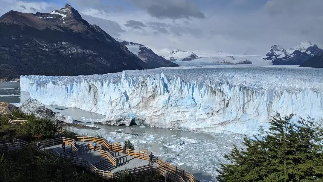
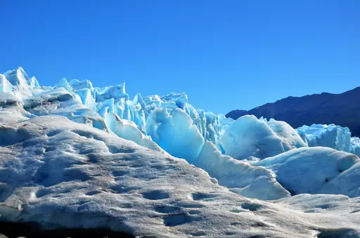
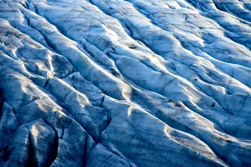
Perito Moreno Glacier stands as one of Argentina’s most striking natural features. Located in Los Glaciares National Park this massive ice formation stretches across the Southern Patagonian Ice Field. Visitors encounter towering walls of blue-white ice that shift with light throughout the day. The glacier moves slowly but steadily reshaping the landscape over centuries.
The glacier’s surface reveals deep crevasses and sharp ridges shaped by wind and meltwater. Hikers follow marked paths to viewpoints where they can see massive chunks calve into lakes below. These events happen without warning creating sudden splashes that echo across valleys. Guides recommend sturdy boots and layered clothing because winds can change quickly even in summer months.
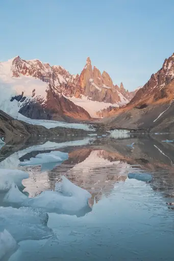
Nearby towns like El Calafate provide basic services for travelers seeking adventure or quiet observation. Local outfitters organize boat tours to approach the glacier up close while keeping safe distances. Photography enthusiasts find endless opportunities to capture reflections of ice against water and sky. The area also supports small research stations studying climate impacts on glaciers.
Exploring Perito Moreno feels like witnessing a slow-motion natural masterpiece. Its scale reminds visitors how powerful Earth’s processes remain despite human activity. Travelers often leave with a clearer sense of time measured not in hours but in centuries. The experience encourages respect for remote places where nature still leads the way.
There’s nothing quite like standing on the walkways and hearing the glacier crack and roar as huge chunks of ice tumble into the turquoise waters below. Whether you’re trekking atop the glacier, kayaking close to its towering face or simply soaking in the views from a boat or balcony, Perito Moreno is a sensory overload you’ll never forget. The area is well-organized for visitors, with marked trails, accessible viewpoints and options for every budget. Just be aware that entrance fees have risen, tours can be pricey and weather is famously unpredictable – expect strong winds and sudden cold snaps even in summer.
Most visitors base themselves in El Calafate, 80 km away. Regular buses, shuttles and guided tours connect the town to the glacier. El Calafate has an airport with flights from Buenos Aires and other Argentine cities. From the park entrance, you can walk, take a shuttle or join excursions.
Stay in El Calafate, which offers everything from hostels to luxury lodges. There are no hotels at the glacier itself, but day trips are easy. Book ahead in high season (Dec–Mar); some remote estancias offer unique Patagonian experiences.
Log in to add this place to a travel list and get a summary of all recommended items for your whole trip.
We calculate the average costs when travelling to destinations and compare those with the living costs at your home. With this you can get an estimate of how expensive or cheap the destination is for you.
To customise this, you can set up which location and price level are used for the calculations in your account settings.
The exchange rate price factor shows how expensive or cheap a currency currently is compared to its historical average. It's a quick way to see if a country is currently more or less affordable due to exchange rate changes.
