




Was this page helpful?

| Public website: | www.nps.gov |
|---|
| Power Grid: |
120 V, 60 Hz Plug: Type A , Type B
Type A:
  Read about power adapters |
|---|---|
| Currency: |
US Dollar (USD) £1 ≈ US$1.33 |
| Cashless info: |
Rating 5/5
The U.S. is highly cashless, with credit and debit cards accepted almost everywhere. Mobile payment options like Apple Pay and Google Pay are widely used.
Save with a travel credit card |
| eSIM providers: |
Best value: Saily Flexibility: Airalo Read our in-depth comparison |
| Tipping: | Tipping is customary and expected in the U.S. In restaurants, 15-20% is standard. Taxi drivers, hotel staff, and tour guides also expect tips, usually around 10-20% depending on the service. |
|---|---|
| Public drinking: | Public drinking laws vary by state, but it is generally prohibited in public spaces without a permit. |
| Public smoking: | Smoking is restricted in most indoor public spaces and some outdoor areas. Local laws vary. |
| Etiquette: | Greet with a firm handshake, maintain eye contact, respect personal space, and avoid discussing politics or income unless invited to share opinions. Politeness and friendliness are appreciated. |
| Thanksgiving (November) |
A major holiday with closures and domestic travel surges. |
|---|---|
| Independence Day (July) |
Expect parades, fireworks, and celebrations nationwide. |
| Christmas (December) |
Markets, festive events, and crowded tourist spots. |
| Emergency contact: | Emergency Number: 911 (Police, Fire, Ambulance) |
|---|---|
| Taxi apps: | Uber, Lyft, Bolt |
| Helpful links: |
Wikipedia Visa regulations Customs & border control Travel with medicine |
| Other: | The U.S. is known for its diverse landscapes, cultural experiences, and regional cuisines. Public transport is efficient in cities but less so in rural areas. Renting a car is recommended for exploring national parks. |
The best times to travel section shows how the months compare for a visit, so you can find the time of year that fits what you want to do.
Background colours of the months:
The colour shows the typical temperature: yellow (hot), green (mild) and blue (cold). How strong the colour is shows the travel season: full colour means high season, soft colour means shoulder season and soft-striped means off season.
Weather symbols:
Each month has one symbol showing what the weather is typically like, such as hot and sunny, freezing or a rainy or snowy season. Use them to quickly spot months that match the weather you want, or to avoid the ones that don't.
Crowdedness:
The people icon shows how busy the place usually is. The more people, the more crowded it gets.
Additional notes:
The grey info boxes point out special things worth knowing, like recurring weather issues or seasonal events.
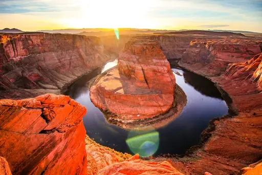
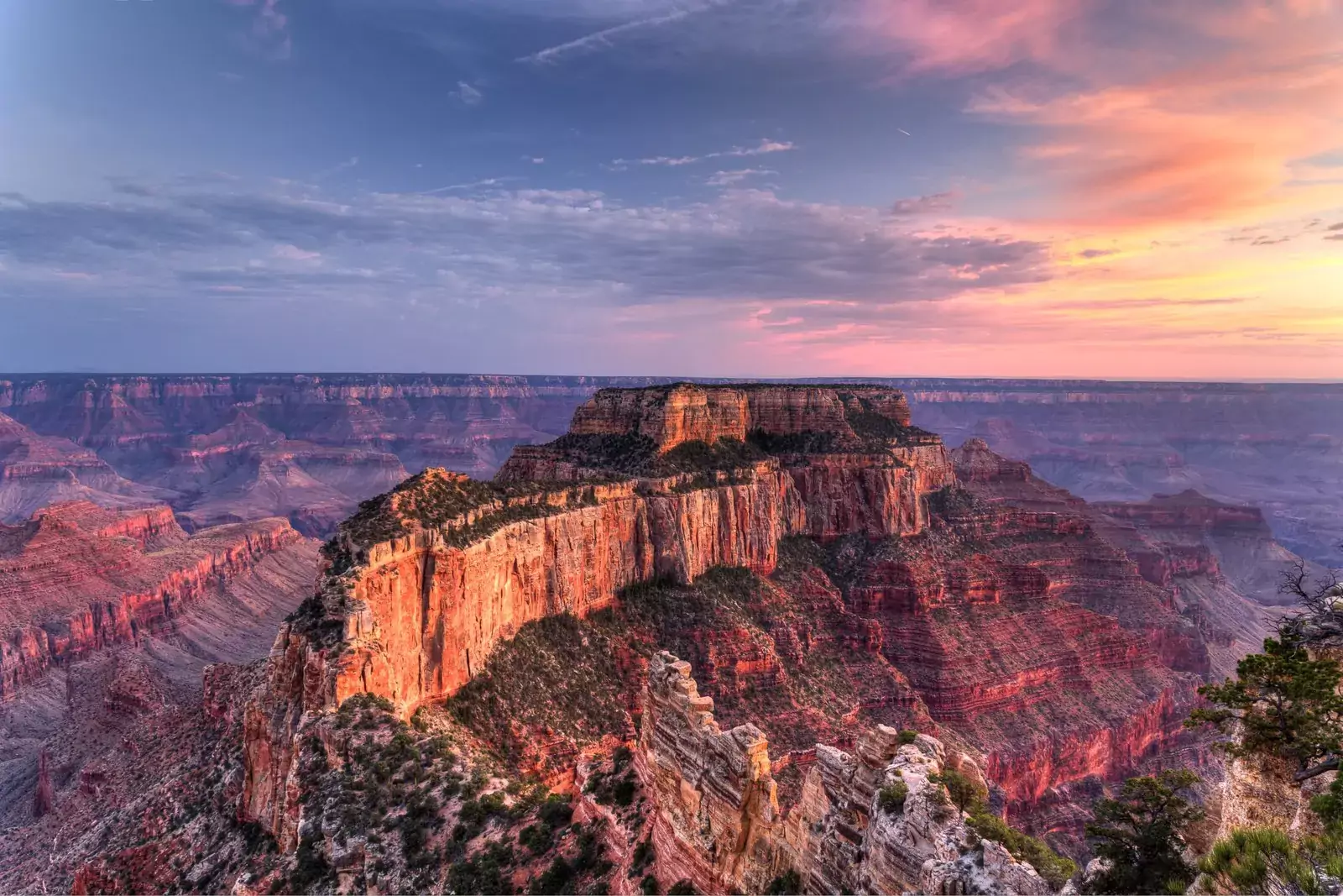
The Grand Canyon is a testament to nature's incredible power, where the Colorado River has carved a massive chasm through layers of rock over millions of years. At an average depth of about one mile and stretching 277 miles long, this vast scenic wonder reveals the Earth's geological history through its exposed rock layers. The canyon's immense size - wider than the entire state of Rhode Island at 18 miles across at its widest point - creates its own weather patterns and ecosystems, supporting diverse wildlife including approximately 70 mammal species, 250 bird species and 25 types of reptiles.
Visitors to the Grand Canyon have several options for experiencing this natural marvel. The South Rim, open year-round and home to Grand Canyon Village, is the most accessible and popular area, offering numerous viewpoints, hiking trails and visitor services. The North Rim, standing 1,000 feet higher than the South Rim at an average height of 8,000 feet, provides a different perspective and is less crowded but only open seasonally due to winter snow. The West Rim, managed by the Hualapai Tribe rather than the National Park Service, features the famous glass-bottomed Skywalk extending over the canyon edge.
While the Grand Canyon's beauty is undeniable, visitors should be prepared for several challenges. As the second most-visited national park in the USA with nearly 6 million annual visitors, crowds can be overwhelming, particularly between 10am and 4pm during peak season. The weather can be extreme and unpredictable - summer temperatures can be scorching, while winter brings snow to the rims. Monsoon season (July to mid-September) can bring dangerous flash floods, particularly in the inner canyon. And despite its popularity, the Grand Canyon remains a wilderness area with real safety hazards - steep, unfenced cliffs, challenging hiking trails and wild animals all require respect and caution.
For those willing to venture beyond the rim viewpoints, the Grand Canyon offers transformative experiences. Hiking into the canyon provides a completely different perspective, though it's important to remember that the return journey uphill is always more strenuous. The Colorado River at the canyon bottom offers thrilling rafting adventures through rapids and calm stretches alike. For a less physically demanding experience, the free shuttle bus system on the South Rim provides access to numerous viewpoints and ranger-led programs offer insights into the canyon's natural and cultural history. Whether you're spending a few hours or several days, the Grand Canyon's immense scale and beauty leave visitors with a profound appreciation for one of Earth's most spectacular landscapes.
The Grand Canyon is accessible via several routes, with the South Rim being the most popular and accessible year-round. You can drive to the South Rim via Highway 64 from either the south or east. The entrance fee is US$35 (£26.30) per vehicle for a week-long permit, giving access to both South and North Rims. The South Rim is located about 60 miles north of Williams, Arizona (via route 64 from Interstate 40) and 80 miles northwest of Flagstaff (via route 180). If you prefer not to drive, numerous tour operators offer day trips from nearby cities like Las Vegas, Phoenix and Flagstaff. For those flying in, the nearest major airports are in Phoenix (about 3.5 hours drive) and Las Vegas (about 4.5 hours drive). There's also a small airport in Flagstaff with limited connections. For a unique approach, you can take the historic Grand Canyon Railway from Williams to the South Rim, which offers a scenic and nostalgic journey through the Arizona countryside.
Accommodation options at the Grand Canyon range from historic lodges within the park to modern hotels in nearby towns. Inside the park, the South Rim offers several lodging choices including the historic El Tovar Hotel and more affordable options like Bright Angel Lodge and Maswik Lodge. These park accommodations should be booked at least six months in advance due to high demand. The North Rim has more limited options with Grand Canyon Lodge being the only in-park lodging. Outside the park, towns like Tusayan, Williams and Flagstaff offer additional hotel options at various price points. For a more rustic experience, campgrounds are available on both rims, though these also require advance reservations during peak season.



Log in to add this place to a travel list and get a summary of all recommended items for your whole trip.
We calculate the average costs when travelling to destinations and compare those with the living costs at your home. With this you can get an estimate of how expensive or cheap the destination is for you.
To customise this, you can set up which location and price level are used for the calculations in your account settings.
The exchange rate price factor shows how expensive or cheap a currency currently is compared to its historical average. It's a quick way to see if a country is currently more or less affordable due to exchange rate changes.
