Asia › Tajikistan › Pamir Mountains

Pamir Mountains

Scroll
The Remote Roof of the World

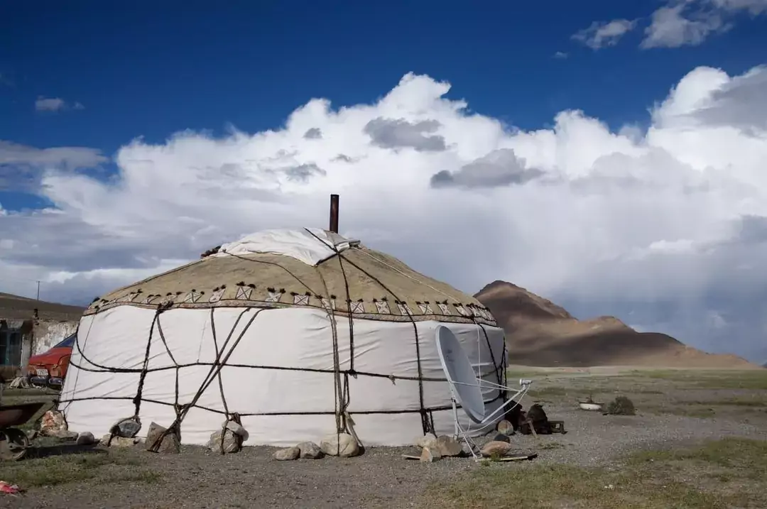
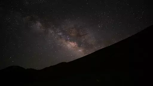
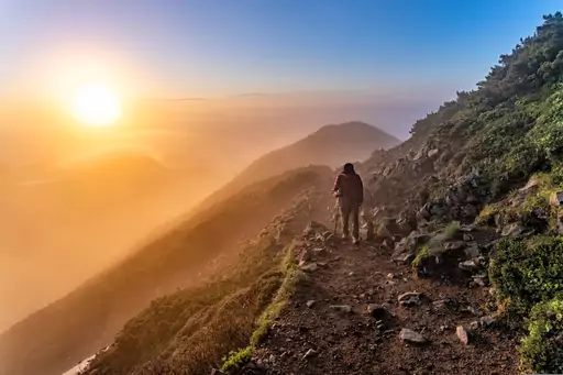
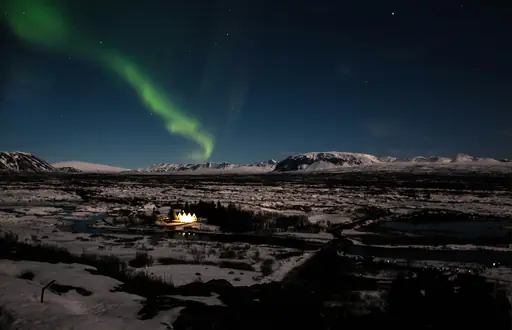
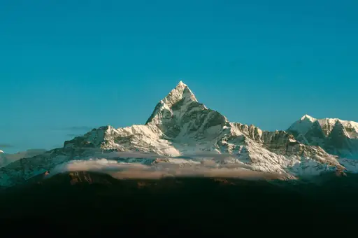
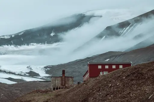
The Pamir Mountains in Tajikistan rise above 4,000 meters with rugged peaks and wide valleys. Glacial rivers cut through steep slopes while remote villages cling to high ground. At night, clear skies reveal bright stars over snow-covered ridges. Local communities rely on livestock and small farms for daily life. Hiking trails pass ancient caravanserais and offer views of jagged summits. The area remains largely untouched by mass tourism, making it a quiet place to experience mountain culture and natural beauty without crowds or distractions.

Mountain in Tajikistan
Climate zone: Tundra

Tundra: Polar climates where warmest month remains cool, allowing only low-growing vegetation above permafrost or seasonally frozen ground.

See climate table
Price level: $$$
$Cheap
$$Medium
$$$Expensive, upscale
$$$+Very expensive, luxury
See price details
Safety: 3.9
General Safety:6
Health & medical:1
Accessibility:1
Tap water:1
Read details
Tourist English: 2/5
English proficiency is limited in the Pamir region. Tour guides and some guesthouse owners in Khorog speak basic English, but in remote villages, communication may rely on gestures or translation apps. Russian is more widely understood than English.
Last update: 30 Oct 2026
* We earn a commission from some links on this page.
Pamir Mountains Summary

These place ratings give you a quick overview of how well a destination matches different types of trips.

‘Best for’ scores:
The specific interest scores show where this place really shines – whether it's ideal for hiking, food & drink experiences, museums or other activities. These highlights help you understand what makes the destination special at a glance.

‘Your personal’ scores:
This reflects how well a place matches your personal preferences. You can adjust the importances of travel topics or other personal requirements categories in your account settings.

‘Suited for’ badges:
These give you a quick overview of how well a destination suits specific types of travellers, to help you find the places that match your lifestyle, preferences or travel situation.

Read how our scores work
World-class for high mountain adventure. Drive the Pamir Highway, trek remote valleys, meet local communities and enjoy vast alpine landscapes.
Place score
6.6
Best at:
Mountains
10
Secluded
10
Natural sites
10
Stargazing
10
Motorcycling
10
Personal score
?
Log in to see how this place matches your personal travel interests.
Suited for
👶 2
Families
🧓 2
Seniors
🕌 9
Halal
❤️ 6
Couples
Tajikistan – Quick facts
Power Grid: 220 V, 50 Hz
Plug: Type C , Type F
Type C:
Diagram of a Type C power plug
Type F:
Diagram of a Type F power plug

Read about power adapters
Currency: Tajikistani Somoni (TJS)
£1 ≈ TJS 12.25
Cashless info: Rating 2/5
Cashless payments are not widely accepted in Tajikistan, and cash is the most common method of payment. Credit cards are rarely accepted outside of major hotels and businesses.

Save with a travel credit card
eSIM providers: Best value: Saily
Flexibility: Airalo
Read our in-depth comparison
Tipping: Tipping is appreciated in Tajikistan, though not mandatory. A 5-10% tip is common in restaurants, and small tips for hotel staff and taxi drivers are appreciated.
Public drinking: Public drinking is not common in Tajikistan, and alcohol is typically consumed in private or in licensed venues.
Public smoking: Smoking is common in Tajikistan, and it is allowed in outdoor public spaces and designated indoor areas.
Independence Day
(9 September)
Celebrates Tajikistan’s independence from the Soviet Union
Navruz
(21–24 March)
Celebrates the Persian New Year
Emergency contact: Emergency Numbers: 102 (Police), 103 (Ambulance), 101 (Fire)
Taxi apps:
Other: Tajikistan is known for its mountainous landscapes, including the Pamir Mountains, and offers adventure tourism. However, travellers should be cautious of political instability and remote areas.
Best times to travel

The best times to travel section shows how the months compare for a visit, so you can find the time of year that fits what you want to do.

Background colours of the months:
The colour shows the typical temperature: yellow (hot), green (mild) and blue (cold). How strong the colour is shows the travel season: full colour means high season, soft colour means shoulder season and soft-striped means off season.

Weather symbols:
Each month has one symbol showing what the weather is typically like, such as hot and sunny, freezing or a rainy or snowy season. Use them to quickly spot months that match the weather you want, or to avoid the ones that don't.

Crowdedness:
The people icon shows how busy the place usually is. The more people, the more crowded it gets.

Additional notes:
The grey info boxes point out special things worth knowing, like recurring weather issues or seasonal events.

for Pamir Mountains, Tajikistan
🌨️
Jan
🌨️
Feb
❄️
Mar
❄️
Apr
☀️
May
☀️
Jun
☀️
Jul
☀️
Aug
☀️
Sep
❄️
Oct
❄️
Nov
❄️
Dec
High season: July - Sep.
Shoulder season: May - June, Oct.
Crowdedness: 2 (Few tourists)
Tap on a month for more info Hover over a month for more info
Pamir Highway (M41) and high passes are usually fully open June to October, with snow closures and rockfalls possible outside that window
Altitude of 3,000 to 4,600 metres along the highway: allow time to acclimatise, and carry extra supplies as fuel and services are scarce
Many guesthouses and homestays in Murghab, Langar and Khorog close or run minimal service from November to April

Why travel to Pamir Mountains?

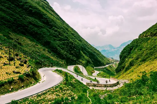
The Pamir Mountains offer a truly off-the-beaten-path adventure for those seeking to explore one of the world's last great wilderness areas. The legendary Pamir Highway (M41) provides one of the planet's most spectacular road trips, winding through dramatic mountain passes, alongside the Afghan border and past villages that have changed little in centuries. Along the way, you'll discover stunning natural wonders like the vibrant blue Zaroshkul and Tshakhin Lakes, soak in natural hot springs at Kavk, explore ancient fortresses like Yamchun and experience the warm hospitality of the Pamiri people in homestays that offer a genuine cultural immersion.

Knowledge before you go

  • Hire 4WD transport. Roads are rough, high-altitude passes treacherous.
  • Acclimatize in Khorog first to avoid altitude sickness above 4000 meters.
  • Stay in homestays along Pamir Highway; GBAO permit required for entry.
  • Taste Pamiri bread, apricot yogurt in Wakhan Corridor villages near Afghan border.

How to travel to Pamir Mountains

The main gateways to the Pamir Mountains are Dushanbe (Tajikistan's capital) and Osh (Kyrgyzstan). Most travelers fly into one of these cities and then arrange transportation to the mountains. From Dushanbe, it's a two-day drive along the Pamir Highway to reach Khorog, the capital of the Gorno-Badakhshan region. For those short on time, a small 20-seater plane connects Dushanbe and Khorog with spectacular views, though flights are weather-dependent and often fully booked.

Access summary

  • From Dushanbe (DYU): Fly or 4x4 to Khorog, 1 hour or 15–16 hours.
  • From Dushanbe city: Start Pamir Highway (M41) by shared 4x4, multi‑day journey.
  • From Osh, Kyrgyzstan: Drive Pamir Highway via Murghab to Tajik Pamirs, several days.

Where to stay in Pamir Mountains

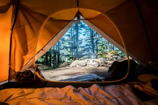
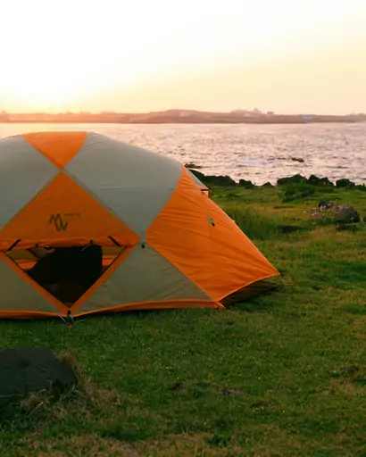
Accommodation in the Pamir Mountains ranges from basic guesthouses and homestays in towns like Khorog, Kalai Khumb and Bulunkul to camping in the wilderness during treks. Homestays offer a wonderful opportunity to experience Pamiri hospitality and culture, though facilities are simple with shared bathrooms and limited electricity. When trekking, camping equipment is essential as you'll be staying in tents beside lakes and rivers in remote areas. Advance booking is recommended for organized tours that include accommodation arrangements.

Hotel recommendations

*by rating and popularity. Commissions have no influence on the rankings.
We couldn't find any nearby hotels for now.

How to get around Pamir Mountains

Getting around the Pamir Mountains typically requires a 4WD vehicle due to the rugged terrain and poor road conditions. The Pamir Highway (M41) is the main artery through the region, connecting Dushanbe to Osh in Kyrgyzstan. Public transport is limited to shared jeeps that travel non-stop between major towns. For trekking, many routes require guides, porters and pack animals to transport gear, especially on the newly established Pamir Trail sections.
Budget snapshot
Costs compared to home

We calculate the average costs when travelling to destinations and compare those with the living costs at your home. With this you can get an estimate of how expensive or cheap the destination is for you.

To customise this, you can set up which location and price level are used for the calculations in your account settings.

---
We can't detect your current location. Please log in and set your current location in the account settings to see a cost comparison.
Exchange rate trend

The exchange rate price factor shows how expensive or cheap a currency currently is compared to its historical average. It's a quick way to see if a country is currently more or less affordable due to exchange rate changes.

+15 %
Your exchange rate (GBP to TJS) is 15% worse than in recent years. That means travelling now is more expensive compared to the past.

Safety information overview

General safety
6
The Pamir region is generally safe from crime, but natural hazards are significant. High altitude, remote locations and extreme weather pose the greatest risks. Special permits are required for the GBAO region and border areas. Military checkpoints are common and documentation will be checked.
Health & Medical
1
Medical facilities are extremely limited, with basic services in Khorog and virtually none in remote areas. Altitude sickness is a serious risk above 3,000 meters. Evacuation can be difficult and expensive. Comprehensive travel insurance with helicopter evacuation coverage is essential.
Accessi­bility
1
The Pamir Mountains present significant accessibility challenges with rough terrain, high altitudes and basic infrastructure. Most activities require good physical fitness. The region is not suitable for those with mobility issues or serious health conditions requiring regular medical attention.
Tap water
1
Tap water is not safe to drink. Use water purification tablets, filters or bottled water. When trekking, water from mountain streams should be treated. Staying hydrated is crucial at high altitudes to help prevent altitude sickness.

Looking for inspiration?

Discover
Best stargazing destinations in Asia
Asia's dark sky options range from high-altitude Himalayan plateaus and cold desert regions of the interior to remote island locations scattered across the Pacific and Indian…
Read more
Discover
Top adventure destinations and outdoor activities
Adventure travel covers an enormous range of activities and risk tolerances, from multi-day wilderness trekking and white water rafting to technical climbing, polar expeditions and…
Read more
Discover
Top motorcycling destinations and scenic routes
A great motorcycle route asks for more than scenery: it needs road surface, corner sequencing and enough remoteness to make the ride itself the point rather than simply transport…
Read more
Discover
Top camping destinations and outdoor escapes
Camping travel spans an enormous range of experiences from wild backcountry camping in remote wilderness to well-serviced campsite networks with full amenity infrastructure that…
Read more
Discover
Best natural wonder destinations in Asia
Asia contains some of the most extraordinary natural wonders on earth, shaped by the collision of tectonic plates, vast river systems, volcanic activity and climatic extremes that…
Read more
Discover
Best motorcycle destinations in Asia
Asia has some of the highest and most dramatic roads in the world, and for a lot of riders a motorcycle trip here is something they talk about for years. In India, the road from…
Read more
Discover
Best camping destinations in Asia
Asia's camping offer ranges from the well-developed campsite networks of East Asia and the high-altitude wilderness camping of the Himalayan regions to the jungle environments of…
Read more
Discover
Top hiking destinations and famous trails
Hiking at its best is one of the most direct ways to engage with a landscape. The pace forces a relationship with terrain, weather and distance that faster forms of travel rarely…
Read more
Discover
Best rural retreat destinations in Asia
Rural retreat travel is defined by the deliberate removal from urban pace and density, with landscape immersion, slower rhythms and direct engagement with food, nature and local…
Read more
Discover
Best hiking destinations in Asia
Asia offers some of the most varied and rewarding hiking terrain on earth, ranging from high altitude Himalayan trails and volcanic crater routes to ancient pilgrimage paths,…
Read more
Discover
Top stargazing destinations and dark sky reserves
The best dark sky destinations are found far from urban light pollution, typically in high-altitude deserts, remote island locations and vast uninhabited interior regions.…
Read more
Discover
Best mountain destinations in Asia
Asia contains the world's highest and most extensive mountain systems, with the Himalayas, Karakoram and Hindu Kush forming a vast elevated arc across the continent that includes…
Read more
Discover
Best climbing destinations in Asia
Asia has some of the most varied climbing on the planet, from towering limestone cliffs above turquoise water to high mountain routes that push climbers to their limits. The…
Read more
Discover
Top rural retreat destinations and countryside getaways
Rural retreat travel is defined by the deliberate removal from urban pace and density, with landscape immersion, slower rhythms and direct engagement with food, nature and local…
Read more
Discover
Extraordinary natural wonders and scenic landscapes
Natural wonders occupy a different category from other travel destinations. They are places where the scale, the geology, the light or the sheer improbability of what exists there…
Read more
Was this page helpful?
Feedback