

Half Dome

Scroll
Iconic Granite Challenge Peak

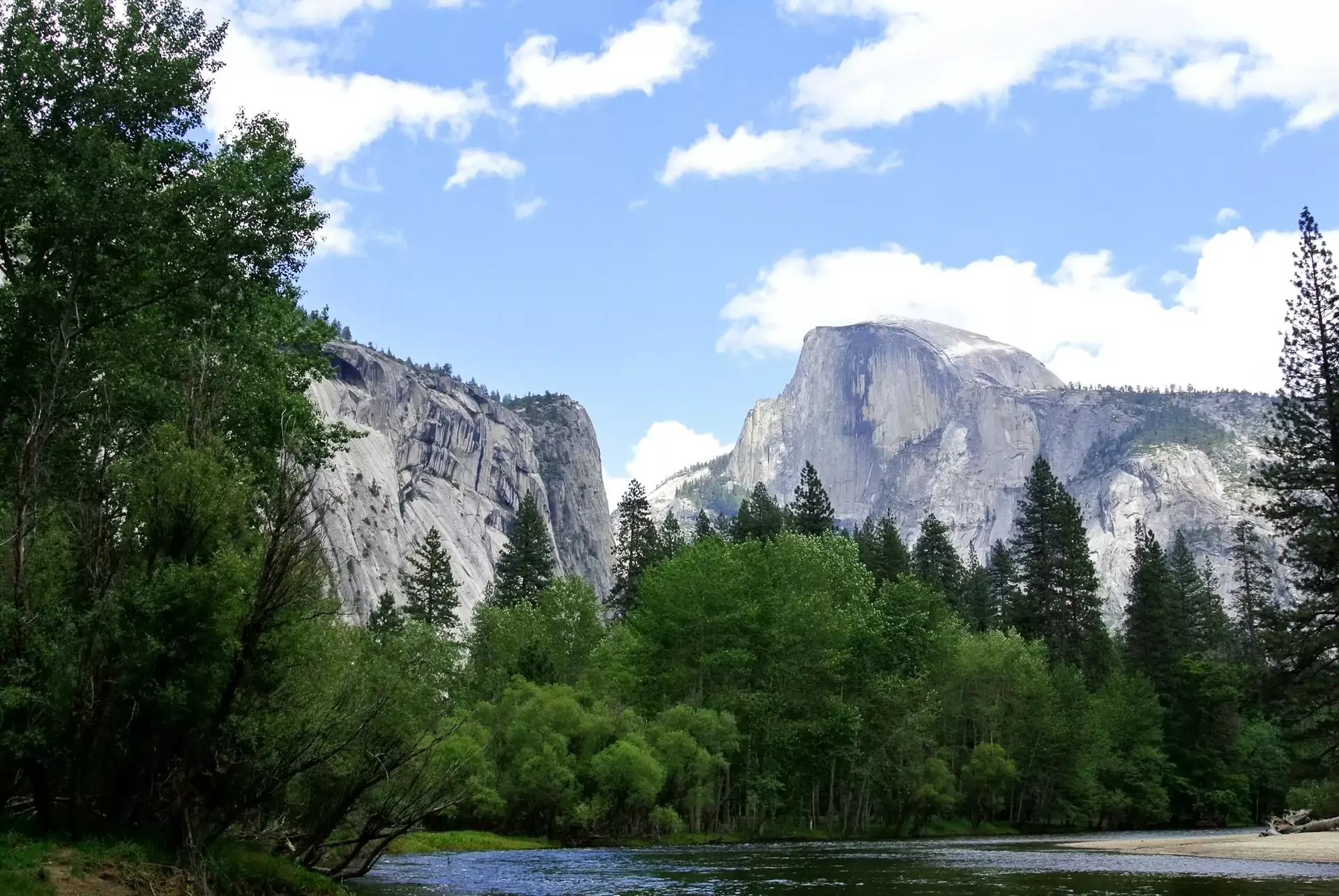
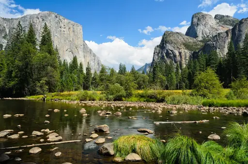
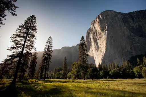
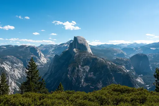
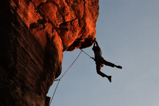
Half Dome rises 8,842 feet above California’s Sierra Nevada. Its granite face draws climbers from around the world who tackle steep trails and cables to reach the summit view. The park provides wide valleys, waterfalls and dense forests below. Visitors can camp or stay in nearby towns while enjoying crisp mountain air and clear night skies. Weather changes quickly here so pack layers and check conditions before heading out. Half Dome stands as a striking landmark for those who value outdoor adventure and natural beauty.

Peak in United States
Climate zone: Mediterranean

Mediterranean: Mediterranean-type climates with warm, dry summers and cool, wet winters, often at higher elevations or coastal latitudes.

See climate table
Ticket price: free
$Cheap
$$Medium
$$$Expensive, upscale
$$$+Very expensive, luxury
Safety: 6.0
General Safety:7
Accessibility:2
Read details
Tourist English: 5/5
English is widely spoken among park staff and visitors, making communication straightforward across Yosemite National Park.
Last update: 12 Oct 2026
* We earn a commission from some links on this page.
Half Dome Summary
Iconic for challenging summit hikes. Trek steep mountain trails, climb the famous cables route and enjoy panoramic Yosemite views.
Public website: www.nps.gov
United States – Quick facts
Power Grid: 120 V, 60 Hz
Plug: Type A , Type B
Type A:
Diagram of a Type A power plug
Type B:
Diagram of a Type B power plug

Read about power adapters
Currency: US Dollar (USD)
£1 ≈ US$1.33
Cashless info: Rating 5/5
The U.S. is highly cashless, with credit and debit cards accepted almost everywhere. Mobile payment options like Apple Pay and Google Pay are widely used.

Save with a travel credit card
eSIM providers: Best value: Saily
Flexibility: Airalo
Read our in-depth comparison
Tipping: Tipping is customary and expected in the U.S. In restaurants, 15-20% is standard. Taxi drivers, hotel staff, and tour guides also expect tips, usually around 10-20% depending on the service.
Public drinking: Public drinking laws vary by state, but it is generally prohibited in public spaces without a permit.
Public smoking: Smoking is restricted in most indoor public spaces and some outdoor areas. Local laws vary.
Etiquette: Greet with a firm handshake, maintain eye contact, respect personal space, and avoid discussing politics or income unless invited to share opinions. Politeness and friendliness are appreciated.
Thanksgiving
(November)
A major holiday with closures and domestic travel surges.
Independence Day
(July)
Expect parades, fireworks, and celebrations nationwide.
Christmas
(December)
Markets, festive events, and crowded tourist spots.
Emergency contact: Emergency Number: 911 (Police, Fire, Ambulance)
Taxi apps: Uber, Lyft, Bolt
Helpful links: Wikipedia
Visa regulations
Customs & border control
Travel with medicine
Other: The U.S. is known for its diverse landscapes, cultural experiences, and regional cuisines. Public transport is efficient in cities but less so in rural areas. Renting a car is recommended for exploring national parks.
Best times to travel

The best times to travel section shows how the months compare for a visit, so you can find the time of year that fits what you want to do.

Background colours of the months:
The colour shows the typical temperature: yellow (hot), green (mild) and blue (cold). How strong the colour is shows the travel season: full colour means high season, soft colour means shoulder season and soft-striped means off season.

Weather symbols:
Each month has one symbol showing what the weather is typically like, such as hot and sunny, freezing or a rainy or snowy season. Use them to quickly spot months that match the weather you want, or to avoid the ones that don't.

Crowdedness:
The people icon shows how busy the place usually is. The more people, the more crowded it gets.

Additional notes:
The grey info boxes point out special things worth knowing, like recurring weather issues or seasonal events.

for Half Dome, United States
🌨️
Jan
🌨️
Feb
🌨️
Mar
☀️
Apr
☀️
May
☀️
Jun
🔥
Jul
🔥
Aug
🔥
Sep
☀️
Oct
☀️
Nov
🌨️
Dec
High season: June - Sep.
Shoulder season: May, Oct.
Tap on a month for more info Hover over a month for more info
Cables are up roughly late May to mid October, weather permitting; a permit is required
Permits for the cables are allocated by preseason lottery, with few daily permits
Thunderstorms can make the summit dangerous, so descend if clouds build

Half Dome is a striking granite monolith rising approximately 8,800 feet above sea level, characteristically shaped like a dome cut in half. This geological marvel has formed over millions of years through glacial erosion and rock exfoliation. It’s one of Yosemite’s most recognizable landmarks and a bucket-list destination for hikers and rock climbers.

The hike to the summit is strenuous and demanding, covering 14 to 16 miles round trip with about 4,800 feet of elevation gain. The last 400 feet involve ascending via metal cables fixed on the steep rock face, which requires strength, balance and caution. Permits are required to hike beyond the subdome and the cables are typically installed from late May through mid-October.

While the climb offers breathtaking views of Yosemite Valley, Glacier Point and the High Sierra, it’s not without risks. Hikers must be prepared for changing weather, heat, exhaustion and the physical demands of the final cable ascent. Injuries and rescue operations occur annually, often related to unpreparedness or risky behaviors on the cables. It’s advised to start early, bring enough water, wear gloves and sturdy shoes and respect turnaround times to ensure safety.

Despite these challenges, conquering Half Dome remains a deeply rewarding experience, offering a unique perspective on one of America’s most treasured natural landscapes.

Why travel to Half Dome?

🏯Places worth seeing
  • 1 Glacier Point
  • 2 Tunnel View
  • 3 Yosemite Valley
🎡Places for activities
  • 1 Mist Trail
  • 2 John Muir Trail
🏞️Natural landmarks
  • 1 Four Mile Trail
  • 2 Liberty Cap

Knowledge before you go

  • Secure permit early. Required for cables section.
  • Train for 14-16 mile hike with 4800ft elevation; cables demand upper body strength and nerve.
  • Start at dawn from Happy Isles via Mist Trail; waterfalls make first miles wet and slippery.
  • Wear gloves for cables; avoid thunder storms when slick granite turns deadly fast on descent.

How to travel to Half Dome

Half Dome is located within Yosemite National Park in California. The main gateway airports are Fresno Yosemite International Airport, San Francisco International Airport and Sacramento International Airport. From there, visitors typically drive to the park, with Yosemite Valley serving as the main base for Half Dome hikes. Yosemite National Park is accessible via US highways and well-marked park roads. Shuttle services operate seasonally within the park, but a car rental or tour is usually the most convenient way to get around.

Access summary

  • From Fresno Yosemite (FAT): Drive or seasonal YARTS bus, about 2–2.5 hours.
  • From Merced: Drive or YARTS bus via Highway 140 to Yosemite Valley, around 2 hours.
  • From San Francisco Bay Area: Drive via 120 or 140 to Yosemite Valley, typically 4–5 hours.

Where to stay near Half Dome

Most visitors stay in Yosemite Valley, which offers a range of accommodations from rustic campgrounds and hostels to lodges and hotels. Reservations are strongly recommended during peak season due to high demand.

Hotel recommendations

*by rating and popularity. Commissions have no influence on the rankings.
We couldn't find any nearby hotels for now.
Budget snapshot
Costs compared to home

We calculate the average costs when travelling to destinations and compare those with the living costs at your home. With this you can get an estimate of how expensive or cheap the destination is for you.

To customise this, you can set up which location and price level are used for the calculations in your account settings.

+5 %
Daily expenses in the region are around 5% higher than the average across United States. That means you'll spend around the same on meals and getting around.
Exchange rate trend

The exchange rate price factor shows how expensive or cheap a currency currently is compared to its historical average. It's a quick way to see if a country is currently more or less affordable due to exchange rate changes.

-4 %
Your exchange rate (GBP to USD) is 4% better than in recent years. That means travelling now costs around the same compared to the past.

Safety information overview

General safety
7
Yosemite’s Half Dome is generally safe for experienced hikers, but risks include altitude sickness, sudden weather changes and steep cliffs. Follow official trail guidelines, carry proper gear, stay on marked paths and check daily conditions to minimize accidents.
Accessi­bility
2
Half‑Dome’s accessibility is limited: no wheelchair‑friendly routes, steep granite walls and a closed trail during winter. The park offers accessible visitor centers and some paved paths nearby, but the peak itself remains challenging for mobility‑restricted hikers.

Looking for inspiration?

Discover
Best photography destinations in North America
Narrow desert canyons in the American Southwest create light patterns that have become some of the most recognisable images in landscape photography, while glacial lakes further…
Read more
Discover
Top photography destinations and scenic landscapes
A genuinely photogenic destination offers more than one good shot: it has the light, the composition and enough variety of conditions to reward repeat visits at different times of…
Read more
Discover
Top hiking destinations and famous trails
Hiking at its best is one of the most direct ways to engage with a landscape. The pace forces a relationship with terrain, weather and distance that faster forms of travel rarely…
Read more
Discover
Best hiking destinations in North America
North America's hiking offer is defined by scale and wilderness, with trails passing through landscapes that dwarf anything found in more densely populated regions. From arctic…
Read more
Discover
Best mountain destinations in North America
North America's mountain landscapes range from the arctic ranges of Alaska and the Yukon and the dramatic peaks of the Rockies to the volcanic summits of the Pacific northwest and…
Read more
Discover
Top mountain destinations and famous peaks
Mountain travel spans an enormous range of experience, from high-altitude expeditions and multi-day trekking circuits to accessible alpine day walks and scenic drives through…
Read more
Discover
Top rock climbing destinations and bouldering spots
Climbing means something different to almost everyone who does it and the best climbing destinations reflect that, since no single place suits every style or skill level. Some…
Read more
Discover
Best climbing destinations in North America
North America is where modern climbing really came into its own, and the continent still offers an enormous range, from desert towers to alpine granite that draws climbers from all…
Read more
Discover
Most beautiful beaches and coastal escapes
For a lot of people, a beach is the whole point of a holiday, but what makes a beach day perfect really depends on personal taste. Some travellers want isolation and the feeling…
Read more
Discover
Stunning national parks and wilderness areas
National parks exist because someone decided that certain landscapes were too important to lose. The best of them protect ecosystems, wildlife and natural processes that would…
Read more
Discover
Intimate escapes and romantic getaways
The most memorable trips for couples tend to have less to do with luxury and more to do with the quality of shared experience. A place that slows you down, removes the usual…
Read more
Was this page helpful?
Feedback