

North America › United States › California › Big Sur

Big Sur

Scroll
Coastal cliffs and luminous sunsets

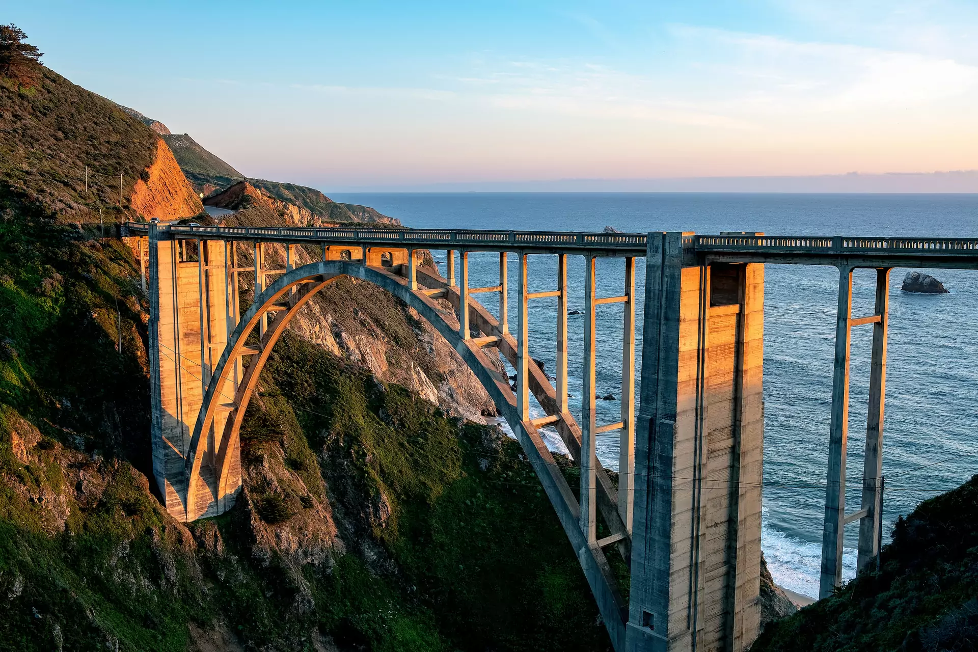
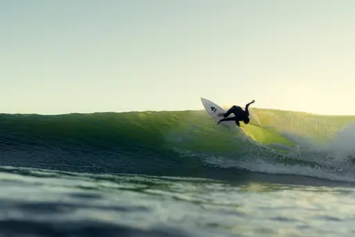
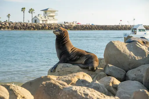
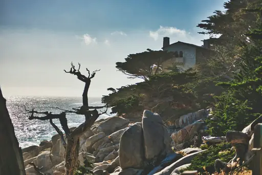
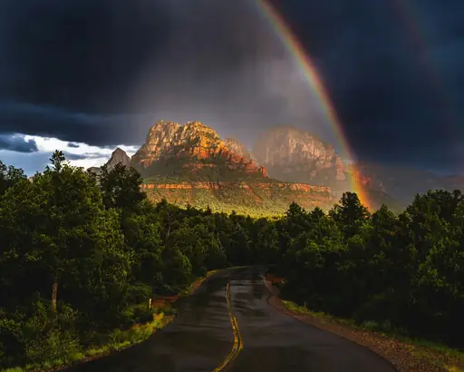
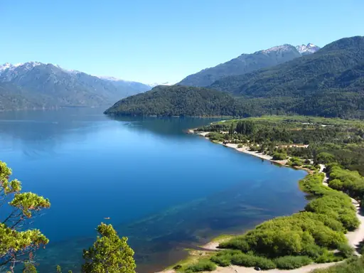
Big Sur stretches along California’s central coastline, where steep cliffs drop toward the Pacific Ocean and dense forests meet rocky shores. The area is known for dramatic views, including Bixby Creek Bridge and McWay Falls. Trails wind through redwood groves while small towns provide simple lodging and local food. Weather stays mild most of the year, making it easy to explore beaches, tide pools and scenic overlooks. Visitors often notice clear skies, ocean breezes and a quiet atmosphere that feels far from crowded cities.

Region in United States
Climate zone: Mediterranean

Mediterranean: Mediterranean-type climates with warm, dry summers and cool, wet winters, often at higher elevations or coastal latitudes.

See climate table
Price level: $$$+
$Cheap
$$Medium
$$$Expensive, upscale
$$$+Very expensive, luxury
See price details
Safety: 7.3
General Safety:9
Health & medical:5
Accessibility:3
Tap water:7
Read details
Tourist English: 4/5
English is widely spoken in Big Sur, especially among locals and service staff. Most residents use clear, friendly English, making it easy for tourists to ask directions, order food or book accommodations.
Last update: 12 Oct 2026
* We earn a commission from some links on this page.
Big Sur Summary

These place ratings give you a quick overview of how well a destination matches different types of trips.

‘Best for’ scores:
The specific interest scores show where this place really shines – whether it's ideal for hiking, food & drink experiences, museums or other activities. These highlights help you understand what makes the destination special at a glance.

‘Your personal’ scores:
This reflects how well a place matches your personal preferences. You can adjust the importances of travel topics or other personal requirements categories in your account settings.

‘Suited for’ badges:
These give you a quick overview of how well a destination suits specific types of travellers, to help you find the places that match your lifestyle, preferences or travel situation.

Read how our scores work
Great at dramatic coastlines and towering redwoods. Visitors enjoy sunrise hikes along cliffs, tasting local artisanal cheeses and exploring hidden tide pools in the rugged shoreline.
Place score
9.0
Best at:
Natural sites
10
Sea
9
Motorcycling
9
Luxury
8
Spotless
8
Personal score
?
Log in to see how this place matches your personal travel interests.
Suited for
👶 4
Families
🧓 3
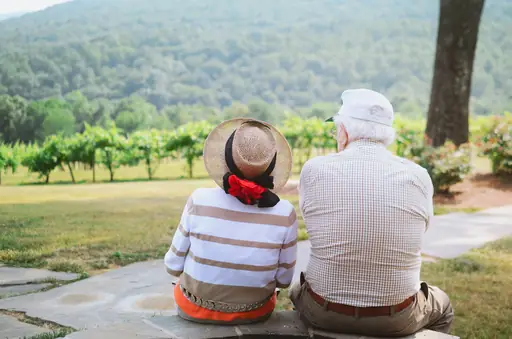
Seniors
❤️ 9
Couples
🌈 7
LGBTQ+
United States – Quick facts
Power Grid: 120 V, 60 Hz
Plug: Type A , Type B
Type A:
Diagram of a Type A power plug
Type B:
Diagram of a Type B power plug

Read about power adapters
Currency: US Dollar (USD)
£1 ≈ US$1.33
Cashless info: Rating 5/5
The U.S. is highly cashless, with credit and debit cards accepted almost everywhere. Mobile payment options like Apple Pay and Google Pay are widely used.

Save with a travel credit card
eSIM providers: Best value: Saily
Flexibility: Airalo
Read our in-depth comparison
Tipping: Tipping is customary and expected in the U.S. In restaurants, 15-20% is standard. Taxi drivers, hotel staff, and tour guides also expect tips, usually around 10-20% depending on the service.
Public drinking: Public drinking laws vary by state, but it is generally prohibited in public spaces without a permit.
Public smoking: Smoking is restricted in most indoor public spaces and some outdoor areas. Local laws vary.
Etiquette: Greet with a firm handshake, maintain eye contact, respect personal space, and avoid discussing politics or income unless invited to share opinions. Politeness and friendliness are appreciated.
Thanksgiving
(November)
A major holiday with closures and domestic travel surges.
Independence Day
(July)
Expect parades, fireworks, and celebrations nationwide.
Christmas
(December)
Markets, festive events, and crowded tourist spots.
Emergency contact: Emergency Number: 911 (Police, Fire, Ambulance)
Taxi apps: Uber, Lyft, Bolt
Helpful links: Wikipedia
Visa regulations
Customs & border control
Travel with medicine
Other: The U.S. is known for its diverse landscapes, cultural experiences, and regional cuisines. Public transport is efficient in cities but less so in rural areas. Renting a car is recommended for exploring national parks.
Best times to travel

The best times to travel section shows how the months compare for a visit, so you can find the time of year that fits what you want to do.

Background colours of the months:
The colour shows the typical temperature: yellow (hot), green (mild) and blue (cold). How strong the colour is shows the travel season: full colour means high season, soft colour means shoulder season and soft-striped means off season.

Weather symbols:
Each month has one symbol showing what the weather is typically like, such as hot and sunny, freezing or a rainy or snowy season. Use them to quickly spot months that match the weather you want, or to avoid the ones that don't.

Crowdedness:
The people icon shows how busy the place usually is. The more people, the more crowded it gets.

Additional notes:
The grey info boxes point out special things worth knowing, like recurring weather issues or seasonal events.

for Big Sur, United States
☀️
Jan
☀️
Feb
☀️
Mar
☀️
Apr
☀️
May
☀️
Jun
☀️
Jul
☀️
Aug
☀️
Sep
☀️
Oct
☀️
Nov
☀️
Dec
High season: May - Oct.
Shoulder season: March - April, Nov.
Crowdedness: 7 (Many tourists)
Tap on a month for more info Hover over a month for more info
Highway 1 is often closed by landslides and storm damage in winter, check road status before driving
Wildfire season late summer to autumn can close trails, campsites and sections of the highway
Grey whale migration December to April, humpbacks and blue whales from late spring to autumn

Why travel to Big Sur?

Big Sur offers a compelling blend of natural beauty, cultural richness and outdoor adventure that appeals to travelers seeking both relaxation and exploration. The dramatic coastline, where towering cliffs meet the Pacific Ocean, provides iconic vistas such as Bixby Bridge and McWay Falls – ideal for photography, hiking or simply watching sunsets. Trails like the Pacific Coast Trail and Garrapata State Park allow visitors to experience rugged scenery while staying active. Beyond its scenic allure, Big Sur hosts a vibrant arts scene. Local galleries showcase works inspired by the landscape and seasonal festivals celebrate regional cuisine and music. The area’s culinary offerings range from farm‑to‑table restaurants featuring fresh, locally sourced ingredients to casual beachside cafés serving fresh seafood. For those interested in history, nearby Hearst Castle offers insight into early 20th‑century California opulence, while the historic town of Carmel‑by‑the-Sea provides charming shops and a relaxed atmosphere. The region’s climate – mild summers and cool, foggy mornings – creates comfortable conditions for year‑round visits. Whether you’re looking to unwind on pristine beaches, hike along cliffside trails or immerse yourself in local culture, Big Sur delivers an authentic California experience that balances natural wonder with thoughtful hospitality.

🏯Places worth seeing
  • 1 Garrapata State Park
  • 2 Julia Pfeiffer Burns State Park
  • 3 Pfeiffer Beach
  • 4 Andrew Molera State Park
  • 5 Point Lobos State Natural Reserve
  • 6 Bixby Creek Bridge
  • 7 Big Sur River
  • 8 McWay Falls
🏞️Natural landmarks
  • 1 Bixby Creek Bridge
  • 2 McWay Falls

Knowledge before you go

  • Pack layered clothing; coastal fog makes temperatures unpredictable.
  • Reserve a campsite early, as Big Sur’s popular campgrounds fill up during peak season and require permits for certain sites.
  • Use the scenic Highway 1 only in daylight to avoid nighttime traffic jams caused by frequent road closures from landslides or maintenance work.
  • Explore lesser-known trails like McWay Falls Loop, which offers dramatic ocean views without the crowds of popular viewpoints.

How to travel to Big Sur

Big Sur is accessible primarily by road via California State Route 1, which stretches along the Pacific coastline and connects major cities such as San Francisco to Los Angeles. The drive from San Francisco takes approximately 2.5–3 hours through scenic routes like Highway 1, with numerous pullouts for views of the ocean and cliffs. Major airports nearby include Monterey Regional Airport (MRY) and San Jose International Airport (SJC), both within a 90‑minute drive. Public transportation options are limited; however, guided tours and shuttle services operate seasonally. The region is car‑dependent due to its rural nature and lack of direct public transit links to remote areas.

Access summary

  • From San Francisco International (SFO): 30‑min drive to Big Sur via Highway 1.
  • From Los Angeles (LAX): 4‑hour drive via US‑101/Highway 1.
  • By ferry from Monterey: 45‑minute ride to Big Sur.

Where to stay in Big Sur

Big Sur offers a mix of rustic cabins, beachfront cottages and upscale lodges that cater to travelers seeking solitude or luxury. Prices range from modest US$150 – 250 (£112.73 – 187.88) per night for basic cabin rentals to US$400 – 600 (£300.61 – 450.92) for premium oceanfront suites with panoramic views. Many accommodations emphasize eco‑friendly design, using reclaimed wood and solar panels, reflecting the region’s commitment to sustainability. The area is renowned for its “treehouse” style lodging, where guests can sleep among the redwoods while enjoying guided hikes. For those preferring a more traditional stay, there are boutique inns with locally sourced cuisine and complimentary surf lessons and sunset views daily.

Hotel recommendations

*by rating and popularity. Commissions have no influence on the rankings.
We couldn't find any nearby hotels for now.

How to get around Big Sur

Big Sur offers scenic drives along Highway 1, winding through rugged coastal cliffs and redwood forests. The most popular method is by car, with rental vehicles available at Monterey Regional Airport or major cities like San Francisco. Public transportation options are limited; however, seasonal shuttle services connect nearby towns to the highway. Biking is feasible on certain flat stretches but not recommended along the winding coastal roads. Walking trails exist inland from Highway 1, though oceanfront paths may be closed during storms. Parking is available at designated viewpoints for photo stops. Car rentals with GPS are advised due to limited cell service in remote areas. Plan fuel stops as services are sparse between Carmel and San Simeon.
Budget snapshot
Costs compared to home

We calculate the average costs when travelling to destinations and compare those with the living costs at your home. With this you can get an estimate of how expensive or cheap the destination is for you.

To customise this, you can set up which location and price level are used for the calculations in your account settings.

+3 %
Daily expenses in the region are around 3% higher than the average across United States. That means you'll spend around the same on meals and getting around.
Exchange rate trend

The exchange rate price factor shows how expensive or cheap a currency currently is compared to its historical average. It's a quick way to see if a country is currently more or less affordable due to exchange rate changes.

-4 %
Your exchange rate (GBP to USD) is 4% better than in recent years. That means travelling now costs around the same compared to the past.

Travel costs (Data for Soledad, United States - 44 km away)

To help you plan your trip, we provide estimated daily costs per person (when travelling as a pair) for different travel styles. These numbers give you an idea of what you might spend each day at this destination, including accommodation, food, transport and activities.

Additionally, we also provide average hotel costs for different travel styles to give you an estimate for the accommodation only.

Please note that these are only estimates. The real costs depend on booking times, season and other factors.

Daily cost summary

Travel style categories explained:

Backpacker:
Staying in hostels or budget hotels, cooking your own meals or eating cheap and choosing low-cost activities.

Mid-range:
Staying in mid-range hotels, eating at a mix of restaurants and casual spots and enjoying a variety of activities.

Luxury:
Staying in luxury hotels, dining out at high-end restaurants and enjoying premium experiences without worrying about the price.

Backpacker Mid-range Luxury
💵 Total costs per day, including accommodation
£70
£147
£386
🏨 Accommodation per night, per person
£30
£64
£139
🍝 Food per day
£33
£75
£215
🚕 Transportation per day
£8
£8
£31
Food & Drink
🍽️ Restaurant Dinner, per person
£29
🍛 Lunch Set, per person
£15
🍟 Fast food combo
£9
🍝 Preparing your own food, per day
£12
☕ Cappuccino
£3.90
🍺 Beer in a restaurant, 0.5 l
£5
Transportation
🚌 Public transport ticket
£1.90
🚕 Taxi Ride, 10 km / 6 mi
£18
⛽ Petrol, 1 l
£0.85
Other
🎞️ Cinema ticket
£11
👩‍⚕️ Doctor's consult
£90
🤧 Cold medication
£7.50
💇 Basic haircut
£17

Safety information overview

General safety
9
Big Sur, California, remains generally safe for travelers. Low crime rates and well‑maintained roads characterize the area, though visitors should stay alert in tourist hotspots and avoid isolated coastal paths after dark. Follow standard precautions: keep valuables secure and heed local advisories.
Health & Medical
5
Big Sur offers excellent medical care with nearby hospitals and urgent‑care centers, high standards of hygiene and a low pollution level thanks to coastal breezes. Travelers should stay hydrated, use sunscreen, avoid wildfires smoke and keep up-to-date vaccinations for common travel illnesses.
Accessi­bility
3
Big Sur offers stunning coastal views, but accessibility can be challenging. Many trails and viewpoints are steep or unpaved, limiting wheelchair use. Parking is limited and public transport is sparse. However, some visitor centers provide ramps and a few scenic overlooks have accessible paths.
Tap water
7
Tap water in Big Sur, California, is generally safe and well‑treated, meeting U.S. EPA standards. Local municipalities provide free public fountains and refill stations along the coast, making hydration convenient for residents and visitors alike.

Looking for inspiration?

Discover
Top digital nomad destinations and remote work hubs in North America
North America gives remote workers a strong mix of reliable infrastructure and genuine variety, from busy coastal cities to small mountain towns. Some remote workers want a big…
Read more
Discover
Best travel destinations for food allergies
Travelling with a food allergy adds a layer of planning most people never have to think about and the right destination can make that planning a lot easier. Some travellers…
Read more
Discover
Best couple vacation destinations in North America
North America might not trade on romance the way some continents do, but couples who look past the clichés will find an almost unfair amount of variety waiting for them here.…
Read more
Discover
Best destinations for first-time travelers in North America
North America offers a comfortable starting point for many first-time travelers, particularly those already familiar with English speaking countries. The United States and…
Read more
Discover
Best travel destinations for seniors in North America
North America offers older travelers a strong mix of accessible infrastructure and destinations built specifically with comfort in mind. National parks across the continent have…
Read more
Discover
Top digital nomad destinations and remote work hubs in 2026
Working from anywhere in the world sounds simple until you actually try it and the best digital nomad destinations look different depending on what kind of remote worker you are.…
Read more
Discover
Best couple holiday destinations
Travelling as a couple sounds simple enough, yet the best couple holiday destinations mean something different to almost every pair. What feels romantic to one couple can feel like…
Read more
Discover
Best running destinations in North America
One major race remains the only major marathon requiring a qualifying time for most entrants, giving it a status unlike any other race on the continent. A larger city's marathon,…
Read more
Discover
Top running destinations and marathon routes
The world's best running destinations combine a genuinely good route with the kind of organisation, including closed roads, crowd support and logistics, that turns a long run into…
Read more
Discover
Best destinations for first-time travellers
A first trip abroad works best somewhere that eases you in, rather than throwing every possible culture shock and logistical headache at you at once. Some first-time travellers…
Read more
Discover
Best spiritual destinations in North America
North America has a long history of places that people see as special, from ancient pyramids to red rock canyons that seem to invite a bit of quiet reflection. Sedona in Arizona…
Read more
Discover
Best travel destinations for food allergies in North America
Food allergy awareness runs fairly high across North America, backed by laws that require major allergens to be listed clearly on packaged food. The United States and Canada…
Read more
Discover
Best travel destinations for seniors
Senior travel covers a wide range, from slow, low effort trips built around comfort to more independent trips for travellers who still want to cover plenty of ground. Some…
Read more
Discover
Most beautiful beaches and coastal escapes
For a lot of people, a beach is the whole point of a holiday, but what makes a beach day perfect really depends on personal taste. Some travellers want isolation and the feeling…
Read more
Discover
Stunning national parks and wilderness areas
National parks exist because someone decided that certain landscapes were too important to lose. The best of them protect ecosystems, wildlife and natural processes that would…
Read more
Was this page helpful?
Feedback