



Was this page helpful?

| Opening hours: |
|
||
|---|---|---|---|
| Public website: | explorandocenotes.com.mx |
| Power Grid: |
127 V, 60 Hz Plug: Type A , Type B
Type A:
  Read about power adapters |
|---|---|
| Currency: |
Mexican Peso (MXN) £1 ≈ MX$24.84 |
| Cashless info: |
Rating 4/5
Cashless payments are becoming more common in urban areas. Major cities like Mexico City and Guadalajara accept credit cards and mobile payments, but cash is still the preferred payment method in many places.
Save with a travel credit card |
| eSIM providers: |
Best value: Saily Flexibility: Airalo Read our in-depth comparison |
| Tipping: | Tipping is customary in Mexico. In restaurants, leave 10-15% for good service. Taxi fares should be rounded up. Small tips are appreciated by hotel staff and service workers. |
|---|---|
| Public drinking: | Public drinking is not allowed in most areas, though it is permitted in some tourist zones and beaches. Be cautious about local laws regarding alcohol consumption in public spaces. |
| Public smoking: | Smoking is allowed in designated areas in public spaces, but most indoor places such as restaurants and shops have non-smoking policies. |
| Independence Day (16 September) |
Major national celebration with parades and festivities |
|---|---|
| Day of the Dead (1–2 November) |
Traditional celebrations honouring deceased loved ones |
| Emergency contact: | Emergency Number: 911 (Police, Fire, Ambulance) |
|---|---|
| Taxi apps: | Uber, Didi, Cabify |
| Other: | Mexico offers rich cultural experiences, beautiful beaches, and diverse landscapes. Travellers should take standard safety precautions and be mindful of their surroundings. |
The best times to travel section shows how the months compare for a visit, so you can find the time of year that fits what you want to do.
Background colours of the months:
The colour shows the typical temperature: yellow (hot), green (mild) and blue (cold). How strong the colour is shows the travel season: full colour means high season, soft colour means shoulder season and soft-striped means off season.
Weather symbols:
Each month has one symbol showing what the weather is typically like, such as hot and sunny, freezing or a rainy or snowy season. Use them to quickly spot months that match the weather you want, or to avoid the ones that don't.
Crowdedness:
The people icon shows how busy the place usually is. The more people, the more crowded it gets.
Additional notes:
The grey info boxes point out special things worth knowing, like recurring weather issues or seasonal events.
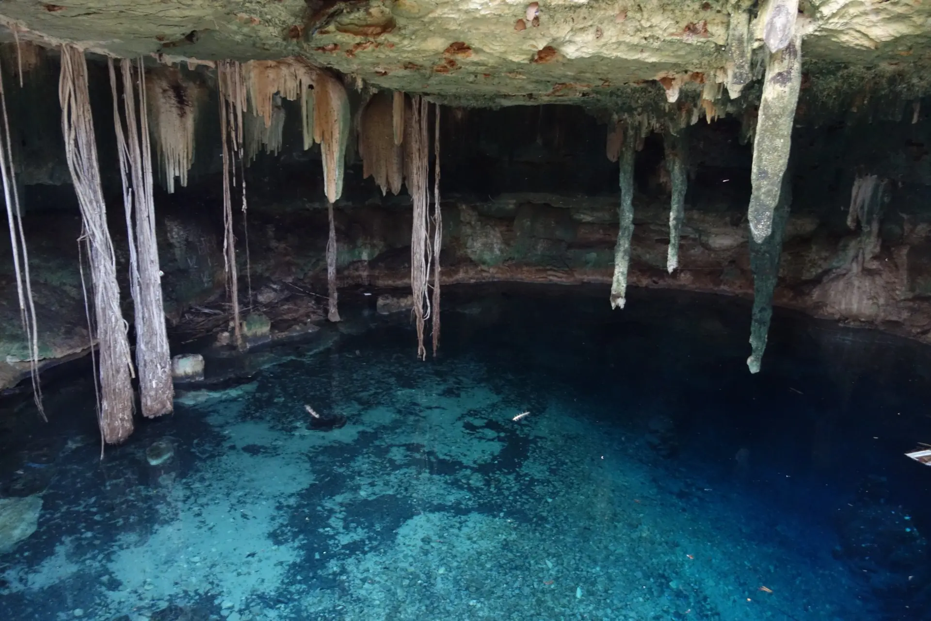
Cenote Kankirixche is a natural swimming hole located in Mexico’s Yucatán Peninsula. This underground pool formed by limestone bedrock provides clear water that stays cool year round. Visitors can jump from low stone edges or float gently on the surface. The site sits near small villages where local families run simple cafes serving fresh fruit and traditional meals.
The cenote’s opening is wide enough for sunlight to reach deep inside. Stalactites hang like slow drips from the ceiling while stalagmites rise from the bottom. Some parts of the pool are shallow enough for children to wade in safely. The water feels smooth and clean even after rain because limestone filters it naturally.
Nearby trails lead to other small cenotes that look similar but feel quieter. Guides often share stories about how ancient communities used these pools for rituals and daily life. You might see birds resting on low branches or spot tiny fish darting near the surface. The air around the water smells faintly of earth and fresh herbs from nearby plants.
Travelers should bring reef-safe sunscreen and a reusable bottle to stay hydrated. Swimming shoes protect feet from sharp rocks along the edge. Many people visit early in the morning when temperatures are milder and crowds are smaller. Respecting local rules helps keep this place clean for future visitors.
Cenote Kankirixche is located in the Yucatán Peninsula, Mexico, within a protected natural area near Tulum. The site is accessible by road via Highway 180D, which connects major cities like Cancún and Playa del Carmen to the interior regions of Quintana Roo. Public transportation options include buses from Tulum or Cancún, with shared vans (colectivos) also available for shorter trips. Private vehicles can reach the cenote directly via well-maintained roads, though some areas may require a short walk through trails. The site is near other attractions like Cenote Dos Ojos and Sisal Beach, making it part of a broader network of eco‑tourism destinations in the region.
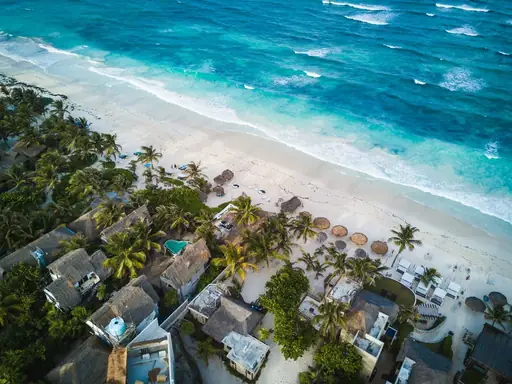
In the vicinity of Cenote Kankirixche, lodging ranges from rustic eco‑villages to boutique inns that emphasize sustainability and local culture. Many guesthouses offer modest rooms with shared bathrooms, typically priced between MX$600 – 1,200 (£24.02 – 48.04) per night, while higher‑end boutique hotels provide private suites, rooftop terraces and organic breakfast options for MX$1,600 – 2,400 (£64.06 – 96.09). The area is renowned for its “casa de huéspedes” style accommodations – simple, family‑run homes that give travelers an authentic Yucatecan experience. For those seeking a more luxurious stay, several eco‑resorts feature plunge pools overlooking cenotes, yoga studios and guided tours of nearby Mayan ruins. All options prioritize low environmental impact while delivering comfortable, culturally immersive stays.
Log in to add this place to a travel list and get a summary of all recommended items for your whole trip.
We calculate the average costs when travelling to destinations and compare those with the living costs at your home. With this you can get an estimate of how expensive or cheap the destination is for you.
To customise this, you can set up which location and price level are used for the calculations in your account settings.
The exchange rate price factor shows how expensive or cheap a currency currently is compared to its historical average. It's a quick way to see if a country is currently more or less affordable due to exchange rate changes.
