



Was this page helpful?

The best times to travel section shows how the months compare for a visit, so you can find the time of year that fits what you want to do.
Background colours of the months:
The colour shows the typical temperature: yellow (hot), green (mild) and blue (cold). How strong the colour is shows the travel season: full colour means high season, soft colour means shoulder season and soft-striped means off season.
Weather symbols:
Each month has one symbol showing what the weather is typically like, such as hot and sunny, freezing or a rainy or snowy season. Use them to quickly spot months that match the weather you want, or to avoid the ones that don't.
Crowdedness:
The people icon shows how busy the place usually is. The more people, the more crowded it gets.
Additional notes:
The grey info boxes point out special things worth knowing, like recurring weather issues or seasonal events.
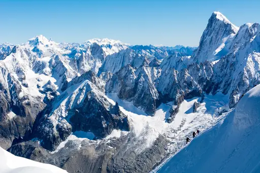
K2 stands as one of the highest peaks on Earth at 8,611 meters above sea level. Located in the Karakoram range along Pakistan’s northern border with China it draws climbers from around the world seeking a serious challenge. The mountain’s steep faces and unpredictable weather make every expedition demanding yet rewarding for those prepared to face its elements.
The landscape surrounding K2 is rugged and remote. Thick glaciers stretch across valleys while rocky ridges rise sharply above snowfields. In summer the region sees brief windows of stable conditions when winds ease and temperatures stay moderate enough for movement. Most visitors travel through base camps that serve as starting points before ascending into higher terrain where oxygen thins and cold intensifies.
Local communities in the area rely on seasonal work related to mountaineering activities. Guides porters and cooks play key roles supporting expeditions while sharing knowledge of trails and weather patterns passed down through generations. Visitors often notice how mountain life balances hard labor with moments of rest under wide open skies where silence feels constant.
Climbing K2 requires careful planning physical fitness and respect for natural forces. Routes vary but most involve technical ice climbing mixed with rock scrambling at high altitude. Success depends on teamwork clear communication and flexibility when conditions change quickly. Even after reaching the summit the descent demands focus because exhaustion combined with thin air can increase risk. The experience remains a test of endurance and humility for all who attempt it.
K2, located in the Karakoram range of Pakistan’s Gilgit-Baltistan region, is accessible primarily through the Skardu Valley. The nearest major town, Skardu, serves as the main gateway for trekkers and climbers aiming to reach Base Camp. From Skardu, travelers can drive or take a jeep along the scenic Karakoram Highway (KKH), which connects to the Baltoro Glacier region. Alternatively, flights from Islamabad or Lahore to Skardu offer faster access during favorable weather conditions. The journey involves navigating high-altitude roads with potential seasonal closures due to snowfall. Local guides and porters are often arranged in advance for expeditions to K2’s base camp or climbing routes.
Near the K2 region, accommodations range from modest guesthouses in Skardu and Gilgit to more upscale lodges that cater to trekkers and climbers. Most options are basic, offering simple rooms with shared bathrooms, but some newer establishments provide private cabins, hot showers and Wi‑Fi for a higher price point. The area is renowned for its rustic mountain hostels, where travelers can experience traditional hospitality and hearty local cuisine. Seasonal campsites along the base camp route offer tents or canvas shelters, often managed by experienced guides who also supply gear rentals. For those seeking comfort, boutique eco‑lodges with solar power and panoramic views are emerging, though they come at a premium compared to the standard guesthouses.
Log in to add this place to a travel list and get a summary of all recommended items for your whole trip.
We calculate the average costs when travelling to destinations and compare those with the living costs at your home. With this you can get an estimate of how expensive or cheap the destination is for you.
To customise this, you can set up which location and price level are used for the calculations in your account settings.
