




Was this page helpful?

| Power Grid: |
120 V, 60 Hz Plug: Type A , Type B
Type A:
  Read about power adapters |
|---|---|
| Currency: |
US Dollar (USD) £1 ≈ US$1.33 |
| Cashless info: |
Rating 5/5
The U.S. is highly cashless, with credit and debit cards accepted almost everywhere. Mobile payment options like Apple Pay and Google Pay are widely used.
Save with a travel credit card |
| eSIM providers: |
Best value: Saily Flexibility: Airalo Read our in-depth comparison |
| Tipping: | Tipping is customary and expected in the U.S. In restaurants, 15-20% is standard. Taxi drivers, hotel staff, and tour guides also expect tips, usually around 10-20% depending on the service. |
|---|---|
| Public drinking: | Public drinking laws vary by state, but it is generally prohibited in public spaces without a permit. |
| Public smoking: | Smoking is restricted in most indoor public spaces and some outdoor areas. Local laws vary. |
| Etiquette: | Greet with a firm handshake, maintain eye contact, respect personal space, and avoid discussing politics or income unless invited to share opinions. Politeness and friendliness are appreciated. |
| Thanksgiving (November) |
A major holiday with closures and domestic travel surges. |
|---|---|
| Independence Day (July) |
Expect parades, fireworks, and celebrations nationwide. |
| Christmas (December) |
Markets, festive events, and crowded tourist spots. |
| Emergency contact: | Emergency Number: 911 (Police, Fire, Ambulance) |
|---|---|
| Taxi apps: | Uber, Lyft, Bolt |
| Helpful links: |
Wikipedia Visa regulations Customs & border control Travel with medicine |
| Other: | The U.S. is known for its diverse landscapes, cultural experiences, and regional cuisines. Public transport is efficient in cities but less so in rural areas. Renting a car is recommended for exploring national parks. |
The best times to travel section shows how the months compare for a visit, so you can find the time of year that fits what you want to do.
Background colours of the months:
The colour shows the typical temperature: yellow (hot), green (mild) and blue (cold). How strong the colour is shows the travel season: full colour means high season, soft colour means shoulder season and soft-striped means off season.
Weather symbols:
Each month has one symbol showing what the weather is typically like, such as hot and sunny, freezing or a rainy or snowy season. Use them to quickly spot months that match the weather you want, or to avoid the ones that don't.
Crowdedness:
The people icon shows how busy the place usually is. The more people, the more crowded it gets.
Additional notes:
The grey info boxes point out special things worth knowing, like recurring weather issues or seasonal events.
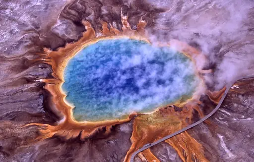
The Geysers in Nevada stands out as a unique geothermal field located north of the state’s central region. This area features clusters of hot springs and steam vents that have shaped both the landscape and local culture over time. Visitors encounter open fields dotted with metal pipes and concrete structures where boiling water shoots into the air at regular intervals.
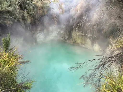
The primary attraction comes from the predictable eruptions of several major geysers. These natural spouts can reach impressive heights depending on underground pressure and temperature levels. The site functions as an active laboratory for scientists studying geothermal energy while also providing a striking visual display that draws photographers and curious travelers alike. Early morning visits often reveal mist rising above pools, creating soft light effects across the terrain.
Access to viewing areas follows marked paths designed to keep people safe from sudden steam bursts or hot water flows. Boardwalks guide guests along stable ground while interpretive signs explain how geothermal systems work beneath the surface. Educational programs occasionally run during peak seasons, allowing deeper insight into volcanic activity and sustainable energy potential.
Nearby towns such as Calistoga serve as bases for those wanting overnight stays or local dining options. The region’s economy relies partly on tourism but also benefits from research projects focused on renewable power generation. Seasonal changes influence visitor numbers; cooler months often bring clearer skies, making photography easier while still showcasing the raw energy that defines this part of Nevada.
The Geysers, located in Nevada, United States, is accessible primarily by road via Highway 128 and Highway 20. The nearest major city is Caliente, approximately 30 miles south, with regular shuttle services available during peak tourist seasons. Visitors can also reach the area using U.S. Route 50, which runs east-west through western Nevada. Rental cars are recommended for flexibility, as public transportation options within the region are limited. The site is situated near Highway 128, connecting it to the broader regional road network. Air travel requires flying into Reno-Tahoe International Airport or Fallon Regional Airport, followed by a drive of about two hours. No direct rail access exists; road transport remains the primary means for visitors.
In the remote high desert surrounding the Geysers, lodging options are sparse yet distinctive. Most visitors opt for rustic cabins or lodge-style accommodations that blend into the rugged landscape, offering panoramic views of the steaming vents and star‑filled skies. Budget travelers can find modest campgrounds with basic amenities, while mid‑range guests enjoy cabin rentals featuring wood‑fire pits and communal kitchens. Luxury seekers often head to boutique eco‑resorts a short drive away, where geothermal heating powers sustainably designed suites that echo the natural heat of the geysers. The area’s reputation for unique, nature‑immersive stays attracts those who value authenticity over opulence.
Log in to add this place to a travel list and get a summary of all recommended items for your whole trip.
We calculate the average costs when travelling to destinations and compare those with the living costs at your home. With this you can get an estimate of how expensive or cheap the destination is for you.
To customise this, you can set up which location and price level are used for the calculations in your account settings.
The exchange rate price factor shows how expensive or cheap a currency currently is compared to its historical average. It's a quick way to see if a country is currently more or less affordable due to exchange rate changes.
