Back to grid

Best motorcycle destinations in South America

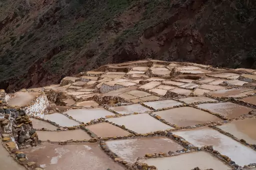
Sacred Valley
Ancient terraces echoing timeless Andean rhythms
8.3
The Urubamba River formed this valley, which Quechua speakers call Willkamayu, meaning sacred river. Its elevation drops from about 3,000 metres at Pisac to 2,050 metres below Machu Picchu. Pisac to Ollantaytambo covers about 60 kilometres. Inca ruins, terraces and the Moray site line the valley.
Highlights:
  • 🛍️ Stroll through Pisac market, shop woven textiles
  • 🗿 Explore Ollantaytambo ruins, climb fortress walls
  • 🏔️ Hike to Machu Picchu via the Inca Trail
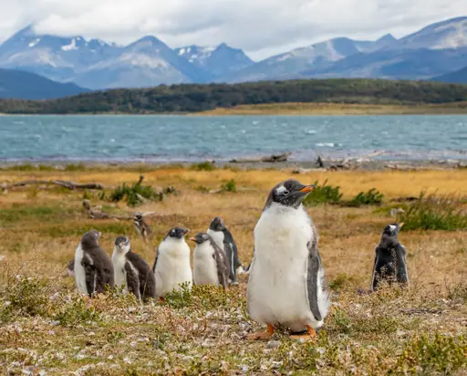
Ushuaia
End of the World Adventures
7.0
National Route 3 ends in Tierra del Fuego National Park, where it meets the southern terminus of the Pan-American Highway. The road crosses the Andes through Garibaldi Pass. Commodore Augusto Lasserre founded Ushuaia on October 12, 1884. The Beagle Channel bounds the city to the south.
Highlights:
  • 🥾 Hike to Laguna Esmeralda surrounded by snow-capped peaks
  • 🚂 Take the End of the World Train to Tierra del Fuego National Park
  • 🚢 Cruise through the Beagle Channel and spot sea lions
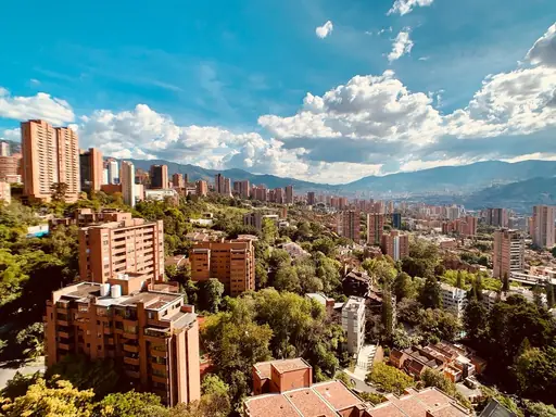
Medellín
The City of Eternal Spring
7.4
Seven hills surround the city, including El Volador, Nutibara and El Picacho. It lies at about 1,495 metres in the Aburrá Valley. Temperatures typically stay between 17 and 28 degrees Celsius with small variation through the year. That steady climate earned it the nickname City of the Eternal Spring.
Highlights:
  • 🌺 Stroll through the Botanical Garden and its orchid collection
  • 🎨 Explore Comuna 13’s colorful murals and vibrant street art
  • 🚡 Ride the Metrocable to Parque Arví for panoramic views
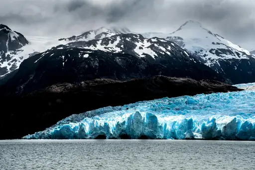
Patagonia
Untamed Beauty at the End of the World
8.3
National Route 40 runs 5,194 kilometres from Cabo Vírgenes to La Quiaca and crosses 11 provinces. Its stretch between Perito Moreno and Tres Lagos is described as the most remote part of the route. Los Glaciares National Park, the second largest in Argentina, lies close to the road.
Highlights:
  • 🐧 Explore the diverse wildlife on Peninsula Valdés
  • ❄️ Witness the massive Perito Moreno Glacier up close
  • 🥾 Hike the legendary trails of Torres del Paine National Park
Cusco
Gateway to the Incan Empire's Heart
8.4
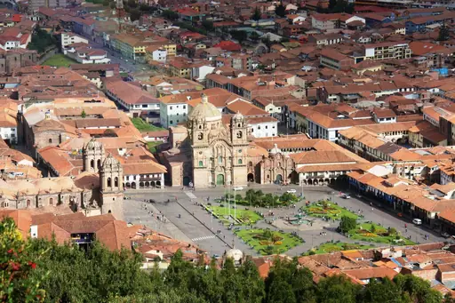
The Inca capital until 1532 stands at about 3,400 metres. Roads connect Cusco to Puerto Maldonado, Arequipa, Abancay, Juliaca and Puno. The walled fortress of Sacsayhuamán lies just outside town. Salcantay, the highest peak nearby, rises about 60 kilometres to the northwest. Cusco became a World Heritage Site in 1983.
Highlights:
  • 🏛️ Stroll through Plaza de Armas and admire colonial architecture
  • 🏔️ Take the train or trek to the awe-inspiring Machu Picchu
  • 🧱 Visit the ancient Inca site of Sacsayhuamán overlooking the city
Atacama Desert
Endless dunes under starlit desert skies
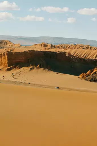
A strip about 1,600 kilometres long runs along northern Chile's Pacific coast. It is called the driest nonpolar desert in the world and covers roughly 105,000 square kilometres. San Pedro de Atacama stands at about 2,400 metres. About 80 geysers fill a valley roughly 80 kilometres from the town.
Highlights:
  • 🗻 Hike to El Tatio geysers before sunrise
  • ✨ Stargaze from San Pedro observatory, record constellations
  • 🌄 Explore Valle de la Luna during golden hour
Carretera Austral
Endless Patagonian horizons under starlit skies
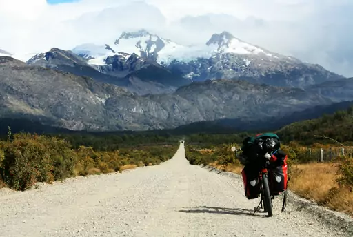
Work on Route 7 began in 1976 and the road opened to traffic in 1988. It runs about 1,240 kilometres from Puerto Montt to Villa O'Higgins. The full route requires three ferry crossings. The Hornopirén to Caleta Gonzalo crossing takes about five hours and tickets are bought in advance.
Highlights:
  • 🏙️ Explore Valdivia's historic port and night markets
  • 🥾 Hike to the turquoise waters of Cueva del Milodón
  • 🚗 Drive the scenic Carretera Austral to coastal villages
Feedback