We use cookies and external services: MapTiler for interactive maps and Google Maps to show route duration/distance. Both may process personal data such as your IP address, including transfers outside the EU/EEA. See our privacy policy for details. By clicking ‘Accept all’, you consent to this.
Victoria Falls has a subtropical climate with three main seasons: a hot, rainy summer, a dry, mild winter, and a warm, dry spring. Summer highs reach 32–34°C, while winter lows can dip to 6–8°C. Rain falls mainly from November to March, while sunshine is abundant in the dry season. Each season brings dramatic changes to the falls and surrounding landscapes.
The best times to travel section shows how the months compare for a visit, so you can find the time of year that fits what you want to do.
Background colours of the months:
The colour shows the typical temperature: yellow (hot), green (mild) and blue (cold). How strong the colour is shows the travel season: full colour means high season, soft colour means shoulder season and soft-striped means off season.
Weather symbols:
Each month has one symbol showing what the weather is typically like, such as hot and sunny, freezing or a rainy or snowy season. Use them to quickly spot months that match the weather you want, or to avoid the ones that don't.
Crowdedness:
The people icon shows how busy the place usually is. The more people, the more crowded it gets.
Additional notes:
The grey info boxes point out special things worth knowing, like recurring weather issues or seasonal events.
The climate of Victoria Falls
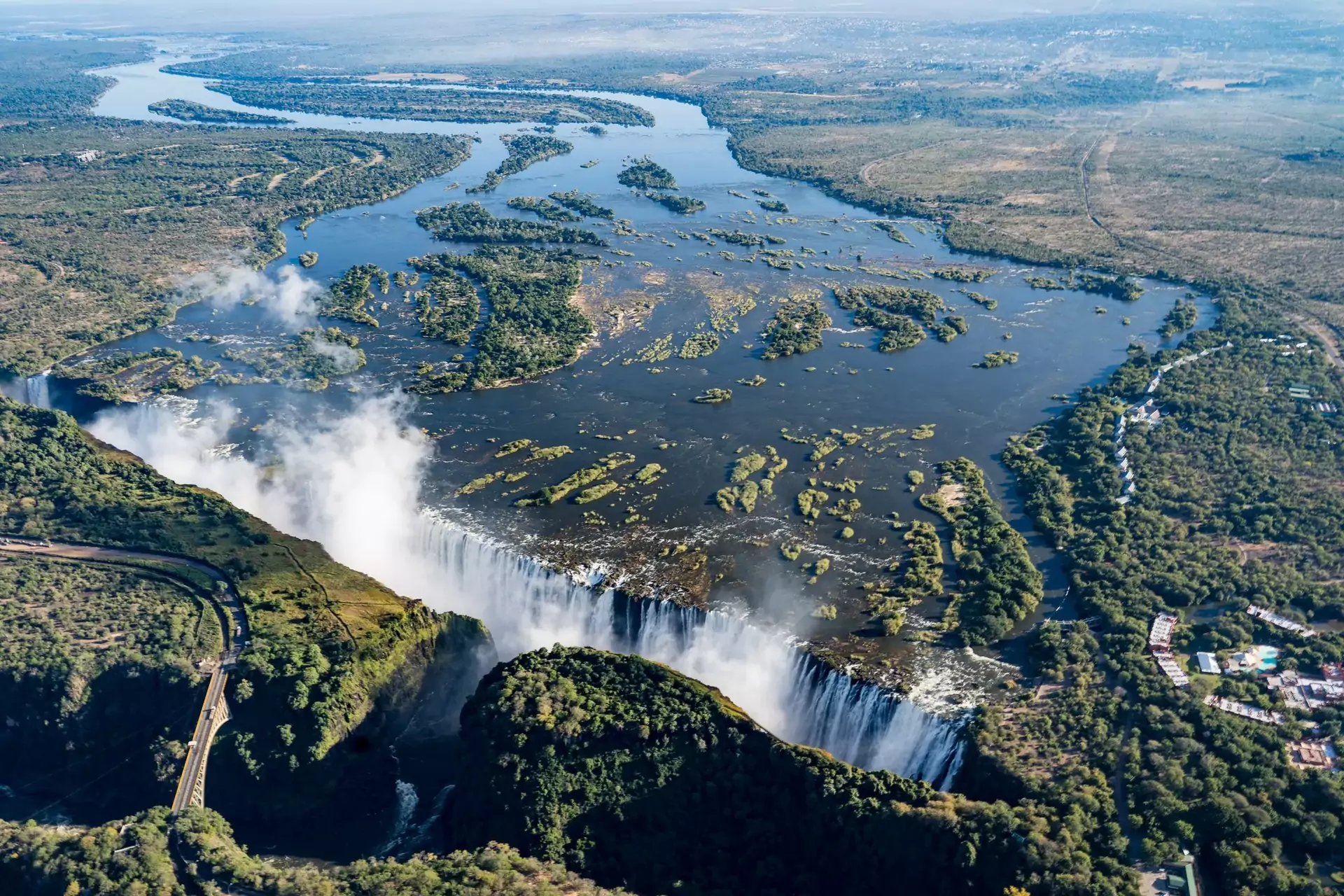
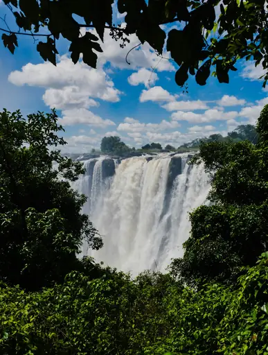
Victoria Falls, perched at 900 metres above sea level on the Zambezi River, experiences a subtropical climate with pronounced wet and dry seasons. Summers (November–March) are hot, humid, and rainy, with average highs of 30–34°C and frequent afternoon thunderstorms. Rainfall peaks in January and February, with up to 175 mm per month, transforming the landscape into a lush, green paradise. The falls are at their most powerful from February to May, when the river is in full flood, creating immense spray and mist that can obscure views but offer a breathtaking spectacle. Humidity is high (up to 73%), and sunshine alternates with dramatic downpours.
Winters (June–August) are dry, mild, and sunny, with average highs of 24–27°C and cool nights dropping to 6–10°C. Rain is almost nonexistent, and skies are clear, making this the best time for safaris and outdoor activities. The falls' water volume decreases, revealing the rocky gorge and allowing for clearer views and adventure activities like white-water rafting. Spring (September–October) is hot and dry, with highs of 32–34°C and minimal rainfall. October is the hottest month, and the falls are at their lowest flow, exposing more rock but offering unique photographic opportunities. Winds are generally light to moderate, but can increase during storms or in the hot, dry season. Victoria Falls receives about 690 mm of rain annually and enjoys 2,500+ hours of sunshine, with daylight ranging from 11 to 13 hours depending on the season.
| Average climate data for Victoria Falls, Zimbabwe | |||||||||||||
|---|---|---|---|---|---|---|---|---|---|---|---|---|---|
| Month | Jan | Feb | Mar | Apr | May | Jun | Jul | Aug | Sep | Oct | Nov | Dec | Year |
| Average maximum temperature (°C) | 29 | 29 | 29 | 29 | 28 | 26 | 25 | 30 | 34 | 36 | 34 | 31 | 36 |
| Average minimum temperature (°C) | 20 | 19 | 18 | 16 | 14 | 12 | 11 | 14 | 18 | 22 | 22 | 22 | 11 |
| Average precipitation (mm) | 124 | 108 | 65 | 12 | 1 | 0 | 0 | 0 | 0 | 6 | 39 | 101 | 456 |
| Average rainfall days (days) | 22 | 21 | 19 | 9 | 1 | 0 | 1 | 0 | 0 | 3 | 13 | 22 | 113 |
| Average relative humidity (%) | 72 | 76 | 74 | 61 | 51 | 48 | 44 | 31 | 24 | 27 | 45 | 62 | 51 |
| Average wind speed (km/h) | 8 | 8 | 9 | 9 | 9 | 10 | 11 | 11 | 12 | 12 | 10 | 8 | 10 |
| Average daily daylight hours (h) | 13 | 12 | 12 | 11 | 11 | 11 | 11 | 11 | 12 | 12 | 13 | 13 | 12 |
| Average daily sunshine hours (h) | 9 | 8 | 8 | 9 | 7 | 7 | 8 | 10 | 10 | 12 | 11 | 10 | 9 |
| Average cloud coverage (%) | 39 | 37 | 32 | 21 | 10 | 8 | 7 | 3 | 1 | 8 | 20 | 32 | 18 |
| Average UV index | 6 | 6 | 6 | 6 | 6 | 5 | 6 | 6 | 7 | 8 | 7 | 6 | 6 |
Travel info
- Summer (November–March): Hot, humid, and rainy, highs of 30–34°C. Frequent thunderstorms and lush landscapes. The falls are at their fullest from February, but spray can obscure views – pack light, waterproof clothes and be prepared for muddy trails.
- Autumn (April–May): Warm and less humid, highs of 26–28°C. Rainfall decreases, but the falls remain spectacular with powerful flow and dramatic mist. Ideal for photography – bring a rain jacket for spray.
- Winter (June–August): Mild and dry, highs of 24–27°C, cool nights of 6–10°C. Clear skies, excellent for safaris and walking tours. Water levels drop, revealing more of the gorge – pack layers for chilly mornings and evenings.
- Spring (September–October): Hot and dry, highs of 32–34°C. Water levels at their lowest, unique views of the falls' geology. Best for adventure activities like rafting and Devil’s Pool – bring sun protection and stay hydrated.
- General Tips: Weather can change quickly – always check the forecast. Summer is wettest and greenest; winter and spring are sunniest and best for outdoor activities. Pack waterproof gear for the rainy season and layers for cool winter nights.
The best time to visit Victoria Falls
The best time to visit Victoria Falls is from April to June, just after the rainy season. The falls are at their most dramatic, with immense spray and powerful flow, while the weather is warm and pleasant (highs of 25–28°C). This period combines spectacular waterfall views, lush scenery, and manageable crowds, making it ideal for sightseeing and photography.
The worst time to visit Victoria Falls
The least favourable time to visit is from late October to mid-December, when temperatures are hottest (often exceeding 34°C), humidity is high, and water levels at the falls are at their lowest. Some sections may dry up, especially on the Zambian side, and the heat can make outdoor activities uncomfortable. November also marks the start of the rainy season, with muddy trails and unpredictable weather.
Frequently asked questions
Victoria Falls has a subtropical climate with hot, rainy summers (highs 30–34°C) and mild, dry winters (highs 24–27°C, lows 6–10°C). Rain falls mainly from November to March, while the rest of the year is sunny and dry.
The rainy season runs from November to March, with frequent afternoon thunderstorms and lush, green landscapes. The falls reach peak flow from February to May, creating dramatic spray and mist.
Winters (June–August) are mild during the day (highs 24–27°C) but can be chilly at night, with lows dropping to 6–10°C. Warm layers are recommended for early mornings and evenings.
The falls are at their most powerful from February to May, after the summer rains. This is when the Zambezi River is in full flood, creating immense spray, rainbows, and a thunderous roar.
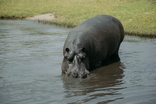
Yes, the dry winter months (June–September) are best for safaris. Animals gather at water sources, vegetation is sparse, and the weather is mild and sunny, making wildlife easier to spot.
Pack lightweight, breathable clothes for summer, waterproof gear for the rainy season, and layers for cool winter nights. Sun protection, insect repellent, and sturdy shoes are essential year-round.
Yes, but some activities depend on the season. White-water rafting and Devil’s Pool are best in the dry months (August–January), while helicopter flights and rainforest walks are spectacular year-round.
Minimum and maximum temperatures in Victoria Falls
The warmest month, with the highest average maximum temperature, is October (35.8 °C). The month with the lowest average maximum temperature is July (25.2 °C). Overall, the average maximum temperature over the whole year is 29.8 °C.
The month with the highest average minimum temperature is November (22.4 °C). The coldest month, with the lowest average minimum temperature, is July (11.2 °C). Overall, the average minimum temperature over the whole year is 17.4 °C.
Rainfall amount in Victoria Falls
The wettest month, with the highest amount of precipitation, is January (124.2 mm). The driest months, with the least amount of precipitation, are June, July, August and September (0 mm). Over the whole year there are 456.2 mm of rainfall on average.
Rainfall days in Victoria Falls
The month with the most days of rain is January (22.5 days). The month with the fewest days of rain is August (0.1 days). Over the whole year there are 113.4 days of rain on average.
Relative humidity in Victoria Falls
The month with the highest average relative humidity is February (76.1 %). The month with the lowest average relative humidity is September (24.1 %). The overall average relative humidity over the whole year is 51.3 %.
Wind speed in Victoria Falls
The windiest month, with the highest average wind speed, is October (12.2 km/h). The calmest month, with the lowest average wind speed, is December (8.2 km/h). The overall average wind speed over the whole year is 9.8 km/h.
Cloud coverage in Victoria Falls
The month with the cloudiest skies, so the highest cloud coverage, is January (38.9 %). The month with the clearest skies, so the lowest cloud coverage, is September (0.9 %). Over the whole year there is an average cloud coverage of 17.9 %.
Daylight hours and sunshine hours in Victoria Falls
The months with the longest days, so the most daylight, are January and December (Average daylight: 13 h). The months with the shortest days, so the least daylight, are June and July (Average daylight: 11 h). Over the whole year there are 11.9 h of daylight per day on average.
The month with the most sunshine per day is October (Average sunshine: 12 h). The month with the least sunshine per day is May (Average sunshine: 7 h). Over the whole year there are 9.2 h of sunlight per day on average.
UV index in Victoria Falls
The month with the highest average UV index is October (UV index: 8). The month with the lowest average UV index is June (UV index: 5). Over the whole year the average UV index is 6.2.
- Victoria Falls climate overview
- Climate table
- Related travel information for Victoria Falls
- The best time to visit Victoria Falls
- The worst time to visit Victoria Falls
- Frequently asked questions
- Temperature summary
- Rainfall amount summary
- Rainfall days summary
- Relative humidity summary
- Wind speed summary
- Cloud coverage summary
- Daylight hours and sunshine hours summary
- UV index summary
- Other recommended travel destinations