







Was this page helpful?

These place ratings give you a quick overview of how well a destination matches different types of trips.
"Best for" scores:
The specific interest scores show where this place really shines – whether it's ideal for hiking, food & drink experiences, museums or other activities. These highlights help you understand what makes the destination special at a glance.
"Your personal" scores:
This reflects how well a place matches your personal preferences. You can adjust the importances of travel topics or other personal requirements categories in your account settings.
"Suited for" badges:
These give you a quick overview of how well a destination suits specific types of travelers, to help you find the places that match your lifestyle, preferences or travel situation.
| Power Grid: |
110 V, 60 Hz Plug: Type A , Type B
Type A:
  Read about power adapters |
|---|---|
| Currency: |
Colombian Peso (COP) $1 ≈ COP 3,164.48 |
| Cashless info: |
Rating 3/5
Cashless payments are becoming more common, especially in cities. Credit and debit cards are widely accepted, but cash is still preferred in many rural areas.
Save with a travel credit card |
| eSIM providers: |
Best value: Saily Flexibility: Airalo Read our in-depth comparison |
| Tipping: | Tipping is not obligatory, but a tip of 5-10% is appreciated in restaurants. Taxis generally do not expect a tip, but rounding up the fare is common. |
|---|---|
| Public drinking: | Public drinking is not allowed in some areas, especially in cities. It is best to consume alcohol in licensed venues like bars or restaurants. |
| Public smoking: | Smoking is prohibited in indoor public spaces, including restaurants, bars, and public transport. |
| Independence Day (July 20) |
National holiday celebrating Colombia's independence with parades and festivities |
|---|---|
| Christmas (December 25) |
Celebrated with family gatherings and festive meals |
| Emergency contact: | Emergency Number: 123 |
|---|---|
| Taxi apps: | Uber, Cabify |
| Other: | Colombia is known for its coffee, vibrant culture, and beautiful landscapes, including the Andes mountains and Caribbean beaches. |
The best times to travel section shows how the months compare for a visit, so you can find the time of year that fits what you want to do.
Background colors of the months:
The color shows the typical temperature: yellow (hot), green (mild) and blue (cold). How strong the color is shows the travel season: full color means high season, soft color means shoulder season and soft-striped means off season.
Weather symbols:
Each month has one symbol showing what the weather is typically like, such as hot and sunny, freezing or a rainy or snowy season. Use them to quickly spot months that match the weather you want, or to avoid the ones that don't.
Crowdedness:
The people icon shows how busy the place usually is. The more people, the more crowded it gets.
Additional notes:
The gray info boxes point out special things worth knowing, like recurring weather issues or seasonal events.
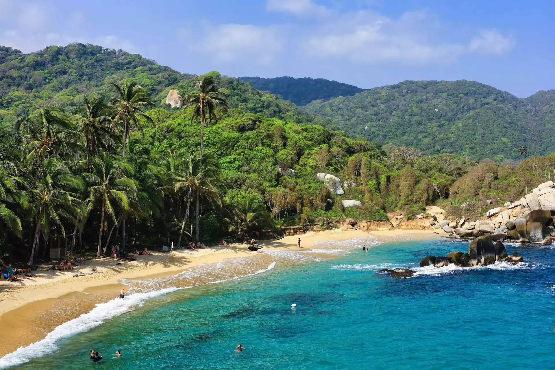
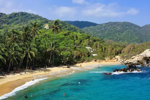
Forest that reaches the sea is what sets Tayrona apart from the city beaches around Santa Marta. Trails go through the trees and past large boulders to a string of bays. Monkeys and many birds live in the woods behind them. The coast is mostly undeveloped, with camps and a few ecohabs as the only buildings. Cabo San Juan is the best-known stop, with two bays on either side of a rocky point and a lookout on the rocks. Swimming at Cabo San Juan is allowed with care. La Piscina is a sheltered bay with a natural reef barrier. Other beaches, including Arrecifes and Cañaveral, have strong currents and no swimming, so the walk is more about scenery than a beach day. From Cabo San Juan a trail goes inland to Pueblito, the remains of a Tairona settlement, although access can be restricted. The park is also sacred land for the Arhuaco, Kogui, Wiwa and Kankuamo peoples. It closes for conservation several times a year. A day trip covers the entrance area and a beach or two. With one or two nights inside you can reach Cabo San Juan and walk back without hurrying.
Most visitors reach Tayrona National Park from Santa Marta, which is about 22 mi from the El Zaino entrance by road. Buses, shared minivans and taxis make the trip in about an hour depending on traffic. Taxis cost more but save time if you're carrying luggage for an overnight stay. Santa Marta's Simón Bolívar (SMR) is the nearest airport, with Barranquilla (BAQ) as the larger alternative. From either you continue by road through Santa Marta. Cartagena (CTG) is farther, at roughly four to five hours by road to Santa Marta before the last leg to the park. If you drive, the main coastal road east from Santa Marta goes to the park entrances. A car helps you reach the gates but not move around inside. Daily capacity in the park is limited and the ticket offices close once it's reached, so arrive in the morning. Entry rules and reservation requirements can change, so check the national parks website before you go.
Staying inside Tayrona National Park is what most overnight visitors want. Cañaveral has ecohabs, which are traditional-style cabins near the sea. Arrecifes and Cabo San Juan have camping areas and hammocks, with shared bathrooms, lockers and restaurants. Cabo San Juan is the most popular spot, so it fills up first. Rooms and camp spots inside are limited and demand is higher than supply on long weekends and in the mid-year holidays, so reserve ahead for those periods. Closure periods also affect when you can sleep inside the park. Outside the gates, hostels and lodges along the coastal road near the entrances work as a base for an early start. Santa Marta has the widest choice of hotels and hostels, but it adds the road trip to the day. If you plan to stay inside, a night or two is enough to see Cabo San Juan without rushing.
Cars can't go inside Tayrona National Park, so you get around on foot on trails that link the beaches and camps. The main trail starts at El Zaino and goes through forest toward Cañaveral, Arrecifes and Cabo San Juan, the farthest and best-known stop. Trails are muddy and steep in places. The walk between beaches is part of the visit.
Walking:
Walking from El Zaino to the first accommodation areas takes about an hour with luggage. Cabo San Juan is farther, so plan a few hours on foot and start early since you shouldn't be on the trails after the park closes.
Pack mules:
Mules at the entrance carry bags to the camps and ecohabs, which helps if you're staying overnight with heavy luggage. Agree the price before you load.
Entrances:
El Zaino is the main entrance and the usual starting point, while Calabazo is a separate and more demanding hiking route. Palangana leads to Playa Cristal and has shorter opening hours.
Food inside Tayrona National Park comes from the restaurants at Cabo San Juan and the camping areas, which are the main places to eat. Menus are simple and usually include fish with coconut rice and fried plantain, which is common on this coast, along with eggs and arepas for breakfast.
Cash matters because the park has no ATMs. Day visitors can pack snacks and sandwiches from Santa Marta. Drinks are sold at some stops along the trail. Supplies can run short at the farthest beaches, so bring extra if you have dietary needs. Single-use plastics such as straws and foam containers aren't allowed in.
We calculate the average costs when traveling to destinations and compare those with the living costs at your home. With this you can get an estimate of how expensive or cheap the destination is for you.
To customize this, you can set up which location and price level are used for the calculations in your account settings.
The exchange rate price factor shows how expensive or cheap a currency currently is compared to its historical average. It's a quick way to see if a country is currently more or less affordable due to exchange rate changes.
To help you plan your trip, we provide estimated daily costs per person (when traveling as a pair) for different travel styles. These numbers give you an idea of what you might spend each day at this destination, including accommodation, food, transport and activities.
Additionally, we also provide average hotel costs for different travel styles to give you an estimate for the accommodation only.
Please note that these are only estimates. The real costs depend on booking times, season and other factors.
Travel style categories explained:
Backpacker:
Staying in hostels or budget hotels, cooking your own meals or eating cheap and choosing low-cost activities.
Mid-range:
Staying in mid-range hotels, eating at a mix of restaurants and casual spots and enjoying a variety of activities.
Luxury:
Staying in luxury hotels, dining out at high-end restaurants and enjoying premium experiences without worrying about the price.
| Backpacker | Mid-range | Luxury | |
|---|---|---|---|
| 💵 Total costs per day, including accommodation | |||
| 🏨 Accommodation per night, per person | |||
| 🍝 Food per day | |||
| 🚕 Transportation per day |
| 🍽️ Restaurant Dinner, per person | |
|---|---|
| 🍛 Lunch Set, per person | |
| 🍟 Fast food combo | |
| 🍝 Preparing your own food, per day | |
| ☕ Cappuccino | |
| 🍺 Beer in a restaurant, 0.5 l / 16 oz |
| 🚌 Public transport ticket | |
|---|---|
| 🚕 Taxi Ride, 10 km / 6 mi | |
| ⛽ Gas, 1 l / ¼ gal |
| 🎞️ Movie ticket | |
|---|---|
| 👩⚕️ Doctor's consult | |
| 🤧 Cold medication | |
| 💇 Basic haircut |
Log in to add this place to a travel list and get a summary of all recommended items for your whole trip.
